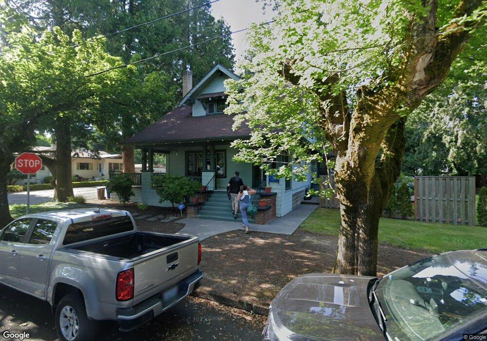
53 NW 12th St Gresham, OR 97030
Downtown Gresham NeighborhoodEstimated Value: $429,000 - $688,000
3
Beds
2
Baths
1,706
Sq Ft
$298/Sq Ft
Est. Value
About This Home
This home is located at 53 NW 12th St, Gresham, OR 97030 and is currently estimated at $508,915, approximately $298 per square foot. 53 NW 12th St is a home located in Multnomah County with nearby schools including Highland Elementary School, Clear Creek Middle School, and Gresham High School.
Ownership History
Date
Name
Owned For
Owner Type
Purchase Details
Closed on
Jul 29, 2020
Sold by
Patterson S Jane
Bought by
Ice Robert L and Ice Jean C
Current Estimated Value
Purchase Details
Closed on
Jun 26, 2015
Sold by
Seitsinger Sherri L
Bought by
Shernan Properties Llc
Purchase Details
Closed on
Jun 8, 2015
Sold by
Fray Marsha J
Bought by
Seitsinger Sherri L and Kolin Nancy A
Purchase Details
Closed on
Apr 25, 2015
Sold by
Kolin Nancy A
Bought by
Fray Marsha J and Seitsinger Sherri L
Purchase Details
Closed on
Jul 12, 2011
Sold by
Seitsinger Betty J
Bought by
Seitsinger Betty J and Betty J Seitsinger Revocable Living Trus
Create a Home Valuation Report for This Property
The Home Valuation Report is an in-depth analysis detailing your home's value as well as a comparison with similar homes in the area
Home Values in the Area
Average Home Value in this Area
Purchase History
| Date | Buyer | Sale Price | Title Company |
|---|---|---|---|
| Ice Robert L | $335,000 | Fidelity Natl Ttl Co Of Or | |
| Shernan Properties Llc | -- | Accommodation | |
| Seitsinger Sherri L | $75,000 | Accommodation | |
| Fray Marsha J | -- | None Available | |
| Seitsinger Betty J | -- | None Available |
Source: Public Records
Tax History
| Year | Tax Paid | Tax Assessment Tax Assessment Total Assessment is a certain percentage of the fair market value that is determined by local assessors to be the total taxable value of land and additions on the property. | Land | Improvement |
|---|---|---|---|---|
| 2025 | $4,811 | $236,400 | -- | -- |
| 2024 | $4,605 | $229,520 | -- | -- |
| 2023 | $4,196 | $222,840 | $0 | $0 |
| 2022 | $4,078 | $216,350 | $0 | $0 |
| 2021 | $3,975 | $210,050 | $0 | $0 |
| 2020 | $3,741 | $203,940 | $0 | $0 |
| 2019 | $3,643 | $198,000 | $0 | $0 |
| 2018 | $3,473 | $192,240 | $0 | $0 |
| 2017 | $3,333 | $186,650 | $0 | $0 |
| 2016 | $2,938 | $181,220 | $0 | $0 |
Source: Public Records
Map
Nearby Homes
- 54 NW 13th St
- 1783 1791 NE Beech Place
- 349 NE 18th St
- 0 NE 5th St
- 210 NE 5th St
- 660 NE 9th St
- 450 NE 22nd St
- 894 NE Linden Ave
- 318 NE Roberts Ave Unit 308
- 318 NE Roberts Ave Unit 203
- 491 NE Elliott Ave
- 1035 SE 225th Ave
- 994 NW Wallula Ave
- 535 NE 24th St
- 1325 NW 9th St
- 234 NE Cleveland Ave
- 2730 NE Roberts Ave
- 0 NE 6th St
- 21033 SE Clay Ct
- 1113 W Powell Blvd
- 105 NW 12th St
- 35 NW 12th St
- 54 NW 12th St
- 40 NW 13th St
- 90 NW 13th St Unit 92
- 110 NW 12th St
- 25 NW 13th St
- 25 NW
- 1209 N Main Ave
- 1133 N Main Ave
- 1227 N Main Ave
- 110 NW 13th St
- 133 NW 12th St
- 1239 N Main Ave
- 55 NW 11th St
- 47 NW 11th St Unit 49
- 112 NW 13th St
- 15 NW 13th St
- 124 NW 12th St
- 31 NW 11th St
Your Personal Tour Guide
Ask me questions while you tour the home.