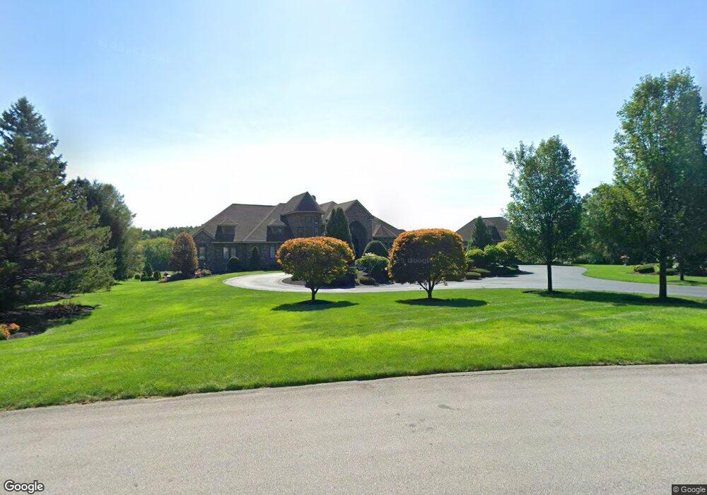
53 Powers Rd Hollis, NH 03049
Hollis NeighborhoodEstimated Value: $1,371,000 - $3,130,000
3
Beds
4
Baths
5,289
Sq Ft
$443/Sq Ft
Est. Value
About This Home
This home is located at 53 Powers Rd, Hollis, NH 03049 and is currently estimated at $2,342,390, approximately $442 per square foot. 53 Powers Rd is a home with nearby schools including Hollis Primary School, Hollis Upper Elementary School, and Hollis-Brookline Middle School.
Ownership History
Date
Name
Owned For
Owner Type
Purchase Details
Closed on
Mar 28, 2023
Sold by
Labonte Clermont G and Labonte Raymonde
Bought by
Labonte Ret
Current Estimated Value
Purchase Details
Closed on
Apr 17, 2015
Sold by
Labonte Raymond
Bought by
Punjabi Rajes and Punjabi Shilpy T
Create a Home Valuation Report for This Property
The Home Valuation Report is an in-depth analysis detailing your home's value as well as a comparison with similar homes in the area
Home Values in the Area
Average Home Value in this Area
Purchase History
| Date | Buyer | Sale Price | Title Company |
|---|---|---|---|
| Labonte Ret | -- | None Available | |
| Punjabi Rajes | $1,000,000 | -- |
Source: Public Records
Tax History Compared to Growth
Tax History
| Year | Tax Paid | Tax Assessment Tax Assessment Total Assessment is a certain percentage of the fair market value that is determined by local assessors to be the total taxable value of land and additions on the property. | Land | Improvement |
|---|---|---|---|---|
| 2024 | $42,635 | $2,404,700 | $436,000 | $1,968,700 |
| 2023 | $40,062 | $2,404,700 | $436,000 | $1,968,700 |
| 2022 | $54,274 | $2,404,700 | $436,000 | $1,968,700 |
| 2021 | $33,176 | $1,461,500 | $281,000 | $1,180,500 |
| 2020 | $33,878 | $1,461,500 | $281,000 | $1,180,500 |
| 2019 | $33,761 | $1,461,500 | $281,000 | $1,180,500 |
| 2018 | $31,671 | $1,461,500 | $281,000 | $1,180,500 |
| 2017 | $31,380 | $1,355,500 | $244,100 | $1,111,400 |
| 2016 | $31,759 | $1,355,500 | $244,100 | $1,111,400 |
| 2015 | $31,933 | $1,387,200 | $244,100 | $1,143,100 |
| 2014 | $32,086 | $1,387,200 | $244,100 | $1,143,100 |
| 2013 | $31,656 | $1,387,200 | $244,100 | $1,143,100 |
Source: Public Records
Map
Nearby Homes
- 5 Plainfield Ln
- 11 Bartemus Trail Unit 204
- 20 Martha St
- 76 Bartemus Trail Unit U231
- 4 Chesapeake Rd
- 28 Bartemus Trail Unit U210
- 11 Rideout Rd
- 334 Broad St
- 1014 W Hollis St
- 46 Scenic Dr
- 12 Spring Cove Rd Unit U103
- 2 Matties Way
- 40 Spring Cove Rd Unit U117
- 12 Clovercrest Dr
- 31 Spring Cove Rd Unit U148
- 3 Richmond St
- 27 Country Hill Rd Unit U90
- 4 Nelson St
- 22 Cathedral Cir
- 16 Laurel Ct Unit U320