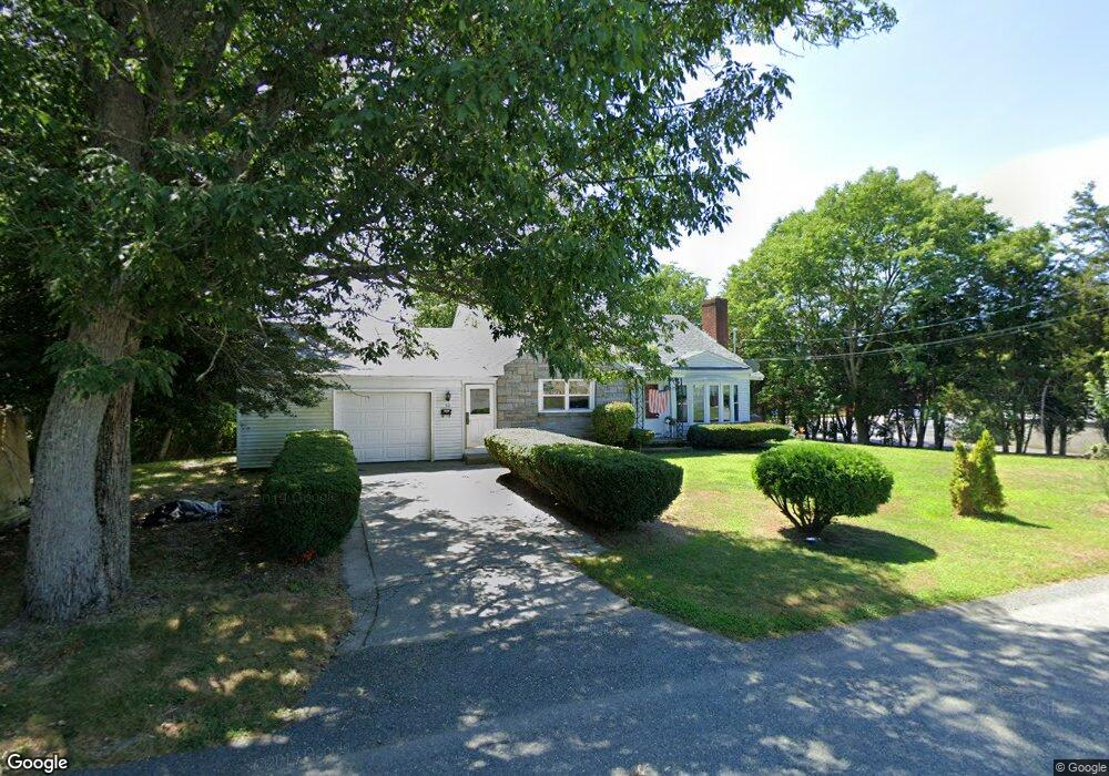
53 Sagamore St Somerset, MA 02726
Brayton Point NeighborhoodEstimated Value: $456,000 - $471,000
3
Beds
1
Bath
1,053
Sq Ft
$441/Sq Ft
Est. Value
About This Home
This home is located at 53 Sagamore St, Somerset, MA 02726 and is currently estimated at $464,353, approximately $440 per square foot. 53 Sagamore St is a home located in Bristol County with nearby schools including Chace Street School, Somerset Middle School, and St. Michael's School.
Ownership History
Date
Name
Owned For
Owner Type
Purchase Details
Closed on
Jun 21, 2017
Sold by
Freitas Rhonda L and Perry Erika L
Bought by
Hannink Philip S
Current Estimated Value
Home Financials for this Owner
Home Financials are based on the most recent Mortgage that was taken out on this home.
Original Mortgage
$75,000
Outstanding Balance
$62,286
Interest Rate
4.05%
Mortgage Type
Commercial
Estimated Equity
$402,067
Purchase Details
Closed on
Sep 26, 1975
Bought by
Hannink Albert and Hannink Lillian
Create a Home Valuation Report for This Property
The Home Valuation Report is an in-depth analysis detailing your home's value as well as a comparison with similar homes in the area
Home Values in the Area
Average Home Value in this Area
Purchase History
| Date | Buyer | Sale Price | Title Company |
|---|---|---|---|
| Hannink Philip S | -- | -- | |
| Hannink Philip S | -- | -- | |
| Hannink Albert | $35,000 | -- |
Source: Public Records
Mortgage History
| Date | Status | Borrower | Loan Amount |
|---|---|---|---|
| Open | Hannink Philip S | $75,000 | |
| Closed | Hannink Philip S | $75,000 |
Source: Public Records
Tax History Compared to Growth
Tax History
| Year | Tax Paid | Tax Assessment Tax Assessment Total Assessment is a certain percentage of the fair market value that is determined by local assessors to be the total taxable value of land and additions on the property. | Land | Improvement |
|---|---|---|---|---|
| 2025 | $5,550 | $417,300 | $190,000 | $227,300 |
| 2024 | $5,273 | $412,300 | $190,000 | $222,300 |
| 2023 | $4,624 | $364,700 | $165,300 | $199,400 |
| 2022 | $4,282 | $322,200 | $143,800 | $178,400 |
| 2021 | $4,323 | $294,500 | $130,800 | $163,700 |
| 2020 | $4,237 | $278,400 | $130,800 | $147,600 |
| 2019 | $4,845 | $265,500 | $130,800 | $134,700 |
| 2018 | $4,320 | $254,700 | $130,800 | $123,900 |
| 2017 | $4,220 | $242,500 | $124,800 | $117,700 |
| 2016 | $4,246 | $242,500 | $124,800 | $117,700 |
| 2015 | $3,963 | $228,400 | $119,200 | $109,200 |
| 2014 | $5,400 | $223,600 | $115,800 | $107,800 |
Source: Public Records
Map
Nearby Homes
- 1496 Riverside Ave
- 82 Perry Ave
- 34 Doherty Ave
- 80 Meadow Ln
- 66 Meadow Ln
- 2396 Riverside Ave
- 8 Tower Hill Rd
- 55 Dias Terrace
- 82 Wellington St
- 96 Wellington St
- 409 Crescent St
- 1928 N Main St Unit 4
- 54 Grant Ave
- 29 Valentine St
- 195 Crescent St Unit 2
- 1810 Highland Ave Unit 22
- 126 Jaffrey St
- 337 Lepes Rd
- 51 Linden Dr
- 21 Bradley Ave
- 72 Sagamore St
- 17 Desmond Ave
- 11 Sagamore St
- 108 County St
- 1537 Riverside Ave
- 69 Desmond Ave
- 57 Desmond Ave
- 1553 Riverside Ave
- 1515 Riverside Ave
- 1565 Riverside Ave
- 83 Desmond Ave
- 46 Desmond Ave
- 1528A Riverside Ave
- 1528 Riverside Ave
- 95 Desmond Ave
- 95 Desmond Ave Unit 2
- 64 Desmond Ave
- 1560 Riverside Ave
- 146 County St
- 65 County St