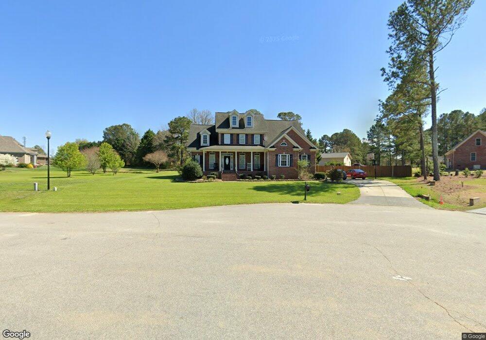
53 Sir Oxford Ln Angier, NC 27501
Pleasant Grove NeighborhoodEstimated Value: $511,357 - $665,000
3
Beds
3
Baths
2,768
Sq Ft
$209/Sq Ft
Est. Value
About This Home
This home is located at 53 Sir Oxford Ln, Angier, NC 27501 and is currently estimated at $579,089, approximately $209 per square foot. 53 Sir Oxford Ln is a home located in Johnston County with nearby schools including McGee's Crossroads Elementary School, McGee's Crossroads Middle School, and West Johnston High School.
Ownership History
Date
Name
Owned For
Owner Type
Purchase Details
Closed on
Jun 15, 2009
Sold by
Keith Underwood Homes Inc
Bought by
Armstrong George and Armstrong Gwendolyn
Current Estimated Value
Home Financials for this Owner
Home Financials are based on the most recent Mortgage that was taken out on this home.
Original Mortgage
$307,705
Outstanding Balance
$194,622
Interest Rate
4.79%
Mortgage Type
Purchase Money Mortgage
Estimated Equity
$384,467
Create a Home Valuation Report for This Property
The Home Valuation Report is an in-depth analysis detailing your home's value as well as a comparison with similar homes in the area
Home Values in the Area
Average Home Value in this Area
Purchase History
| Date | Buyer | Sale Price | Title Company |
|---|---|---|---|
| Armstrong George | $324,000 | None Available |
Source: Public Records
Mortgage History
| Date | Status | Borrower | Loan Amount |
|---|---|---|---|
| Open | Armstrong George | $307,705 |
Source: Public Records
Tax History Compared to Growth
Tax History
| Year | Tax Paid | Tax Assessment Tax Assessment Total Assessment is a certain percentage of the fair market value that is determined by local assessors to be the total taxable value of land and additions on the property. | Land | Improvement |
|---|---|---|---|---|
| 2025 | $3,226 | $507,990 | $95,000 | $412,990 |
| 2024 | $2,425 | $299,370 | $45,000 | $254,370 |
| 2023 | $2,350 | $299,370 | $45,000 | $254,370 |
| 2022 | $2,425 | $299,370 | $45,000 | $254,370 |
| 2021 | $2,425 | $299,370 | $45,000 | $254,370 |
| 2020 | $2,515 | $299,370 | $45,000 | $254,370 |
| 2019 | $2,455 | $299,370 | $45,000 | $254,370 |
| 2018 | $2,597 | $309,120 | $29,000 | $280,120 |
| 2017 | $2,597 | $309,120 | $29,000 | $280,120 |
| 2016 | $2,597 | $309,120 | $29,000 | $280,120 |
| 2015 | $2,597 | $309,120 | $29,000 | $280,120 |
| 2014 | $2,597 | $309,120 | $29,000 | $280,120 |
Source: Public Records
Map
Nearby Homes
- 197 W Paige Wynd Dr
- 25 Mannford Ln
- 108 Fireside Dr
- 7390 Nc 50 Hwy N
- Avery Plan at Daniel Farms
- Cypress Plan at Daniel Farms
- Davidson Plan at Daniel Farms
- Stanley Plan at Daniel Farms
- Arlington Plan at Daniel Farms
- Ellerbe Plan at Daniel Farms
- Graham Plan at Daniel Farms
- Caldwell Plan at Daniel Farms
- Drexel Plan at Daniel Farms
- Raleigh Plan at Daniel Farms
- 32 Quilting Dr
- 56 Flannel Ct Unit 251
- 497 Highview Dr Unit 20
- 529 Highview Dr Unit 21
- 576 Highview Dr Unit 40
- 82 Gander Dr
- 19 Sir Oxford Ln
- 302 Greenleaf Rd
- 127 W Paige Wynd Dr
- 330 Greenleaf Rd
- 20 Sir Oxford Ln
- 65 Sir Oxford Ln Unit 36
- 48 Sir Oxford Ln Unit 34
- 48 Sir Oxford Ln
- 60 Sir Oxford Ln
- 109 W Paige Wynd Dr
- 175 W Paige Wynd Dr
- 175 W Paige Wynd Dr Unit 33
- 238 W Paige Wynd Dr Unit 27
- 158 W Paige Wynd Dr
- 197 W Paige Wynd Dr Unit Lot 32
- 128 W Paige Wynd Dr
- 281 Greenleaf Rd
- 299 Greenleaf Rd
- 267 Greenleaf Rd
- 87 W Paige Wynd Dr