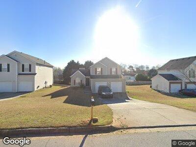
530 Brenston Blvd Unit 1 Ellenwood, GA 30294
Estimated Value: $248,000 - $289,000
3
Beds
3
Baths
1,611
Sq Ft
$162/Sq Ft
Est. Value
About This Home
This home is located at 530 Brenston Blvd Unit 1, Ellenwood, GA 30294 and is currently estimated at $261,444, approximately $162 per square foot. 530 Brenston Blvd Unit 1 is a home located in Clayton County with nearby schools including Thurgood Marshall Elementary School, Morrow Middle School, and Morrow High School.
Ownership History
Date
Name
Owned For
Owner Type
Purchase Details
Closed on
Dec 23, 2016
Sold by
Select American Homes Llc
Bought by
Banksia Investments Llc
Current Estimated Value
Purchase Details
Closed on
Sep 1, 2015
Sold by
Us Bank Na
Bought by
Secretary Of Housing And Urban Dev Washi
Purchase Details
Closed on
Nov 29, 1999
Sold by
Gt Architecture Contractors Corp
Bought by
Richards Sammy L
Home Financials for this Owner
Home Financials are based on the most recent Mortgage that was taken out on this home.
Original Mortgage
$114,932
Interest Rate
7.99%
Mortgage Type
FHA
Create a Home Valuation Report for This Property
The Home Valuation Report is an in-depth analysis detailing your home's value as well as a comparison with similar homes in the area
Home Values in the Area
Average Home Value in this Area
Purchase History
| Date | Buyer | Sale Price | Title Company |
|---|---|---|---|
| Banksia Investments Llc | $87,500 | -- | |
| Select American Homes Llc | $87,500 | -- | |
| Secretary Of Housing And Urban Dev Washi | $99,750 | -- | |
| Us Bank National Association | $99,750 | -- | |
| Richards Sammy L | $115,000 | -- |
Source: Public Records
Mortgage History
| Date | Status | Borrower | Loan Amount |
|---|---|---|---|
| Previous Owner | Richards Sammy L | $115,804 | |
| Previous Owner | Richards Sammy L | $114,932 |
Source: Public Records
Tax History Compared to Growth
Tax History
| Year | Tax Paid | Tax Assessment Tax Assessment Total Assessment is a certain percentage of the fair market value that is determined by local assessors to be the total taxable value of land and additions on the property. | Land | Improvement |
|---|---|---|---|---|
| 2024 | $4,222 | $107,240 | $8,800 | $98,440 |
| 2023 | $3,723 | $103,120 | $8,800 | $94,320 |
| 2022 | $3,317 | $83,560 | $8,800 | $74,760 |
| 2021 | $2,815 | $70,320 | $8,800 | $61,520 |
| 2020 | $2,795 | $68,924 | $8,800 | $60,124 |
| 2019 | $2,629 | $63,816 | $6,400 | $57,416 |
| 2018 | $2,145 | $51,906 | $6,400 | $45,506 |
| 2017 | $1,462 | $35,000 | $6,400 | $28,600 |
| 2016 | $1,262 | $30,091 | $6,400 | $23,691 |
| 2015 | $1,242 | $0 | $0 | $0 |
| 2014 | $1,184 | $28,822 | $6,400 | $22,422 |
Source: Public Records
Map
Nearby Homes
- 5669 Blackberry Row
- 5725 Twain Dr
- 5549 Highway 42
- 5791 Cobbrook Dr
- 5790 Twain Dr
- 5790 Northspring Dr
- 2637 Sol Ct
- 5793 Springfield Place
- 2571 Stanford Dr Unit 4
- 2733 Cedar Tree Ln
- 5868 Dan Dr
- 5878 Nell Ln
- 2382 Old Rex Morrow Rd
- 5810 Northfield Dr
- 2713 Silver Queen Rd Unit 3
- 0 Poplar Ave Unit 10481115
- 0 Poplar Ave Unit 7543163
- 0 Poplar Ave Unit 7517709
- 0 Poplar Ave Unit 10450868
- 5719 Star Flower Dr Unit 1
- 530 Brenston Blvd Unit 26
- 530 Brenston Blvd Unit 1
- 538 Brenston Blvd Unit 1
- 538 Brenston Blvd
- 538 Brenston Blvd Unit 25
- 522 Brenston Blvd Unit 1
- 525 Brenston Ct Unit 1
- 0 Brenston Blvd Unit 8521723
- 0 Brenston Blvd Unit 8261893
- 0 Brenston Blvd Unit 8426811
- 0 Brenston Blvd Unit 8239260
- 0 Brenston Blvd Unit 8134746
- 0 Brenston Blvd Unit 25 7125056
- 0 Brenston Blvd Unit 8766404
- 0 Brenston Blvd Unit 8768485
- 0 Brenston Blvd Unit 3125634
- 0 Brenston Blvd Unit 3127560
- 0 Brenston Blvd Unit 3259497
- 0 Brenston Blvd Unit 7159001
- 0 Brenston Blvd Unit 7195369