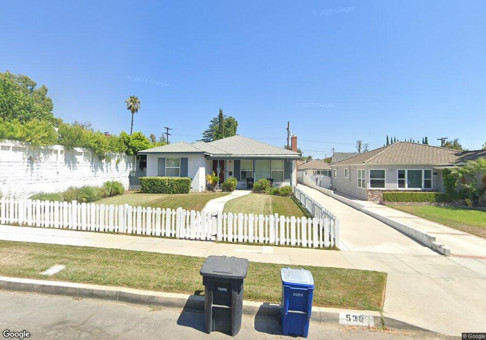
530 Dartmouth Rd Burbank, CA 91504
Hillside District NeighborhoodEstimated Value: $1,319,004 - $1,623,000
3
Beds
2
Baths
1,447
Sq Ft
$999/Sq Ft
Est. Value
About This Home
This home is located at 530 Dartmouth Rd, Burbank, CA 91504 and is currently estimated at $1,445,501, approximately $998 per square foot. 530 Dartmouth Rd is a home located in Los Angeles County with nearby schools including Thomas Jefferson Elementary School, John Muir Middle School, and Burbank High School.
Ownership History
Date
Name
Owned For
Owner Type
Purchase Details
Closed on
Apr 7, 1999
Sold by
Ray Virginia Lee and Martin Richard Earl
Bought by
Lin Paul and Lin Mimi C
Current Estimated Value
Home Financials for this Owner
Home Financials are based on the most recent Mortgage that was taken out on this home.
Original Mortgage
$240,000
Outstanding Balance
$60,267
Interest Rate
6.94%
Estimated Equity
$1,385,234
Purchase Details
Closed on
Nov 4, 1998
Sold by
Martin Ruth E
Bought by
Living Trust Of Ruth Elma Martin
Create a Home Valuation Report for This Property
The Home Valuation Report is an in-depth analysis detailing your home's value as well as a comparison with similar homes in the area
Home Values in the Area
Average Home Value in this Area
Purchase History
| Date | Buyer | Sale Price | Title Company |
|---|---|---|---|
| Lin Paul | $340,000 | Commonwealth Land Title | |
| Living Trust Of Ruth Elma Martin | -- | -- |
Source: Public Records
Mortgage History
| Date | Status | Borrower | Loan Amount |
|---|---|---|---|
| Open | Lin Paul | $240,000 | |
| Closed | Lin Paul | $66,000 |
Source: Public Records
Tax History Compared to Growth
Tax History
| Year | Tax Paid | Tax Assessment Tax Assessment Total Assessment is a certain percentage of the fair market value that is determined by local assessors to be the total taxable value of land and additions on the property. | Land | Improvement |
|---|---|---|---|---|
| 2025 | $5,947 | $533,000 | $335,322 | $197,678 |
| 2024 | $5,947 | $522,550 | $328,748 | $193,802 |
| 2023 | $5,884 | $512,304 | $322,302 | $190,002 |
| 2022 | $5,619 | $502,260 | $315,983 | $186,277 |
| 2021 | $5,591 | $492,413 | $309,788 | $182,625 |
| 2019 | $5,366 | $477,809 | $300,600 | $177,209 |
| 2018 | $5,242 | $468,441 | $294,706 | $173,735 |
| 2016 | $4,967 | $450,253 | $283,263 | $166,990 |
| 2015 | $4,866 | $443,491 | $279,009 | $164,482 |
| 2014 | $4,857 | $434,805 | $273,544 | $161,261 |
Source: Public Records
Map
Nearby Homes
- 531 Tufts Ave
- 648 Uclan Dr
- 1814 Grismer Ave
- 1923 Grismer Ave
- 441 University Ave
- 1608 Grismer Ave
- 1809 Peyton Ave Unit 313
- 736 Irving Dr
- 1622 Keeler St
- 906 Groton Dr
- 1702 Landis St
- 2000 Peyton Ave
- 724 Price Dr
- 2014 Peyton Ave
- 2615 Woodstock Ln
- 230 Bethany Rd Unit 117
- 418 Delaware Rd
- 2528 N Orchard Dr
- 710 E Walnut Ave
- 2420 N Keystone St
- 526 Dartmouth Rd
- 1821 N 6th St
- 524 Dartmouth Rd
- 533 Cambridge Dr
- 527 Cambridge Dr
- 537 Cambridge Dr
- 522 Dartmouth Rd
- 525 Cambridge Dr
- 533 Dartmouth Rd
- 521 Cambridge Dr
- 529 Dartmouth Rd
- 1901 N 6th St
- 523 Dartmouth Rd
- 512 Dartmouth Rd
- 521 Dartmouth Rd
- 517 Cambridge Dr
- 517 Dartmouth Rd
- 511 Cambridge Dr
- 508 Dartmouth Rd
- 511 Dartmouth Rd