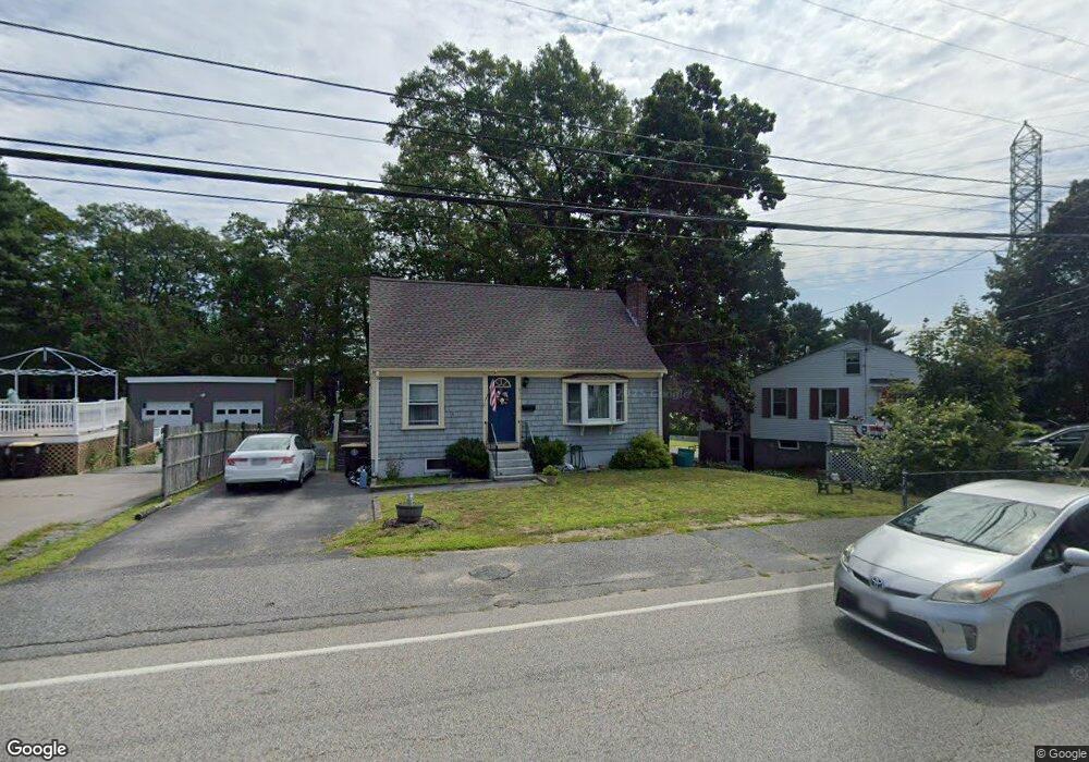
530 Front St Weymouth, MA 02188
East Weymouth NeighborhoodEstimated Value: $541,000 - $631,000
3
Beds
3
Baths
1,170
Sq Ft
$495/Sq Ft
Est. Value
About This Home
This home is located at 530 Front St, Weymouth, MA 02188 and is currently estimated at $579,232, approximately $495 per square foot. 530 Front St is a home located in Norfolk County with nearby schools including Frederick C Murphy, Abigail Adams Middle School, and Weymouth Middle School Chapman.
Ownership History
Date
Name
Owned For
Owner Type
Purchase Details
Closed on
Oct 3, 1997
Sold by
Small Irving C
Bought by
Finnegan Lawrence P and Finnegan Alice A
Current Estimated Value
Purchase Details
Closed on
Mar 7, 1997
Sold by
Bankers Tr Co Tr
Bought by
Small Irving C
Purchase Details
Closed on
Oct 15, 1996
Sold by
Feeney William G Est and Feeney Helen M Est
Bought by
Bankers Trust Co
Create a Home Valuation Report for This Property
The Home Valuation Report is an in-depth analysis detailing your home's value as well as a comparison with similar homes in the area
Home Values in the Area
Average Home Value in this Area
Purchase History
| Date | Buyer | Sale Price | Title Company |
|---|---|---|---|
| Finnegan Lawrence P | $159,899 | -- | |
| Small Irving C | $68,000 | -- | |
| Bankers Trust Co | $90,231 | -- |
Source: Public Records
Mortgage History
| Date | Status | Borrower | Loan Amount |
|---|---|---|---|
| Open | Bankers Trust Co | $22,000 | |
| Open | Bankers Trust Co | $143,000 |
Source: Public Records
Tax History Compared to Growth
Tax History
| Year | Tax Paid | Tax Assessment Tax Assessment Total Assessment is a certain percentage of the fair market value that is determined by local assessors to be the total taxable value of land and additions on the property. | Land | Improvement |
|---|---|---|---|---|
| 2025 | $4,751 | $470,400 | $193,500 | $276,900 |
| 2024 | $4,652 | $453,000 | $184,300 | $268,700 |
| 2023 | $4,433 | $424,200 | $170,700 | $253,500 |
| 2022 | $4,355 | $380,000 | $158,000 | $222,000 |
| 2021 | $4,044 | $344,500 | $158,000 | $186,500 |
| 2020 | $3,793 | $318,200 | $158,000 | $160,200 |
| 2019 | $3,701 | $305,400 | $152,000 | $153,400 |
| 2018 | $3,615 | $289,200 | $144,700 | $144,500 |
| 2017 | $3,578 | $279,300 | $137,900 | $141,400 |
| 2016 | $3,437 | $268,500 | $132,500 | $136,000 |
| 2015 | $3,308 | $256,400 | $132,500 | $123,900 |
| 2014 | $3,131 | $235,400 | $123,300 | $112,100 |
Source: Public Records
Map
Nearby Homes
- 200 Justin Dr Unit 3
- 54 Federal St
- 24 Blake Rd
- 215 Winter St Unit 1P
- 747 Middle St
- 2 Tara Dr Unit 1
- 116 Belmont St
- 33 Congress St
- 76 Kingman St
- 449 Middle St
- 25 Echo Ave
- 42 Sundin Rd
- 501 Commerce Dr Unit 2310
- 501 Commerce Dr Unit 1111
- 501 Commerce Dr Unit 4206
- 501 Commerce Dr Unit 4308
- 501 Commerce Dr Unit 4306
- 19 Saint Margaret St
- 16 Lindbergh Ave
- 15 Summer St