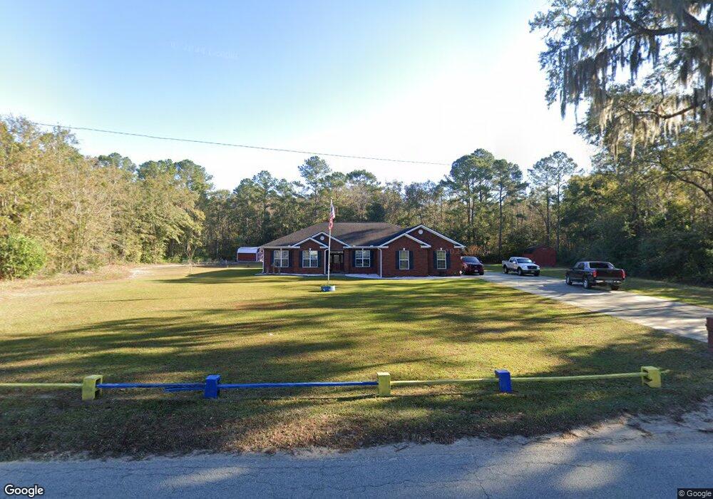
530 Griffin Rd Unit n/a Allenhurst, GA 31301
Estimated Value: $296,000 - $343,387
4
Beds
2
Baths
3,000
Sq Ft
$105/Sq Ft
Est. Value
About This Home
This home is located at 530 Griffin Rd Unit n/a, Allenhurst, GA 31301 and is currently estimated at $314,847, approximately $104 per square foot. 530 Griffin Rd Unit n/a is a home located in Liberty County with nearby schools including Frank Long Elementary School, Lewis Frasier Middle School, and Liberty County High School.
Ownership History
Date
Name
Owned For
Owner Type
Purchase Details
Closed on
Jun 6, 2014
Sold by
Sunbury Development Corp
Bought by
Dodd Robert R and Dood Shalee S
Current Estimated Value
Purchase Details
Closed on
Dec 7, 2009
Sold by
Lee Gentle R
Bought by
Sunbury Development Corporation
Purchase Details
Closed on
Feb 25, 1986
Bought by
Lee Gentle R
Create a Home Valuation Report for This Property
The Home Valuation Report is an in-depth analysis detailing your home's value as well as a comparison with similar homes in the area
Home Values in the Area
Average Home Value in this Area
Purchase History
| Date | Buyer | Sale Price | Title Company |
|---|---|---|---|
| Dodd Robert R | $13,000 | -- | |
| Sunbury Development Corporation | -- | -- | |
| Lee Gentle R | -- | -- |
Source: Public Records
Tax History Compared to Growth
Tax History
| Year | Tax Paid | Tax Assessment Tax Assessment Total Assessment is a certain percentage of the fair market value that is determined by local assessors to be the total taxable value of land and additions on the property. | Land | Improvement |
|---|---|---|---|---|
| 2024 | $16 | $113,834 | $4,673 | $109,161 |
| 2023 | $16 | $100,835 | $4,673 | $96,162 |
| 2022 | $15 | $83,124 | $4,673 | $78,451 |
| 2021 | $15 | $75,323 | $4,673 | $70,650 |
| 2020 | $15 | $76,121 | $4,673 | $71,448 |
| 2019 | $15 | $76,907 | $4,673 | $72,234 |
| 2018 | $15 | $77,693 | $4,673 | $73,020 |
| 2017 | $3,299 | $77,759 | $4,673 | $73,086 |
| 2016 | $154 | $77,824 | $4,673 | $73,152 |
| 2015 | $158 | $76,946 | $3,794 | $73,152 |
| 2014 | $158 | $4,527 | $4,527 | $0 |
| 2013 | -- | $6,414 | $6,414 | $0 |
Source: Public Records
Map
Nearby Homes
- 304 Thompson Rd
- 801 Talmadge Rd
- 1343 Talmadge Rd
- 1105 Buckhead Loop
- 129 Vandiver Rd
- 169 Wellspring Terrace
- 311 Strickland Rd
- 127 Busbee Rd
- 1105 Buckhead Loop SE
- 151 Hunters Branch Dr
- 1801 Dunlevie Rd
- 48 Beaumont Dr
- 34 Beaumont Dr
- 28 Beaumont Dr
- 619 Mccumber Dr
- 1600 Dunlevie Rd Unit 16
- 1600 Dunlevie Rd Unit 50
- 324 Boundary Hall Way
- 246 Boundary Hall Way
- 38 Boundary Hall Way
- 530 Griffin Rd
- 60 Thompson Rd SE
- 537 Griffin Rd
- 537 Griffin Rd
- 575 Griffin Rd SE
- 537 Talmadge Rd
- 1118 Griffin Rd
- 0 Carter Road Property #2
- 0 Unit 2
- 406 Griffin Rd
- 451 Griffin Rd
- 3 Whispering Pines Cir SE
- 195 Jefferson Cir SE
- 211 Jefferson Cir SE
- 175 Jefferson Cir SE
- 103 Thompson Rd
- 229 Jefferson Cir SE
- 81 Carter Rd
- 401 Griffin Rd
- 24 David Ln SE