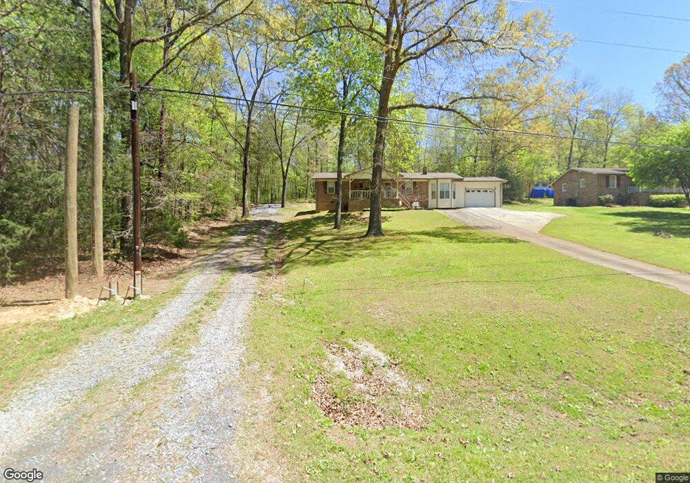
530 Mccowan Rd Rockmart, GA 30153
Estimated Value: $173,000 - $201,000
2
Beds
1
Bath
1,176
Sq Ft
$158/Sq Ft
Est. Value
About This Home
This home is located at 530 Mccowan Rd, Rockmart, GA 30153 and is currently estimated at $185,777, approximately $157 per square foot. 530 Mccowan Rd is a home located in Polk County.
Ownership History
Date
Name
Owned For
Owner Type
Purchase Details
Closed on
Jul 3, 2001
Sold by
Headen Faron R
Bought by
Blackwood Jeremy
Current Estimated Value
Purchase Details
Closed on
Aug 13, 1993
Sold by
Cordova Randy D
Bought by
Headen Faron R
Purchase Details
Closed on
Feb 9, 1989
Sold by
Farmers Home Admin
Bought by
Cordova Randy and Cordova Lisa
Purchase Details
Closed on
May 20, 1988
Sold by
Robinson Phil A
Bought by
Farmers Home Adminis
Purchase Details
Closed on
Feb 27, 1985
Sold by
Farmers Home Admin
Bought by
Robinson Phil A
Purchase Details
Closed on
Jan 26, 1984
Sold by
Fuqua Marvin E
Bought by
Farmers Home Admin
Purchase Details
Closed on
Mar 30, 1983
Sold by
Farmers Home Admin
Bought by
Fuqua Marvin E
Purchase Details
Closed on
Jul 24, 1982
Sold by
Brown Alfred R
Bought by
Farmers Home Admin
Purchase Details
Closed on
Oct 28, 1980
Bought by
Brown Alfred R
Create a Home Valuation Report for This Property
The Home Valuation Report is an in-depth analysis detailing your home's value as well as a comparison with similar homes in the area
Home Values in the Area
Average Home Value in this Area
Purchase History
| Date | Buyer | Sale Price | Title Company |
|---|---|---|---|
| Blackwood Jeremy | -- | -- | |
| Headen Faron R | $33,300 | -- | |
| Cordova Randy | $33,000 | -- | |
| Farmers Home Adminis | -- | -- | |
| Robinson Phil A | -- | -- | |
| Farmers Home Admin | -- | -- | |
| Fuqua Marvin E | -- | -- | |
| Farmers Home Admin | -- | -- | |
| Brown Alfred R | -- | -- |
Source: Public Records
Tax History Compared to Growth
Tax History
| Year | Tax Paid | Tax Assessment Tax Assessment Total Assessment is a certain percentage of the fair market value that is determined by local assessors to be the total taxable value of land and additions on the property. | Land | Improvement |
|---|---|---|---|---|
| 2024 | $1,139 | $54,497 | $2,271 | $52,226 |
| 2023 | $829 | $34,913 | $2,271 | $32,642 |
| 2022 | $695 | $29,266 | $1,514 | $27,752 |
| 2021 | $704 | $29,266 | $1,514 | $27,752 |
| 2020 | $705 | $29,266 | $1,514 | $27,752 |
| 2019 | $647 | $24,092 | $1,514 | $22,578 |
| 2018 | $644 | $23,382 | $1,514 | $21,868 |
| 2017 | $638 | $23,456 | $1,588 | $21,868 |
| 2016 | $621 | $22,828 | $960 | $21,868 |
| 2015 | $629 | $23,027 | $960 | $22,067 |
| 2014 | $633 | $23,027 | $960 | $22,067 |
Source: Public Records
Map
Nearby Homes
- 1211 Bellview Rd
- 1714 Cedartown Hwy
- 740 Calloway Dr
- 65 Wheeler Rd
- 89 Wheeler Rd
- 1039 Old Cedartown Rd
- 702 Calloway Dr
- 197 Oak Hill Dr
- 0 Highway 278 Nathan Dean Bypass Unit 10134156
- 278 Oak Hill Dr
- 133 N Bellview Rd
- 18 Hillside Dr
- 2056 Bellview Rd
- 0 Morgan Valley Rd Unit 7614571
- 0 Morgan Valley Rd Unit 10563202
- 332 Stringer Rd
- 000 Old Collard Valley Rd- 10 Acres
- 93 Clay Rd
- 865 Morgan Valley Rd
- 1676 Old Collard Valley Rd
- 540 Mccowan Rd
- 520 Mccowan Rd
- 510 Mccowan Rd
- 498 Mccowan Rd
- 575 Mccowan Rd
- 576 Mccowan Rd
- 556 Mccowan Rd
- 585 Mccowan Rd
- 531 Mccowan Rd
- 468 Mccowan Rd
- 871 Bellview Rd
- 843 Clarkwood Rd
- 815 Clarkwood Rd
- 501 Mccowan Rd
- 891 Bellview Rd
- 850 Bellview Rd
- 467 Mccowan Rd
- 912 Bellview Rd
- 691 Clarkwood Rd
- 705 Clarkwood Rd