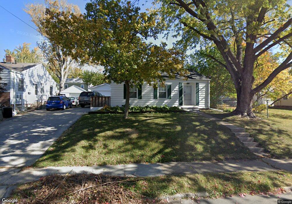
530 W 10th St N Newton, IA 50208
Estimated Value: $121,000 - $137,225
2
Beds
1
Bath
764
Sq Ft
$171/Sq Ft
Est. Value
About This Home
Nice 2 bedroom 1 bath house with a one car detached garage. Fenced yard and a full basement. $1200 a month and a $1200 deposit. You will pay for electric, gas and water and take care of yard work and snow removal. Washer and dryer provided for $35 a month. This is a no smoking house and pets are allowed with non-refundable fee of $250 and $50 a month. No large dogs over 65 pounds or dangerous breeds. Located at 530 W 10th St N
Ownership History
Date
Name
Owned For
Owner Type
Purchase Details
Closed on
Dec 9, 2021
Sold by
Backus Karen S
Bought by
Newton Llc
Current Estimated Value
Create a Home Valuation Report for This Property
The Home Valuation Report is an in-depth analysis detailing your home's value as well as a comparison with similar homes in the area
Home Values in the Area
Average Home Value in this Area
Purchase History
| Date | Buyer | Sale Price | Title Company |
|---|---|---|---|
| Newton Llc | $70,000 | None Available |
Source: Public Records
Property History
| Date | Event | Price | List to Sale | Price per Sq Ft |
|---|---|---|---|---|
| 06/20/2025 06/20/25 | Off Market | $1,200 | -- | -- |
| 05/19/2025 05/19/25 | For Rent | $1,200 | -- | -- |
Tax History Compared to Growth
Tax History
| Year | Tax Paid | Tax Assessment Tax Assessment Total Assessment is a certain percentage of the fair market value that is determined by local assessors to be the total taxable value of land and additions on the property. | Land | Improvement |
|---|---|---|---|---|
| 2025 | $1,999 | $103,010 | $17,960 | $85,050 |
| 2024 | $1,999 | $98,790 | $17,960 | $80,830 |
| 2023 | $1,862 | $98,790 | $17,960 | $80,830 |
| 2022 | $1,712 | $84,610 | $17,960 | $66,650 |
| 2021 | $1,680 | $76,990 | $17,960 | $59,030 |
| 2020 | $1,680 | $71,630 | $17,350 | $54,280 |
| 2019 | $1,504 | $62,320 | $0 | $0 |
| 2018 | $1,504 | $62,320 | $0 | $0 |
| 2017 | $1,506 | $62,320 | $0 | $0 |
| 2016 | $1,506 | $62,320 | $0 | $0 |
| 2015 | $1,470 | $62,320 | $0 | $0 |
| 2014 | $1,414 | $62,320 | $0 | $0 |
Source: Public Records
Map
Nearby Homes
- 549 W 10th St N
- 304 W 11th St N
- 1000 1st Ave W
- 1100 1st Ave W
- 1005 W 8th St N
- 606 W 16th St N
- 8 Chancery Ct
- 420 1st Ave W
- 429 1st Ave W
- 1221 Monroe Dr
- 210 W 13th St S
- 237 W 12th St S
- 308 W 8th St S
- 625 S 3rd Ave W
- 316 N 9th Ave W
- 303 W 5th St S
- 623 S 4th Ave W
- 831 1st St N
- 314 E 3rd St N
- 419 W 2nd St S
- 536 W 10th St N
- 910 N 5th Ave W
- 531 W 9th St N
- 533 W 9th St N
- 531 W 10th St N
- 906 N 5 Ave W
- 533 W 10th St N
- 906 N 5th Ave W
- 902 N 5th Ave W
- 538 W 10th St N
- 535 W 9th St N
- 535 W 10th St N
- 407 W 10th St N
- 540 W 10th St N
- 537 W 10th St N
- 530 W 9th St N
- 538 W 9th St N
- 901 N 5th Ave W
- 405 W 10th St N
- 806 N 5th Ave W