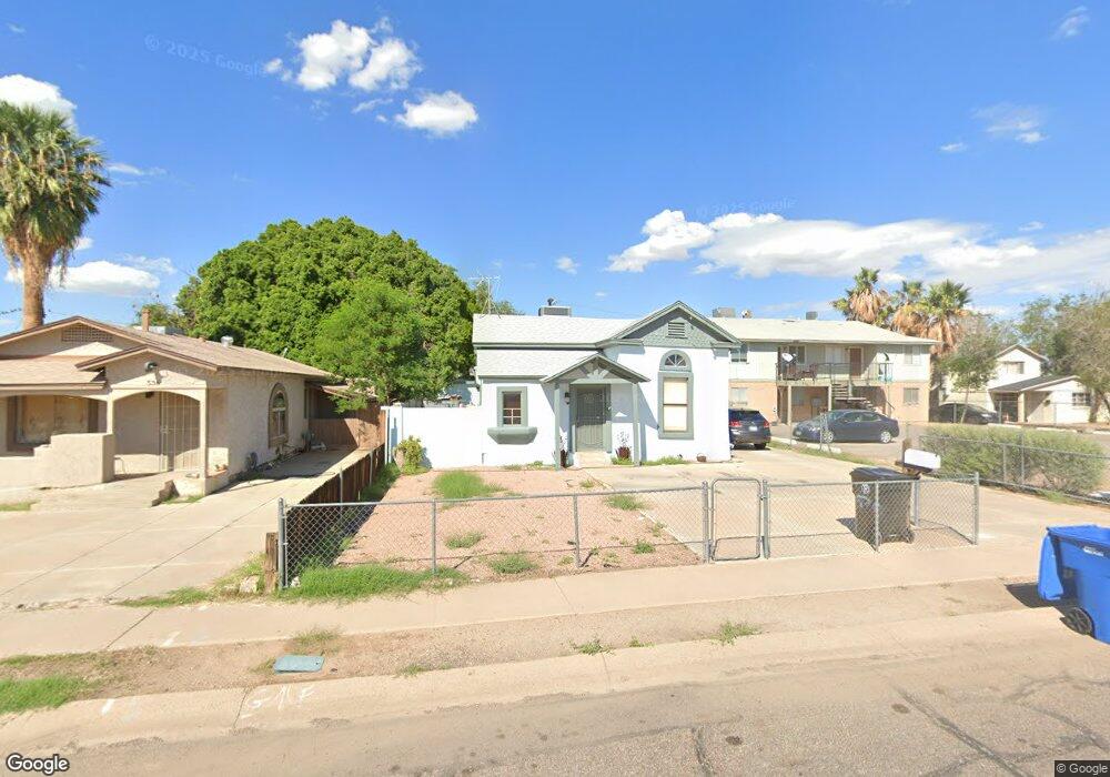
530 W 1st Ave Mesa, AZ 85210
West Main NeighborhoodEstimated Value: $256,000 - $272,000
--
Bed
1
Bath
800
Sq Ft
$329/Sq Ft
Est. Value
About This Home
This home is located at 530 W 1st Ave, Mesa, AZ 85210 and is currently estimated at $262,971, approximately $328 per square foot. 530 W 1st Ave is a home located in Maricopa County with nearby schools including Guerrero Elementary School, Franklin at Brimhall Elementary School, and Franklin West Elementary School.
Ownership History
Date
Name
Owned For
Owner Type
Purchase Details
Closed on
Apr 1, 2024
Sold by
Macias Trust
Bought by
Macias Horace C and Macias Ernest C
Current Estimated Value
Purchase Details
Closed on
Mar 21, 2024
Sold by
Macias Horace C
Bought by
Macias Isabella
Purchase Details
Closed on
Jul 16, 1998
Sold by
Macias Ernest C
Bought by
Macias Elisa C
Purchase Details
Closed on
Jul 15, 1998
Sold by
Macias Elisa C
Bought by
Macias Elisa C and The Macias Trust
Create a Home Valuation Report for This Property
The Home Valuation Report is an in-depth analysis detailing your home's value as well as a comparison with similar homes in the area
Home Values in the Area
Average Home Value in this Area
Purchase History
| Date | Buyer | Sale Price | Title Company |
|---|---|---|---|
| Macias Horace C | -- | None Listed On Document | |
| Macias Isabella | -- | None Listed On Document | |
| Macias Elisa C | -- | -- | |
| Macias Elisa C | -- | -- |
Source: Public Records
Tax History Compared to Growth
Tax History
| Year | Tax Paid | Tax Assessment Tax Assessment Total Assessment is a certain percentage of the fair market value that is determined by local assessors to be the total taxable value of land and additions on the property. | Land | Improvement |
|---|---|---|---|---|
| 2025 | $325 | $3,913 | -- | -- |
| 2024 | $328 | $3,727 | -- | -- |
| 2023 | $328 | $18,520 | $3,700 | $14,820 |
| 2022 | $321 | $13,080 | $2,610 | $10,470 |
| 2021 | $330 | $11,650 | $2,330 | $9,320 |
| 2020 | $326 | $10,500 | $2,100 | $8,400 |
| 2019 | $302 | $8,350 | $1,670 | $6,680 |
| 2018 | $288 | $6,380 | $1,270 | $5,110 |
| 2017 | $279 | $5,110 | $1,020 | $4,090 |
| 2016 | $274 | $4,560 | $910 | $3,650 |
| 2015 | $259 | $4,800 | $960 | $3,840 |
Source: Public Records
Map
Nearby Homes
- 420 W Mahoney Ave
- 141 N Date Unit 6
- 114 S Lebaron
- 730 W Pepper Place
- 225 W 1st St Unit 128
- 146 S Robson
- 705 W 2nd Place
- 921 W University Dr Unit 1232
- 921 W University Dr Unit 1218
- 127 W Pepper Place Unit A107
- 127 W Pepper Place Unit A101
- 127 W Pepper Place Unit A108
- 38 S Macdonald
- 20 S Macdonald
- 315 N Cherry
- 745 W 3rd St
- 453 W University Dr
- 152 W 2nd St
- 752 W 3rd Place
- 537 S Country Club Dr
- 536 W 1st Ave
- 526 W 1st Ave
- 526 W 1st Ave Unit 2
- 526 W 1st Ave Unit 4
- 526 W 1st Ave Unit 1
- 526 W 1st Ave Unit 3
- 542 W 1st Ave
- 518 W 1st Ave
- 518 W 1st Ave Unit 1/2
- 531 W 1st Ave
- 525 W 1st Ave
- 537 W 1st Ave
- 512 W 1st Ave
- 547 W Mahoney Ave
- 541 W 1st Ave
- 117 S Date
- 515 W 1st Ave
- 555 W Mahoney Ave
- 511 W 1st Ave
- 48 S Vineyard