
5300 Cranston Rd Morehead, KY 40351
Estimated payment $1,723/month
Highlights
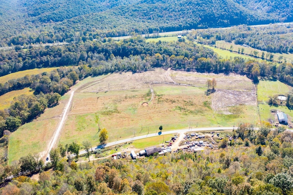
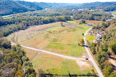
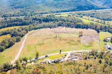
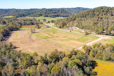
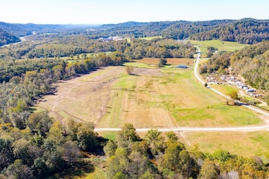
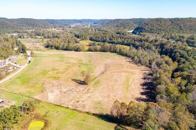
- 42.66 Acre Lot
- Wooded Lot
- The pond is a source of water for the property
- Lake, Pond or Stream
- Pasture
- Creek or Stream
About This Lot
Prime 42.66-Acre Development Opportunity on Cranston Road. This 42.66-acre surveyed tract offers an exceptional opportunity for commercial or residential development in a highly accessible location. Situated along Hwy 377 with road frontage, the property features cleared, level land, making it ideal for a variety of uses. With no restrictions, developers and investors can take advantage of the land's full potential. Infrastructure is already in place, including access to 3-phase power, natural gas, electric, and rural water, ensuring smooth development. A small pond adds character to the property, while a peaceful creek borders the backside, providing a natural touch to the landscape. Whether you're looking to build residential communities, commercial ventures, or a mixed-use project, this property offers flexibility, accessibility, and strong investment potential in a sought-after location.
Listing Agent
Century 21 Advantage Realty, A Robinson Company License #223524 Listed on: 06/05/2025

Property Details
Property Type
- Land
Est. Annual Taxes
- $77
Lot Details
- 42.66 Acre Lot
- Creek or Stream
- Level Lot
- Cleared Lot
- Wooded Lot
- Property is zoned Agricultural
Utilities
- Gas Available
- The pond is a source of water for the property
Additional Features
- Lake, Pond or Stream
- Pasture
Map
Home Values in the Area
Average Home Value in this Area
Tax History
| Year | Tax Paid | Tax Assessment Tax Assessment Total Assessment is a certain percentage of the fair market value that is determined by local assessors to be the total taxable value of land and additions on the property. | Land | Improvement |
|---|---|---|---|---|
| 2025 | $77 | $9,200 | $9,200 | $0 |
| 2024 | $79 | $9,200 | $9,200 | $0 |
| 2023 | $78 | $9,200 | $9,200 | $0 |
| 2022 | $80 | $9,200 | $9,200 | $0 |
| 2021 | $82 | $9,200 | $9,200 | $0 |
| 2020 | $83 | $80,000 | $80,000 | $0 |
| 2019 | $84 | $80,000 | $80,000 | $0 |
| 2018 | $110 | $80,000 | $80,000 | $0 |
| 2017 | -- | $80,000 | $80,000 | $0 |
| 2016 | -- | $12,075 | $12,075 | $0 |
| 2014 | $102 | $12,075 | $0 | $0 |
| 2013 | $102 | $12,075 | $0 | $0 |
Property History
| Date | Event | Price | List to Sale | Price per Sq Ft |
|---|---|---|---|---|
| 06/05/2025 06/05/25 | For Sale | $325,000 | -- | -- |
Purchase History
| Date | Type | Sale Price | Title Company |
|---|---|---|---|
| Deed | $80,000 | Attorney |
Source: Ashland Area Board of REALTORS®
MLS Number: 58896
APN: 076-00-00-020.00
- 000 American Legion Way
- 95 Sylva Dr
- 56 Golden Rod Dr
- 1150 Logan Hollow-Copperas Branch Rd
- 1589 Pennington Flats Rd
- 9999 Indian Dr
- 616 Fraley Dr
- 1357 Knapp Ave
- 67 Clayton Ln N
- 1129 N Wilson Ave Unit Lot 6
- 1129 N Wilson Ave Unit Lot 7
- 7220 Flemingsburg Rd
- 1007 Knapp Ave
- 412 Sunset Dr
- 30 Dusty Rd
- 1100 Flemingsburg Rd
- 129 Quail Hollow Rd
- 0 N Wilson Ave
- 460 Skaggs Rd
- 000 Skaggs Rd