Estimated Value: $305,460 - $338,000
3
Beds
2
Baths
1,396
Sq Ft
$230/Sq Ft
Est. Value
About This Home
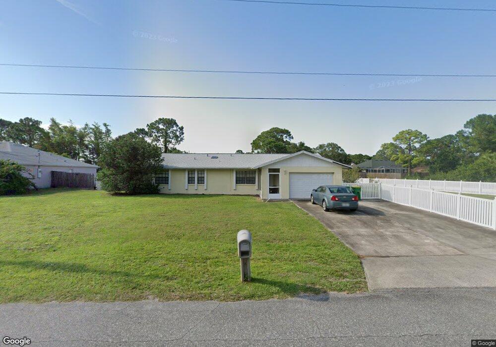
This home is located at 5300 Fruitport St, Cocoa, FL 32927 and is currently estimated at $321,115, approximately $230 per square foot. 5300 Fruitport St is a home located in Brevard County with nearby schools including Enterprise Elementary School, Space Coast Junior/Senior High School, and Sculptor Charter School.
Ownership History
Date
Name
Owned For
Owner Type
Purchase Details
Closed on
May 27, 2009
Sold by
Fort Florence E
Bought by
Fort Florence E
Current Estimated Value
Home Financials for this Owner
Home Financials are based on the most recent Mortgage that was taken out on this home.
Original Mortgage
$35,000
Interest Rate
4.8%
Create a Home Valuation Report for This Property
The Home Valuation Report is an in-depth analysis detailing your home's value as well as a comparison with similar homes in the area
Home Values in the Area
Average Home Value in this Area
Purchase History
| Date | Buyer | Sale Price | Title Company |
|---|---|---|---|
| Fort Florence E | -- | Lsi Lps |
Source: Public Records
Mortgage History
| Date | Status | Borrower | Loan Amount |
|---|---|---|---|
| Closed | Fort Florence E | $35,000 |
Source: Public Records
Tax History Compared to Growth
Tax History
| Year | Tax Paid | Tax Assessment Tax Assessment Total Assessment is a certain percentage of the fair market value that is determined by local assessors to be the total taxable value of land and additions on the property. | Land | Improvement |
|---|---|---|---|---|
| 2025 | $1,234 | $98,300 | -- | -- |
| 2024 | $1,197 | $95,530 | -- | -- |
| 2023 | $1,197 | $92,750 | $0 | $0 |
| 2022 | $1,166 | $90,050 | $0 | $0 |
| 2021 | $1,161 | $87,430 | $0 | $0 |
| 2020 | $1,109 | $86,230 | $0 | $0 |
| 2019 | $1,044 | $84,300 | $0 | $0 |
| 2018 | $1,036 | $82,730 | $0 | $0 |
| 2017 | $1,028 | $81,030 | $0 | $0 |
| 2016 | $1,025 | $79,370 | $18,000 | $61,370 |
| 2015 | $1,033 | $78,820 | $15,000 | $63,820 |
| 2014 | $1,033 | $78,200 | $11,000 | $67,200 |
Source: Public Records
Map
Nearby Homes
- 00 Unknown
- 6615 Dock Ave
- 5220 Holden Rd
- 6760 Cairo Rd
- 5275 Holden Rd
- 5215 Holden Rd
- 6581 Bancroft Ave
- 6375 Cable Ave
- 5575 Curtis Blvd
- 0000 Grissom Pkwy
- 4650 N Highway 1 Hwy
- 6620 Grissom Pkwy
- 5460 Holden Rd
- 5446 Jamaica Rd
- 5049 Jamaica Rd
- 5715 Fairbridge St
- 4975 Fay Blvd
- 6735 Grissom Pkwy
- 6094 Cardiff Ave
- 6061 Banbury Ave
- 5310 Fruitport St
- 5320 Fruitport St
- 6450 Ember Ave
- 5315 Fruitport St
- 6510 Ember Ave
- 5290 Fruitport St
- 0 Fairchild Ave
- 6491 Fairchild Ave
- 5375 Curtis Blvd
- 5315 Curtis Blvd
- 5330 Fruitport St
- 5280 Fruitport St
- 6430 Ember Ave
- 5385 Curtis Blvd
- 5295 Fruitport St
- 6473 Fairchild Ave
- 5305 Curtis Blvd
- 5340 Fruitport St
- 6490 Fairchild Ave
- 5395 Curtis Blvd