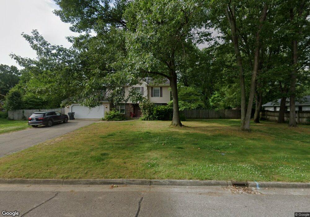
5301 Burning Tree Rd Kalamazoo, MI 49009
Estimated Value: $415,874 - $460,000
4
Beds
3
Baths
2,340
Sq Ft
$189/Sq Ft
Est. Value
About This Home
This home is located at 5301 Burning Tree Rd, Kalamazoo, MI 49009 and is currently estimated at $443,219, approximately $189 per square foot. 5301 Burning Tree Rd is a home located in Kalamazoo County with nearby schools including 12th Street Elementary School, Portage West Middle School, and Portage Central High School.
Ownership History
Date
Name
Owned For
Owner Type
Purchase Details
Closed on
Jun 13, 2017
Sold by
Kay Pamela
Bought by
Heckman Victor Lee and Heckman Tammy A
Current Estimated Value
Purchase Details
Closed on
Sep 29, 2006
Sold by
Heckman Victor L and Heckman Tammy
Bought by
Kay Pamela
Home Financials for this Owner
Home Financials are based on the most recent Mortgage that was taken out on this home.
Original Mortgage
$192,000
Interest Rate
6.49%
Mortgage Type
Purchase Money Mortgage
Purchase Details
Closed on
Apr 6, 2006
Sold by
Heckman Victor L and Heckman Tammy
Bought by
Federal Home Loan Mortgage Corporation
Create a Home Valuation Report for This Property
The Home Valuation Report is an in-depth analysis detailing your home's value as well as a comparison with similar homes in the area
Home Values in the Area
Average Home Value in this Area
Purchase History
| Date | Buyer | Sale Price | Title Company |
|---|---|---|---|
| Heckman Victor Lee | -- | None Available | |
| Kay Pamela | $240,000 | Lighthouse Title | |
| Federal Home Loan Mortgage Corporation | $176,529 | None Available |
Source: Public Records
Mortgage History
| Date | Status | Borrower | Loan Amount |
|---|---|---|---|
| Previous Owner | Kay Pamela | $192,000 |
Source: Public Records
Tax History
| Year | Tax Paid | Tax Assessment Tax Assessment Total Assessment is a certain percentage of the fair market value that is determined by local assessors to be the total taxable value of land and additions on the property. | Land | Improvement |
|---|---|---|---|---|
| 2025 | $1,452 | $185,200 | $0 | $0 |
| 2024 | $1,410 | $173,500 | $0 | $0 |
| 2023 | $1,345 | $157,500 | $0 | $0 |
| 2022 | $4,405 | $141,600 | $0 | $0 |
| 2021 | $4,280 | $132,900 | $0 | $0 |
| 2020 | $4,179 | $130,200 | $0 | $0 |
| 2019 | $3,823 | $125,500 | $0 | $0 |
| 2018 | $2,354 | $126,100 | $0 | $0 |
| 2017 | -- | $125,700 | $0 | $0 |
| 2016 | -- | $121,200 | $0 | $0 |
| 2015 | -- | $105,000 | $13,200 | $91,800 |
| 2014 | -- | $105,000 | $0 | $0 |
Source: Public Records
Map
Nearby Homes
- 5464 Cypress Bay Dr
- 7194 Waltham Dr
- 7341 Salerno Cir
- 7405 Milan Dr
- 4610 Geneva Ave
- 5661 Attleberry Ave
- 5820 Boxthorn Trail
- 4691 Ashton Farms Blvd
- 6787 Tiger Lily Dr Unit 55
- 5944 Gavin Ln
- 6035 S 12th St
- 5950 Boxthorn Trail
- 5978 Boxthorn Trail
- 5250 Queen Victoria Ln
- 6061 Equestrian Woods Ct
- 6107 Equestrian Woods Ct Unit 267
- 4280 Romence Rd
- 7182 Breton Woods Ct
- 7440 Brindle Trail Unit 194
- 5153 Chickadee Dr
- 5317 Burning Tree Rd
- 5304 Stoney Brook Rd
- 5296 Stoney Brook Rd
- 5330 Stoney Brook Rd
- 5290 Burning Tree Rd
- 5326 Burning Tree Rd
- 5258 Stoney Brook Rd
- 5353 Burning Tree Rd
- 5348 Burning Tree Rd
- 7289 Hunters Ridge Dr
- 5268 Burning Tree Rd
- 5358 Stoney Brook Rd
- 5287 Stoney Brook Rd
- 5311 Heathrow Ave
- 7538 Hunters Ridge Dr
- 5275 Heathrow Ave
- 5349 Stoney Brook Rd
- 5244 Burning Tree Rd
- 5273 Stoney Brook Rd
- 5335 Heathrow Ave
Your Personal Tour Guide
Ask me questions while you tour the home.