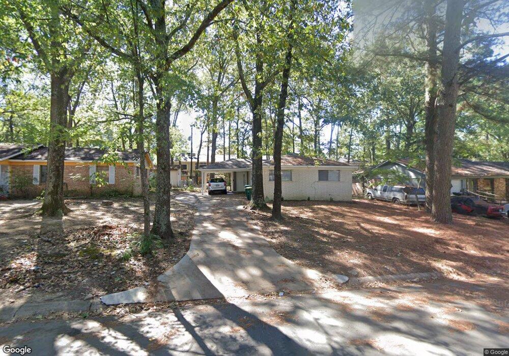
5301 Keats Dr Little Rock, AR 72209
Upper Baseline NeighborhoodEstimated Value: $88,000 - $132,000
3
Beds
2
Baths
1,325
Sq Ft
$86/Sq Ft
Est. Value
About This Home
This home is located at 5301 Keats Dr, Little Rock, AR 72209 and is currently estimated at $114,096, approximately $86 per square foot. 5301 Keats Dr is a home located in Pulaski County with nearby schools including Watson Elementary School, Cloverdale Middle School, and Little Rock Southwest High School.
Ownership History
Date
Name
Owned For
Owner Type
Purchase Details
Closed on
Feb 10, 2021
Sold by
Wells Fargo Bank Na
Bought by
Sfr3-020 Llc
Current Estimated Value
Purchase Details
Closed on
Mar 10, 2020
Sold by
Piggee Ira L and Piggee Deiphia Wilson
Bought by
Wells Fargo Bank National Association
Purchase Details
Closed on
Mar 21, 2001
Sold by
Metcalf James Richard
Bought by
Piggee Ira L
Home Financials for this Owner
Home Financials are based on the most recent Mortgage that was taken out on this home.
Original Mortgage
$49,988
Interest Rate
7.13%
Mortgage Type
FHA
Create a Home Valuation Report for This Property
The Home Valuation Report is an in-depth analysis detailing your home's value as well as a comparison with similar homes in the area
Home Values in the Area
Average Home Value in this Area
Purchase History
| Date | Buyer | Sale Price | Title Company |
|---|---|---|---|
| Sfr3-020 Llc | $42,000 | None Listed On Document | |
| Wells Fargo Bank National Association | $76,969 | None Available | |
| Piggee Ira L | -- | First National Title Company |
Source: Public Records
Mortgage History
| Date | Status | Borrower | Loan Amount |
|---|---|---|---|
| Previous Owner | Piggee Ira L | $49,988 |
Source: Public Records
Tax History Compared to Growth
Tax History
| Year | Tax Paid | Tax Assessment Tax Assessment Total Assessment is a certain percentage of the fair market value that is determined by local assessors to be the total taxable value of land and additions on the property. | Land | Improvement |
|---|---|---|---|---|
| 2025 | $1,154 | $18,289 | $2,800 | $15,489 |
| 2024 | $988 | $18,289 | $2,800 | $15,489 |
| 2023 | $988 | $18,289 | $2,800 | $15,489 |
| 2022 | $906 | $18,289 | $2,800 | $15,489 |
| 2021 | $829 | $11,760 | $2,700 | $9,060 |
| 2020 | $823 | $11,760 | $2,700 | $9,060 |
| 2019 | $823 | $11,760 | $2,700 | $9,060 |
| 2018 | $823 | $11,760 | $2,700 | $9,060 |
| 2017 | $823 | $11,760 | $2,700 | $9,060 |
| 2016 | $911 | $13,020 | $3,000 | $10,020 |
| 2015 | $913 | $13,020 | $3,000 | $10,020 |
| 2014 | $913 | $13,020 | $3,000 | $10,020 |
Source: Public Records
Map
Nearby Homes
- 8406 Dreher Ln
- 8511 Dreher Ln
- 8600 Dreher Ln
- 8616 Dreher Ln
- 5505 Chaucer Ln
- 8301 Stanton Rd
- 5709 Chaucer Ln
- 7 Linkay Ct
- 4623 Stratton Ave
- 5917 Chaucer Ln
- 000 Young Rd
- 5300 Southboro Ct
- 000 Geyer Springs Rd
- 14 Mansfield Dr
- 6315 Hinkson Rd
- 9220 Reck Rd
- 22 Old Glory Ct
- 4028 Arapaho Trail
- 6313 Senate Dr
- TBD Spring Creek Cove