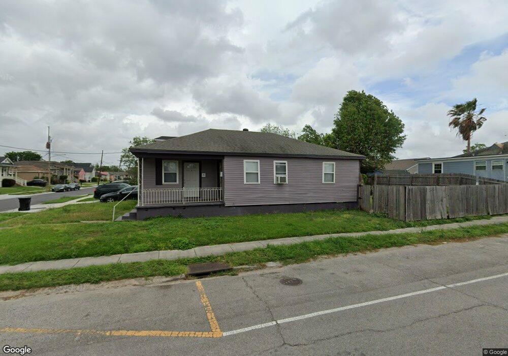
5301 Wickfield Dr New Orleans, LA 70122
Saint Anthony NeighborhoodEstimated Value: $176,178 - $223,000
2
Beds
2
Baths
1,214
Sq Ft
$166/Sq Ft
Est. Value
About This Home
This home is located at 5301 Wickfield Dr, New Orleans, LA 70122 and is currently estimated at $202,045, approximately $166 per square foot. 5301 Wickfield Dr is a home located in Orleans Parish with nearby schools including Mary Bethune Elementary School, Arthur Ashe Charter School, and Edward Hynes Charter School - Uno Campus.
Ownership History
Date
Name
Owned For
Owner Type
Purchase Details
Closed on
Mar 13, 2009
Sold by
Grant Belovia Watkins
Bought by
Grant Andrew A
Current Estimated Value
Home Financials for this Owner
Home Financials are based on the most recent Mortgage that was taken out on this home.
Original Mortgage
$137,464
Outstanding Balance
$88,469
Interest Rate
5.36%
Estimated Equity
$113,576
Purchase Details
Closed on
Oct 26, 2006
Sold by
Tabor Brian T
Bought by
Grant Belovia W
Create a Home Valuation Report for This Property
The Home Valuation Report is an in-depth analysis detailing your home's value as well as a comparison with similar homes in the area
Home Values in the Area
Average Home Value in this Area
Purchase History
| Date | Buyer | Sale Price | Title Company |
|---|---|---|---|
| Grant Andrew A | $140,000 | -- | |
| Grant Belovia W | $30,000 | -- |
Source: Public Records
Mortgage History
| Date | Status | Borrower | Loan Amount |
|---|---|---|---|
| Open | Grant Andrew A | $137,464 |
Source: Public Records
Tax History Compared to Growth
Tax History
| Year | Tax Paid | Tax Assessment Tax Assessment Total Assessment is a certain percentage of the fair market value that is determined by local assessors to be the total taxable value of land and additions on the property. | Land | Improvement |
|---|---|---|---|---|
| 2025 | $703 | $14,820 | $4,000 | $10,820 |
| 2024 | $535 | $14,820 | $4,000 | $10,820 |
| 2023 | $328 | $9,520 | $2,000 | $7,520 |
| 2022 | $328 | $9,140 | $2,000 | $7,140 |
| 2021 | $388 | $9,520 | $2,000 | $7,520 |
| 2020 | $391 | $9,520 | $2,000 | $7,520 |
| 2019 | $563 | $10,580 | $1,500 | $9,080 |
| 2018 | $572 | $10,580 | $1,500 | $9,080 |
| 2017 | $532 | $10,580 | $1,500 | $9,080 |
| 2016 | $546 | $10,580 | $1,500 | $9,080 |
| 2015 | $536 | $10,580 | $1,500 | $9,080 |
| 2014 | -- | $10,580 | $1,500 | $9,080 |
| 2013 | -- | $10,580 | $1,500 | $9,080 |
Source: Public Records
Map
Nearby Homes
- 5313 Wickfield Dr
- 5303 Warrington Dr
- 5200 Warrington Dr
- 5319 Saint Anthony Ave
- 5145 Saint Anthony Ave
- 5330 Cameron Blvd
- 5016 Warrington Dr
- 5519 Wingate Dr
- 5122 Pratt Dr
- 5331 AB Cameron Blvd
- 5143 Cameron Blvd
- 5240 Pasteur Blvd
- 5308 Pasteur Blvd
- 9 Chatham Dr
- 5701 Wildair Dr
- 5611 Charlotte Dr
- 5025 Pauger St
- 5303 Wickfield Dr
- 5302 Wickfield Dr
- 5305 Wickfield Dr
- 5304 Wickfield St
- 5304 Wickfield Dr
- 5302 Wingate Dr
- 5304 Wingate Dr
- 5307 Wickfield Dr
- 5306 Wingate Dr
- 5306 Wickfield Dr
- 1852 Filmore Ave
- 1844 Filmore Ave
- 1860 Filmore Ave
- 5308 Wingate Dr
- 5308 Wickfield Dr
- 5309 Wickfield Dr
- 5309 Wickfield Dr Unit A
- 5301 Warrington Dr
- 5303 Warrington Dr Unit A
- 5303 Warrington Dr Unit B