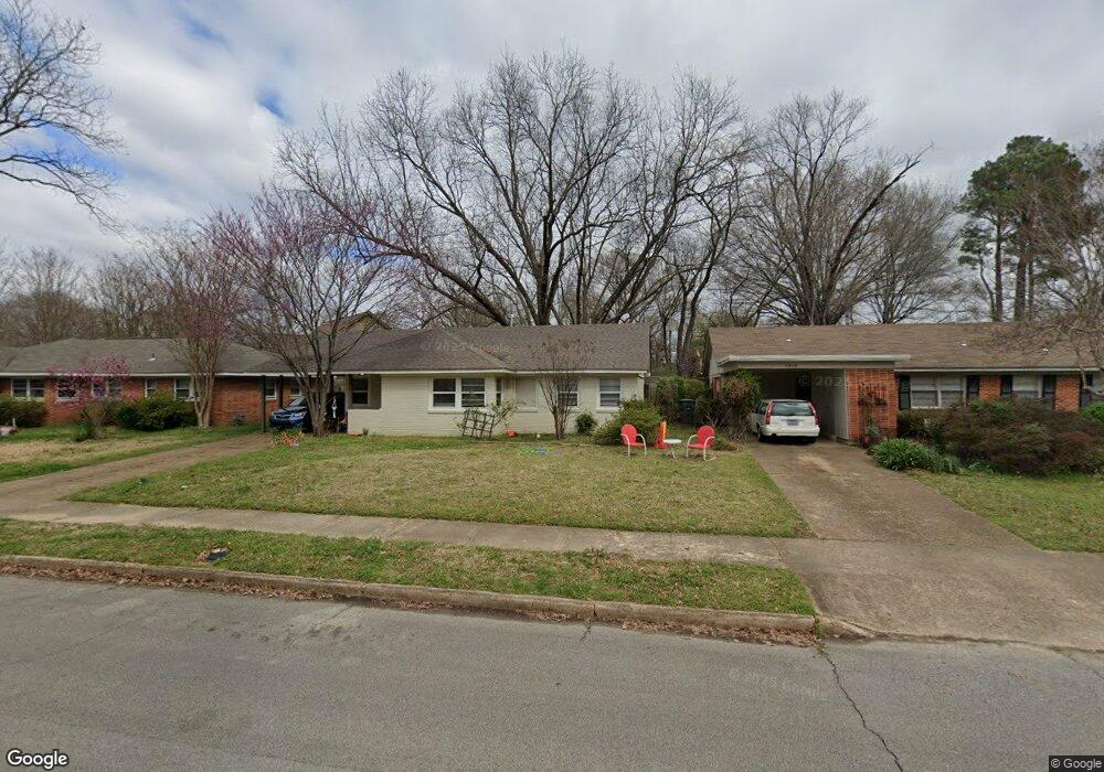
5304 Mesquite Rd Memphis, TN 38120
Audubon Park NeighborhoodEstimated Value: $176,000 - $209,000
3
Beds
2
Baths
1,138
Sq Ft
$170/Sq Ft
Est. Value
About This Home
This home is located at 5304 Mesquite Rd, Memphis, TN 38120 and is currently estimated at $193,560, approximately $170 per square foot. 5304 Mesquite Rd is a home located in Shelby County with nearby schools including Richland Elementary School, White Station Middle, and White Station High.
Ownership History
Date
Name
Owned For
Owner Type
Purchase Details
Closed on
Jul 6, 2018
Sold by
Travid Llc
Bought by
Bc Memphis Property Holdings Llc
Current Estimated Value
Home Financials for this Owner
Home Financials are based on the most recent Mortgage that was taken out on this home.
Original Mortgage
$112,880
Interest Rate
4.6%
Mortgage Type
Commercial
Purchase Details
Closed on
Dec 7, 2006
Sold by
Webster Marjorie
Bought by
Mendelson David
Home Financials for this Owner
Home Financials are based on the most recent Mortgage that was taken out on this home.
Original Mortgage
$87,000
Interest Rate
6.36%
Mortgage Type
Purchase Money Mortgage
Purchase Details
Closed on
Apr 26, 1996
Sold by
Webster Marjorie F
Bought by
Marjorie Webster Living Trust
Create a Home Valuation Report for This Property
The Home Valuation Report is an in-depth analysis detailing your home's value as well as a comparison with similar homes in the area
Home Values in the Area
Average Home Value in this Area
Purchase History
| Date | Buyer | Sale Price | Title Company |
|---|---|---|---|
| Bc Memphis Property Holdings Llc | $102,000 | Closing & Title Svcs | |
| Mendelson David | $97,000 | None Available | |
| Marjorie Webster Living Trust | -- | -- |
Source: Public Records
Mortgage History
| Date | Status | Borrower | Loan Amount |
|---|---|---|---|
| Closed | Bc Memphis Property Holdings Llc | $112,880 | |
| Previous Owner | Mendelson David | $87,000 |
Source: Public Records
Tax History Compared to Growth
Tax History
| Year | Tax Paid | Tax Assessment Tax Assessment Total Assessment is a certain percentage of the fair market value that is determined by local assessors to be the total taxable value of land and additions on the property. | Land | Improvement |
|---|---|---|---|---|
| 2025 | $1,304 | $45,600 | $12,000 | $33,600 |
| 2024 | $1,304 | $38,475 | $9,200 | $29,275 |
| 2023 | $2,344 | $38,475 | $9,200 | $29,275 |
| 2022 | $2,344 | $38,475 | $9,200 | $29,275 |
| 2021 | $2,371 | $38,475 | $9,200 | $29,275 |
| 2020 | $2,061 | $28,450 | $9,200 | $19,250 |
| 2019 | $1,008 | $31,550 | $9,200 | $22,350 |
| 2018 | $1,008 | $31,550 | $9,200 | $22,350 |
| 2017 | $1,032 | $31,550 | $9,200 | $22,350 |
| 2016 | $1,202 | $27,500 | $0 | $0 |
| 2014 | $1,202 | $29,500 | $0 | $0 |
Source: Public Records
Map
Nearby Homes
- 580 N Oak Grove Rd
- 529 Fleda Rd
- 496 Chalmers Rd
- 551 N White Station Rd
- 536 Wheaton Park Cove N
- 5176 White Cliff Dr
- 446 Rosser Rd
- 5137 Whitehall Ave
- 448 N White Station Rd
- 430 Mcelroy Rd
- 422 Mcelroy Rd
- 5119 Tarrytown Dr
- 379 Mcelroy Rd
- 432 Malboro Rd
- 424 Malboro Rd
- 5362 Wilton Ave
- 5238 Peg Ln
- 5468 Mason Rd
- 5033 Henry Heights Dr
- 5121 Lynbar Ave
- 5310 Mesquite Rd
- 5298 Mesquite Rd
- 5294 Mesquite Cove
- 5316 Mesquite Rd
- 5290 Mesquite Cove
- 5292 Mesquite Cove
- 5292 Mesquite Rd
- 5319 Dorsey Ave
- 5305 Dorsey Ave
- 5286 Mesquite Cove
- 575 Podesta St
- 5297 Dorsey Ave
- 5280 Mesquite Cove
- 583 Podesta St
- 5282 Mesquite Cove
- 5289 Dorsey Ave
- 558 Chalmers Rd
- 5305 Mesquite Rd
- 5299 Mesquite Rd
- 5311 Mesquite Rd