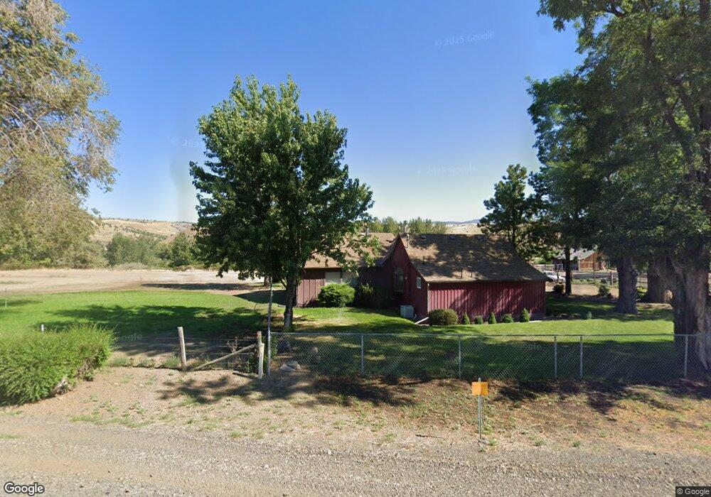
53041 Hwy 26 Mount Vernon, OR 97865
Estimated Value: $433,000 - $519,763
3
Beds
2
Baths
1,911
Sq Ft
$254/Sq Ft
Est. Value
About This Home
This home is located at 53041 Hwy 26, Mount Vernon, OR 97865 and is currently estimated at $484,941, approximately $253 per square foot. 53041 Hwy 26 is a home located in Grant County with nearby schools including Grant Union Junior/Senior High School.
Ownership History
Date
Name
Owned For
Owner Type
Purchase Details
Closed on
Nov 10, 2018
Sold by
Schlappi Patrick H
Bought by
Schlappi Michael Stephen
Current Estimated Value
Purchase Details
Closed on
May 26, 2016
Sold by
Brown Sandra L and Brown Dale L
Bought by
Schlappi Patrick H
Home Financials for this Owner
Home Financials are based on the most recent Mortgage that was taken out on this home.
Original Mortgage
$197,200
Outstanding Balance
$157,052
Interest Rate
3.59%
Mortgage Type
New Conventional
Estimated Equity
$327,889
Create a Home Valuation Report for This Property
The Home Valuation Report is an in-depth analysis detailing your home's value as well as a comparison with similar homes in the area
Home Values in the Area
Average Home Value in this Area
Purchase History
| Date | Buyer | Sale Price | Title Company |
|---|---|---|---|
| Schlappi Michael Stephen | -- | Stewart Title | |
| Schlappi Patrick H | $246,500 | None Available |
Source: Public Records
Mortgage History
| Date | Status | Borrower | Loan Amount |
|---|---|---|---|
| Open | Schlappi Patrick H | $197,200 |
Source: Public Records
Tax History Compared to Growth
Tax History
| Year | Tax Paid | Tax Assessment Tax Assessment Total Assessment is a certain percentage of the fair market value that is determined by local assessors to be the total taxable value of land and additions on the property. | Land | Improvement |
|---|---|---|---|---|
| 2024 | $2,242 | $187,192 | $93,014 | $94,178 |
| 2023 | $2,177 | $181,740 | $90,306 | $91,434 |
| 2022 | $2,114 | $176,447 | $87,672 | $88,775 |
| 2021 | $2,052 | $171,308 | $85,119 | $86,189 |
| 2020 | $2,188 | $166,319 | $82,638 | $83,681 |
| 2019 | $2,126 | $161,475 | $80,234 | $81,241 |
| 2018 | $2,061 | $156,772 | $72,851 | $83,921 |
| 2017 | $2,007 | $152,206 | $70,730 | $81,476 |
| 2016 | $1,950 | $147,773 | $68,669 | $79,104 |
| 2015 | $1,921 | $139,291 | $61,121 | $78,170 |
| 2014 | $1,921 | $139,291 | $61,121 | $78,170 |
| 2013 | $1,785 | $135,234 | $57,954 | $77,280 |
Source: Public Records
Map
Nearby Homes
- 50889 Highway 26
- 54797 U S 26
- 0 Cummings Creek Rd
- 55550 McKern Ln
- 0 Belshaw Rd Unit 24252186
- 31367 Clarks Creek Rd
- 54797 U S Highway 26
- 809 Ingle St
- 210 Mountain Blvd
- 410 N Mountain Blvd
- 440 N Mountain Blvd
- 251 SE Council Dr
- 52960 Cummings Creek Rd
- 0 Wiley Creek Rd Unit 2406 220202660
- 0 Tl 2400 Wiley Creek Rd
- 0 Wiley Creek Rd Unit 610850473
- 0 Wiley Creek Rd Unit 23901466
- 0 Wiley Creek Rd Unit 500934684
- 0 Wiley Creek Rd Unit 148079631
- 53041 Hwy 26
- 52947 Hwy 26
- 24774 Moon Creek Ln
- 24774 Moon Creek Ln
- 24799 Moon Creek Ln
- 24799 Moon Creek Ln
- 24251 Moon Creek Ln
- 53396 Hwy 26
- 25267 Moon Creek Ln
- 0 Moon Creek Ln
- 0 Moon Creek Rd Unit 241488
- 0 Moon Creek Rd Unit 20164701
- 0 Moon Creek Rd
- 24414 Moon Creek Ln
- 24414 Moon Creek Ln
- 53438 Hwy 26
- 53443 Hwy 26
- 27710 Picnic Creek Rd
- 27646 Picnic Creek Rd
- 27646 Picnic Creek Rd