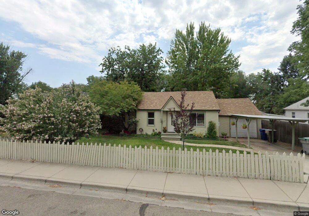
5305 Ponder St Boise, ID 83705
Central Bench NeighborhoodEstimated Value: $325,000 - $364,000
2
Beds
1
Bath
783
Sq Ft
$446/Sq Ft
Est. Value
About This Home
This home is located at 5305 Ponder St, Boise, ID 83705 and is currently estimated at $349,187, approximately $445 per square foot. 5305 Ponder St is a home located in Ada County with nearby schools including Hillcrest Elementary School, South Junior High School, and Borah Senior High School.
Ownership History
Date
Name
Owned For
Owner Type
Purchase Details
Closed on
May 14, 2015
Sold by
Malone April
Bought by
Malone April A
Current Estimated Value
Home Financials for this Owner
Home Financials are based on the most recent Mortgage that was taken out on this home.
Original Mortgage
$94,400
Interest Rate
3.67%
Mortgage Type
New Conventional
Purchase Details
Closed on
Oct 20, 1998
Sold by
Malone April A and Ling April A Ying
Bought by
Malone April A
Create a Home Valuation Report for This Property
The Home Valuation Report is an in-depth analysis detailing your home's value as well as a comparison with similar homes in the area
Home Values in the Area
Average Home Value in this Area
Purchase History
| Date | Buyer | Sale Price | Title Company |
|---|---|---|---|
| Malone April A | -- | Titleone | |
| Malone April A | -- | Stewart Title |
Source: Public Records
Mortgage History
| Date | Status | Borrower | Loan Amount |
|---|---|---|---|
| Closed | Malone April A | $94,400 |
Source: Public Records
Tax History Compared to Growth
Tax History
| Year | Tax Paid | Tax Assessment Tax Assessment Total Assessment is a certain percentage of the fair market value that is determined by local assessors to be the total taxable value of land and additions on the property. | Land | Improvement |
|---|---|---|---|---|
| 2025 | $1,454 | $314,000 | -- | -- |
| 2024 | $1,464 | $285,200 | -- | -- |
| 2023 | $1,464 | $278,300 | $0 | $0 |
| 2022 | $1,721 | $323,500 | $0 | $0 |
| 2021 | $1,529 | $264,900 | $0 | $0 |
| 2020 | $1,438 | $221,100 | $0 | $0 |
| 2019 | $1,465 | $208,000 | $0 | $0 |
| 2018 | $1,312 | $172,800 | $0 | $0 |
| 2017 | $1,151 | $144,100 | $0 | $0 |
| 2016 | $1,096 | $133,800 | $0 | $0 |
| 2015 | -- | $120,700 | $0 | $0 |
| 2012 | -- | $70,100 | $0 | $0 |
Source: Public Records
Map
Nearby Homes
- 5207 W Peg St
- 520 S Scott St
- 703 S Phillippi St
- 707 S Scott St
- 868 S Phillippi St
- 529 S Beach St
- 4820 Albion St
- 421 S Curtis Rd Unit 206
- 421 S Curtis Rd Unit 15
- 421 S Curtis Rd Unit 208
- 824 S Curtis Rd
- 5410 W Edson St
- 854 S Curtis Rd
- 4800 W Franklin Rd
- 4806 W Richardson St
- 5366 W Kootenai St
- 4910 W Edson St
- 815 S Curtis Rd Unit 27
- 2627 W Edson St
- 5231 W Morris Hill Rd
- 5309 Ponder St
- 5301 Ponder St
- 5221 Ponder St
- 5315 Ponder St
- 5215 Ponder St
- 5215 W Ponder St
- 424 S Phillippi St
- 5304 Ponder St
- 426 S Phillippi St
- 5308 Ponder St
- 5300 Ponder St
- 500 S Phillippi St
- 5354 Grover St
- 5354 W Grover St
- 5356 Grover St
- 5220 Ponder St
- 502 S Phillippi St
- 5211 Ponder St
- 508 S Phillippi St
- 5214 Ponder St