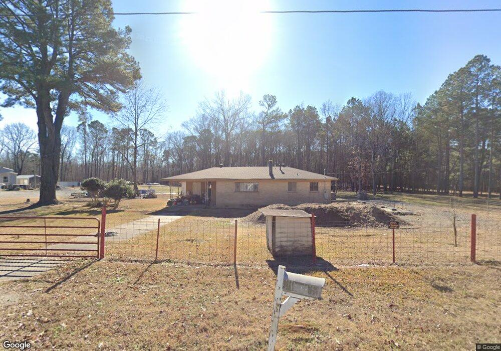
5305 Rinke Rd Little Rock, AR 72209
Upper Baseline NeighborhoodEstimated Value: $65,000 - $110,000
--
Bed
1
Bath
985
Sq Ft
$89/Sq Ft
Est. Value
About This Home
This home is located at 5305 Rinke Rd, Little Rock, AR 72209 and is currently estimated at $88,117, approximately $89 per square foot. 5305 Rinke Rd is a home located in Pulaski County with nearby schools including Watson Elementary School, Cloverdale Middle School, and Little Rock Southwest High School.
Ownership History
Date
Name
Owned For
Owner Type
Purchase Details
Closed on
Mar 26, 2020
Sold by
Asaro Deno
Bought by
Pizarro Maria Aurora Martinez
Current Estimated Value
Purchase Details
Closed on
Mar 28, 2018
Sold by
Asaro Deno and Estate Of Betty Asaro
Bought by
Asaro Denodeno
Purchase Details
Closed on
Apr 21, 1998
Sold by
Fee Joseph L and Fee Stephanie A
Bought by
Asaro Louie and Asaro Betty
Create a Home Valuation Report for This Property
The Home Valuation Report is an in-depth analysis detailing your home's value as well as a comparison with similar homes in the area
Home Values in the Area
Average Home Value in this Area
Purchase History
| Date | Buyer | Sale Price | Title Company |
|---|---|---|---|
| Pizarro Maria Aurora Martinez | -- | None Available | |
| Asaro Denodeno | -- | None Available | |
| Asaro Louie | $40,000 | First Security Title Company |
Source: Public Records
Tax History Compared to Growth
Tax History
| Year | Tax Paid | Tax Assessment Tax Assessment Total Assessment is a certain percentage of the fair market value that is determined by local assessors to be the total taxable value of land and additions on the property. | Land | Improvement |
|---|---|---|---|---|
| 2025 | $689 | $11,342 | $588 | $10,754 |
| 2024 | $591 | $11,342 | $588 | $10,754 |
| 2023 | $591 | $11,342 | $588 | $10,754 |
| 2022 | $542 | $11,342 | $588 | $10,754 |
| 2021 | $496 | $7,040 | $640 | $6,400 |
| 2020 | $60 | $7,040 | $640 | $6,400 |
| 2019 | $41 | $7,040 | $640 | $6,400 |
| 2018 | $46 | $7,040 | $640 | $6,400 |
| 2017 | $46 | $7,040 | $640 | $6,400 |
| 2016 | $46 | $5,660 | $1,590 | $4,070 |
| 2015 | $397 | $5,660 | $1,590 | $4,070 |
| 2014 | $397 | $5,660 | $1,590 | $4,070 |
Source: Public Records
Map
Nearby Homes
- 10407 Republic Ln
- 00 Lovett Dr
- 5817 Drexel Ave
- 5823 Liberty Cove
- 22 Old Glory Ct
- 5300 Southboro Ct
- 000 Geyer Springs Rd
- 9220 Reck Rd
- 6711 Woodfield Rd
- 11902 Chariot Dr
- 10001 Warren Dr
- 3938 Wooddale Dr
- 6313 Senate Dr
- 3810 Vinson Rd
- 6611 Fairfield Dr
- 3603 Rosepoint Cove
- 8616 Dreher Ln
- 7009 Guinevere Dr
- 8600 Dreher Ln
- 8511 Dreher Ln
- 5300 Rinke Rd
- 5401 Rinke Rd
- 5403 Rinke Rd
- 5503 Rinke Rd
- 10419 Independence Ln
- 10415 Independence Ln
- 10407 Independence Ln
- 10401 Independence Ln
- 10323 Independence Ln
- 10420 Independence Ln
- 0 Independence Ln
- 10414 Independence Ln
- 10317 Independence Ln
- 10408 Independence Ln
- 5505 Rinke Rd
- 10311 Independence Ln
- 10402 Independence Ln
- 10324 Independence Ln
- 10423 Republic Ln
- 10307 Independence Ln