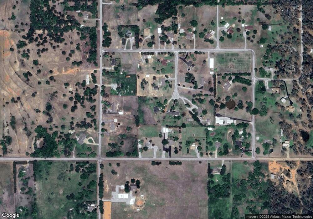
5305 Sherry Ln Duncan, OK 73533
Estimated Value: $189,000 - $245,000
3
Beds
2
Baths
1,504
Sq Ft
$140/Sq Ft
Est. Value
About This Home
This home is located at 5305 Sherry Ln, Duncan, OK 73533 and is currently estimated at $210,485, approximately $139 per square foot. 5305 Sherry Ln is a home with nearby schools including Empire High School.
Ownership History
Date
Name
Owned For
Owner Type
Purchase Details
Closed on
Mar 28, 2013
Sold by
Jones Dani A
Bought by
Jones Michael C E
Current Estimated Value
Purchase Details
Closed on
Mar 17, 2010
Sold by
West Neil K and West Barbara J
Bought by
Jones Michael C and Jones Dani A
Home Financials for this Owner
Home Financials are based on the most recent Mortgage that was taken out on this home.
Original Mortgage
$85,325
Outstanding Balance
$56,467
Interest Rate
4.95%
Mortgage Type
FHA
Estimated Equity
$154,018
Purchase Details
Closed on
Mar 19, 2001
Sold by
Grider Michael M
Create a Home Valuation Report for This Property
The Home Valuation Report is an in-depth analysis detailing your home's value as well as a comparison with similar homes in the area
Home Values in the Area
Average Home Value in this Area
Purchase History
| Date | Buyer | Sale Price | Title Company |
|---|---|---|---|
| Jones Michael C E | -- | None Available | |
| Jones Michael C | $87,000 | None Available | |
| -- | $68,000 | -- |
Source: Public Records
Mortgage History
| Date | Status | Borrower | Loan Amount |
|---|---|---|---|
| Open | Jones Michael C | $85,325 |
Source: Public Records
Tax History Compared to Growth
Tax History
| Year | Tax Paid | Tax Assessment Tax Assessment Total Assessment is a certain percentage of the fair market value that is determined by local assessors to be the total taxable value of land and additions on the property. | Land | Improvement |
|---|---|---|---|---|
| 2024 | $1,109 | $12,991 | $825 | $12,166 |
| 2023 | $1,109 | $12,788 | $825 | $11,963 |
| 2022 | $1,068 | $12,613 | $825 | $11,788 |
| 2021 | $1,038 | $11,889 | $825 | $11,064 |
| 2020 | $1,018 | $11,627 | $778 | $10,849 |
| 2019 | $1,015 | $11,288 | $749 | $10,539 |
| 2018 | $982 | $11,288 | $733 | $10,555 |
| 2017 | $974 | $10,959 | $696 | $10,263 |
| 2016 | $930 | $10,330 | $626 | $9,704 |
| 2015 | $687 | $10,029 | $570 | $9,459 |
| 2014 | $687 | $9,737 | $516 | $9,221 |
Source: Public Records
Map
Nearby Homes
- 5204 5204 Kevin Dr
- 176883 176883 N 2800 Rd
- 3889 Kensworth Dr
- 4001 4001 Collinsworth Dr
- 3889 3889 Kensworth
- 277637 Rd
- 177025 N 2810 Rd
- 177914 177914 N 2770
- 177074 Stephens Dr
- 7492 7492 W Seminole Rd
- 2710 2710 S 27th St
- 1317 S 58th St
- 625 Westview Rd
- 0000 N 58th St Unit D
- 174085 N 2770 Rd
- 1407 S Jim St
- 281550 E 1800 Rd
- 0002 W Beech Ave Unit C
- 0001 W Beech Ave Unit B
- 0000 W Beech Ave Unit A
- 5215 Sherry Ln
- 5320 Sherry Ln
- 279100 E 1770 Rd
- 279100 E 1770 Rd
- 5505 W Fuller Rd
- 176890 N 2790 Rd
- 5310 Sherry Ln
- 176950 N 2790 Rd
- 176950 N 2790 Rd
- 176858 N 2790 Rd
- 5205 Sherry Ln
- 5415 W Fuller Rd
- 5220 Sherry Ln
- 5210 Sherry Ln
- 176822 176822 N 2790 Rd
- 176822 N 2790 Rd
- 5305 Robert Lee Rd
- 286488 E 1770 Rd
- 279241 E 1770 Rd
- 286463 E 1770 Rd
