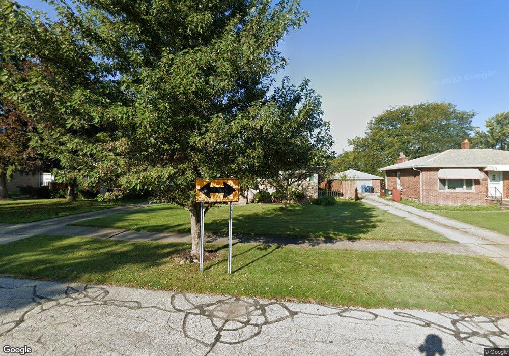
5306 Amherst Dr Cleveland, OH 44129
Estimated Value: $181,000 - $246,000
3
Beds
1
Bath
1,036
Sq Ft
$199/Sq Ft
Est. Value
About This Home
This home is located at 5306 Amherst Dr, Cleveland, OH 44129 and is currently estimated at $206,627, approximately $199 per square foot. 5306 Amherst Dr is a home located in Cuyahoga County with nearby schools including Ridge-Brook Elementary School, Greenbriar Middle School, and Valley Forge High School.
Ownership History
Date
Name
Owned For
Owner Type
Purchase Details
Closed on
May 30, 1995
Sold by
Laska Margaret
Bought by
Plezia Timothy G and Stewart Kimberly S
Current Estimated Value
Home Financials for this Owner
Home Financials are based on the most recent Mortgage that was taken out on this home.
Original Mortgage
$84,150
Interest Rate
8.4%
Mortgage Type
New Conventional
Purchase Details
Closed on
Jun 28, 1985
Sold by
Laska Johanna
Bought by
Laska Margaret
Purchase Details
Closed on
Jan 1, 1975
Bought by
Laska Johanna
Create a Home Valuation Report for This Property
The Home Valuation Report is an in-depth analysis detailing your home's value as well as a comparison with similar homes in the area
Home Values in the Area
Average Home Value in this Area
Purchase History
| Date | Buyer | Sale Price | Title Company |
|---|---|---|---|
| Plezia Timothy G | $93,500 | -- | |
| Laska Margaret | -- | -- | |
| Laska Johanna | -- | -- |
Source: Public Records
Mortgage History
| Date | Status | Borrower | Loan Amount |
|---|---|---|---|
| Closed | Plezia Timothy G | $84,150 |
Source: Public Records
Tax History Compared to Growth
Tax History
| Year | Tax Paid | Tax Assessment Tax Assessment Total Assessment is a certain percentage of the fair market value that is determined by local assessors to be the total taxable value of land and additions on the property. | Land | Improvement |
|---|---|---|---|---|
| 2024 | $3,688 | $59,815 | $11,795 | $48,020 |
| 2023 | $3,278 | $45,780 | $9,870 | $35,910 |
| 2022 | $3,249 | $45,780 | $9,870 | $35,910 |
| 2021 | $3,341 | $45,780 | $9,870 | $35,910 |
| 2020 | $3,100 | $37,520 | $8,090 | $29,440 |
| 2019 | $2,973 | $107,200 | $23,100 | $84,100 |
| 2018 | $2,992 | $37,520 | $8,090 | $29,440 |
| 2017 | $2,925 | $34,270 | $6,580 | $27,690 |
| 2016 | $2,908 | $34,270 | $6,580 | $27,690 |
| 2015 | $2,917 | $34,270 | $6,580 | $27,690 |
| 2014 | $2,917 | $36,470 | $7,000 | $29,470 |
Source: Public Records
Map
Nearby Homes
- 5440 W 84th St Unit 42
- 8206 Newport Ave
- 9118 Fernhill Ave
- 9417 Fernhill Ave
- 7915 Fernhill Ave
- 7707 Liberty Ave
- 5717 Chestnut Dr
- 7609 Wooster Pkwy
- 7910 Dresden Ave
- 9621 Elsmere Dr
- 10620 Aaron Dr
- 6606 Theota Ave
- 4830 Autumn Ln
- 6511 Laverne Ave
- 5860 Pearl Rd
- 5845 Lotusdale Dr
- 6903 Forest Ave
- 6711 Forest Ave
- 6211 Luelda Ave
- 5906 Twin Lakes Dr
- 5308 Amherst Dr
- 5304 Amherst Dr
- 5310 Amherst Dr
- 5302 Amherst Dr
- 5307 Dartmouth Dr
- 5309 Dartmouth Dr
- 5305 Dartmouth Dr
- 5303 Dartmouth Dr
- 5311 Dartmouth Dr
- 5312 Amherst Dr
- 5300 Amherst Dr
- 5309 Amherst Dr
- 5301 Dartmouth Dr
- 5313 Dartmouth Dr
- 5311 Amherst Dr
- 5303 Amherst Dr
- 5314 Amherst Dr
- 5313 Amherst Dr
- 5301 Amherst Dr
- 5315 Dartmouth Dr
