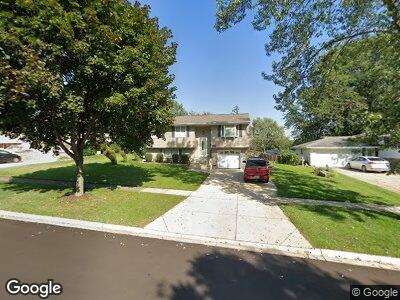
531 Auburn Ln Schaumburg, IL 60193
South Schaumburg NeighborhoodEstimated Value: $332,000 - $382,000
2
Beds
2
Baths
974
Sq Ft
$368/Sq Ft
Est. Value
About This Home
This home is located at 531 Auburn Ln, Schaumburg, IL 60193 and is currently estimated at $358,136, approximately $367 per square foot. 531 Auburn Ln is a home located in Cook County with nearby schools including Nathan Hale Elementary School, Jane Addams Junior High School, and Schaumburg High School.
Ownership History
Date
Name
Owned For
Owner Type
Purchase Details
Closed on
Nov 7, 1997
Sold by
Woollard David W and Woollard Denise M
Bought by
Martin Craig M
Current Estimated Value
Home Financials for this Owner
Home Financials are based on the most recent Mortgage that was taken out on this home.
Original Mortgage
$126,790
Interest Rate
7.46%
Mortgage Type
FHA
Create a Home Valuation Report for This Property
The Home Valuation Report is an in-depth analysis detailing your home's value as well as a comparison with similar homes in the area
Home Values in the Area
Average Home Value in this Area
Purchase History
| Date | Buyer | Sale Price | Title Company |
|---|---|---|---|
| Martin Craig M | $129,000 | Attorneys Natl Title Network |
Source: Public Records
Mortgage History
| Date | Status | Borrower | Loan Amount |
|---|---|---|---|
| Open | Martin Theresa M | $125,000 | |
| Closed | Martin Theresa M | $60,000 | |
| Closed | Martin Craig M | $126,790 |
Source: Public Records
Tax History Compared to Growth
Tax History
| Year | Tax Paid | Tax Assessment Tax Assessment Total Assessment is a certain percentage of the fair market value that is determined by local assessors to be the total taxable value of land and additions on the property. | Land | Improvement |
|---|---|---|---|---|
| 2024 | $2,340 | $27,900 | $7,008 | $20,892 |
| 2023 | $2,340 | $27,900 | $7,008 | $20,892 |
| 2022 | $2,340 | $27,900 | $7,008 | $20,892 |
| 2021 | $2,542 | $21,989 | $4,755 | $17,234 |
| 2020 | $2,327 | $21,989 | $4,755 | $17,234 |
| 2019 | $2,315 | $24,707 | $4,755 | $19,952 |
| 2018 | $2,596 | $18,138 | $4,254 | $13,884 |
| 2017 | $2,511 | $18,138 | $4,254 | $13,884 |
| 2016 | $3,073 | $18,138 | $4,254 | $13,884 |
| 2015 | $3,496 | $16,221 | $3,754 | $12,467 |
| 2014 | $3,385 | $16,221 | $3,754 | $12,467 |
| 2013 | $3,377 | $16,221 | $3,754 | $12,467 |
Source: Public Records
Map
Nearby Homes
- 1408 Hampton Ln
- 1500 W Weathersfield Way
- 1701 Kingston Ln
- 532 Cambridge Dr
- 1224 Kingston Ln
- 1334 Somerset Ln
- 1618 Syracuse Ln
- 1804 Kingston Ln
- 1629 Syracuse Ln
- 214 S Springinsguth Rd
- 1417 Ellisville Ln Unit 254
- 1613 Hartmann Dr
- 121 Cotuit Ct Unit 121
- 630 S Walnut Ln
- 1106 Westfield Ln
- 111 Westover Ct
- 7728 Bolton Way
- 1008 W Weathersfield Way
- 1115 Sharon Ln
- 7541 Wedgewood Dr
- 531 Auburn Ln
- 527 Auburn Ln
- 535 Auburn Ln
- 530 Dartmouth Ln
- 521 Auburn Ln
- 601 Auburn Ln
- 526 Dartmouth Ln
- 534 Dartmouth Ln
- 522 Dartmouth Ln
- 600 Dartmouth Ln
- 530 Auburn Ln
- 526 Auburn Ln
- 605 Auburn Ln
- 536 Auburn Ln
- 522 Auburn Ln
- 1513 Dedham Ln Unit 4
- 1509 Dedham Ln
- 606 Dartmouth Ln Unit 4
- 600 Auburn Ln
- 518 Auburn Ln