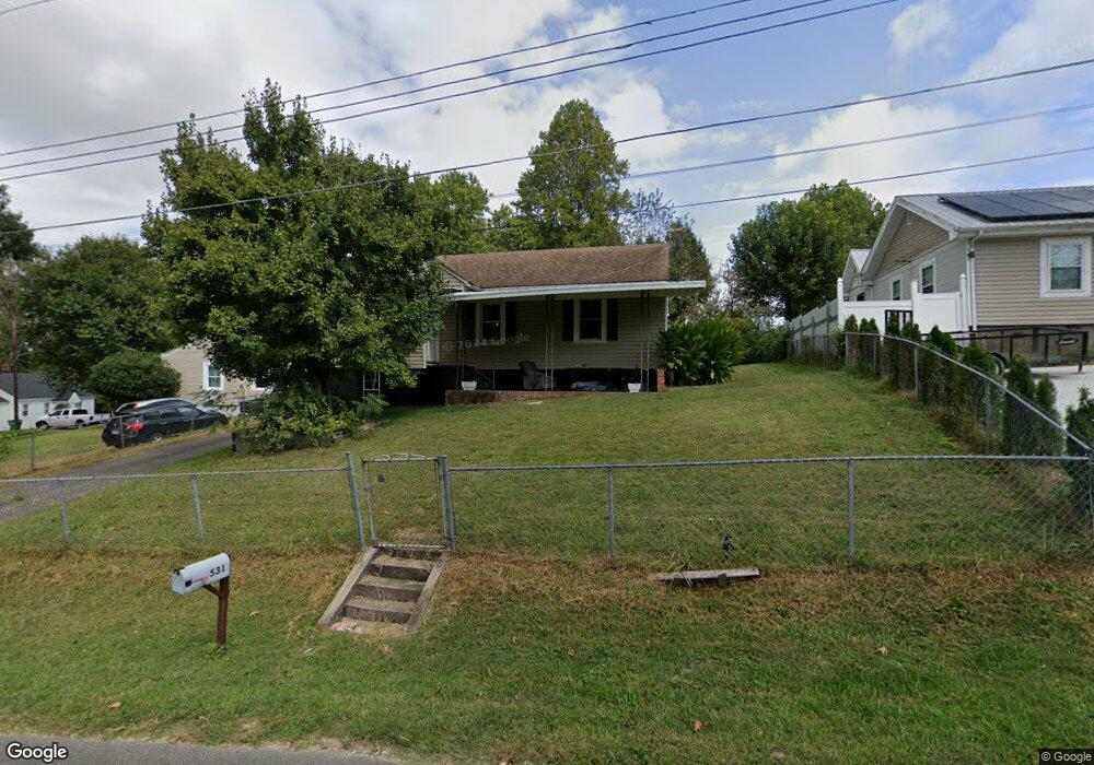
531 Circle Dr Mount Airy, NC 27030
Estimated Value: $119,000 - $161,000
3
Beds
1
Bath
1,040
Sq Ft
$131/Sq Ft
Est. Value
About This Home
This home is located at 531 Circle Dr, Mount Airy, NC 27030 and is currently estimated at $136,273, approximately $131 per square foot. 531 Circle Dr is a home located in Surry County with nearby schools including Bruce H. Tharrington Elementary School, Mount Airy Middle School, and Mount Airy High School.
Ownership History
Date
Name
Owned For
Owner Type
Purchase Details
Closed on
Feb 29, 2016
Sold by
Mchone James Scott and Mchone Rhonda P
Bought by
Yaktime Properties Llc
Current Estimated Value
Purchase Details
Closed on
Dec 19, 2011
Sold by
Surrey Bank & Trust
Bought by
Pilot Mtn Properties Inc
Home Financials for this Owner
Home Financials are based on the most recent Mortgage that was taken out on this home.
Original Mortgage
$90,000
Interest Rate
4.06%
Mortgage Type
Commercial
Purchase Details
Closed on
Nov 30, 2011
Sold by
Dean Stanley
Bought by
Surrey Bank & Trust
Home Financials for this Owner
Home Financials are based on the most recent Mortgage that was taken out on this home.
Original Mortgage
$90,000
Interest Rate
4.06%
Mortgage Type
Commercial
Purchase Details
Closed on
Nov 29, 2006
Sold by
Pilgrim Joyce Jessup and Pilgrim Robert Paul
Bought by
Nichols Land Company Llc
Home Financials for this Owner
Home Financials are based on the most recent Mortgage that was taken out on this home.
Original Mortgage
$45,000
Interest Rate
6.29%
Mortgage Type
Construction
Purchase Details
Closed on
Apr 1, 1997
Purchase Details
Closed on
May 1, 1964
Create a Home Valuation Report for This Property
The Home Valuation Report is an in-depth analysis detailing your home's value as well as a comparison with similar homes in the area
Home Values in the Area
Average Home Value in this Area
Purchase History
| Date | Buyer | Sale Price | Title Company |
|---|---|---|---|
| Yaktime Properties Llc | -- | None Available | |
| Pilot Mtn Properties Inc | $75,000 | None Available | |
| Surrey Bank & Trust | $39,480 | None Available | |
| Nichols Land Company Llc | $35,500 | None Available | |
| Nichols Land Company Llc | $500 | None Available | |
| -- | $40,000 | -- | |
| -- | -- | -- |
Source: Public Records
Mortgage History
| Date | Status | Borrower | Loan Amount |
|---|---|---|---|
| Previous Owner | Pilot Mtn Properties Inc | $90,000 | |
| Previous Owner | Nichols Land Company Llc | $45,000 |
Source: Public Records
Tax History Compared to Growth
Tax History
| Year | Tax Paid | Tax Assessment Tax Assessment Total Assessment is a certain percentage of the fair market value that is determined by local assessors to be the total taxable value of land and additions on the property. | Land | Improvement |
|---|---|---|---|---|
| 2025 | $482 | $71,290 | $10,200 | $61,090 |
| 2024 | $398 | $52,960 | $10,200 | $42,760 |
| 2023 | $393 | $52,960 | $10,200 | $42,760 |
| 2022 | $393 | $52,960 | $10,200 | $42,760 |
| 2021 | $398 | $52,960 | $10,200 | $42,760 |
| 2020 | $373 | $47,400 | $10,200 | $37,200 |
| 2019 | $370 | $47,400 | $10,200 | $37,200 |
| 2018 | $364 | $47,400 | $0 | $0 |
| 2017 | $367 | $47,400 | $0 | $0 |
| 2016 | $362 | $47,400 | $0 | $0 |
| 2013 | -- | $49,850 | $0 | $0 |
Source: Public Records
Map
Nearby Homes
- 400 Cherry St
- 342 Moore Ave
- 226 Hamburg St
- 802 Spring St
- 214 Broad St
- 00 Carroll St
- 220 Broad St
- 241 Rockford St
- 1023 Spring St
- 165 Virginia St Unit 309
- 165 Virginia St Unit 206
- 607 N Main St
- 1020 Frank St
- 1513 Pittman St
- 311 E Lebanon St
- 0 Woodruff St
- 722 Maiden Ln
- 643 Willow St
- 455 Franklin St
- 607 Riverside Dr