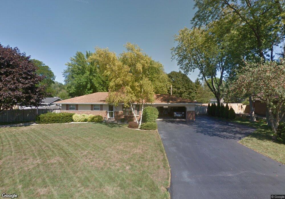
531 Holdridge Ave Winthrop Harbor, IL 60096
Estimated Value: $295,000 - $315,000
3
Beds
2
Baths
1,232
Sq Ft
$249/Sq Ft
Est. Value
About This Home
This home is located at 531 Holdridge Ave, Winthrop Harbor, IL 60096 and is currently estimated at $306,396, approximately $248 per square foot. 531 Holdridge Ave is a home located in Lake County with nearby schools including Westfield School, North Prairie Junior High School, and Zion-Benton Township High School.
Ownership History
Date
Name
Owned For
Owner Type
Purchase Details
Closed on
Feb 2, 1996
Sold by
Stark Robert C and Stark Kathleen I
Bought by
Loy Richard J and Loy Kellie D
Current Estimated Value
Home Financials for this Owner
Home Financials are based on the most recent Mortgage that was taken out on this home.
Original Mortgage
$144,000
Outstanding Balance
$4,740
Interest Rate
7.07%
Estimated Equity
$301,656
Create a Home Valuation Report for This Property
The Home Valuation Report is an in-depth analysis detailing your home's value as well as a comparison with similar homes in the area
Home Values in the Area
Average Home Value in this Area
Purchase History
| Date | Buyer | Sale Price | Title Company |
|---|---|---|---|
| Loy Richard J | $160,000 | -- |
Source: Public Records
Mortgage History
| Date | Status | Borrower | Loan Amount |
|---|---|---|---|
| Open | Loy Richard J | $144,000 |
Source: Public Records
Tax History Compared to Growth
Tax History
| Year | Tax Paid | Tax Assessment Tax Assessment Total Assessment is a certain percentage of the fair market value that is determined by local assessors to be the total taxable value of land and additions on the property. | Land | Improvement |
|---|---|---|---|---|
| 2024 | $7,140 | $86,772 | $9,867 | $76,905 |
| 2023 | $7,085 | $74,610 | $9,525 | $65,085 |
| 2022 | $7,085 | $70,743 | $9,321 | $61,422 |
| 2021 | $6,301 | $60,688 | $9,084 | $51,604 |
| 2020 | $6,104 | $57,914 | $8,669 | $49,245 |
| 2019 | $5,948 | $54,947 | $8,225 | $46,722 |
| 2018 | $5,954 | $54,827 | $9,955 | $44,872 |
| 2017 | $5,904 | $51,578 | $9,365 | $42,213 |
| 2016 | $5,742 | $49,104 | $8,916 | $40,188 |
| 2015 | $5,623 | $45,033 | $8,177 | $36,856 |
| 2014 | $6,036 | $49,551 | $13,548 | $36,003 |
| 2012 | $5,955 | $51,493 | $14,079 | $37,414 |
Source: Public Records
Map
Nearby Homes
- 0 Garnett Ave
- 630 Whitney Ave
- 242 Thompson Ave
- 1810 5th St
- 830 Russell Ave
- 832 Fulton Ave
- 737 Franklin Ave
- 1120 Fulton Ave
- 3109 11th St
- 429 Megan Place
- 436 Megan Place
- 432 Megan Place
- 2404 13th St
- 1228 Pennsylvania Ave
- 1206 Landon Ave
- 0 13th St Unit MRD12432014
- 3015 13th St
- 1808 13th St
- 0 14th St Unit MRD12502206
- 3106 13th St
- 545 Holdridge Ave
- 527 Holdridge Ave
- 542 Russell Ave
- 536 Holdridge Ave
- 540 Holdridge Ave
- 544 Holdridge Ave
- 2315 6th St
- 510 Russell Ave
- 505 Holdridge Ave
- 535 Thompson Ave
- 539 Thompson Ave
- 600 Russell Ave
- 545 Russell Ave
- 515 Russell Ave
- 525 Thompson Ave
- 2401 6th St
- 504 Holdridge Ave
- 2414 6th St
- 607 Holdridge Ave
- 507 Russell Ave