Estimated Value: $327,600 - $379,000
3
Beds
2
Baths
1,710
Sq Ft
$204/Sq Ft
Est. Value
About This Home
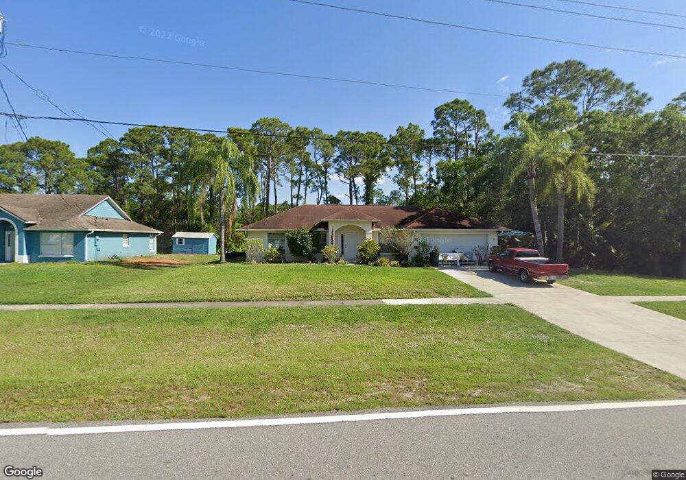
This home is located at 5310 Falcon Blvd, Cocoa, FL 32927 and is currently estimated at $349,650, approximately $204 per square foot. 5310 Falcon Blvd is a home located in Brevard County with nearby schools including Enterprise Elementary School, Space Coast Junior/Senior High School, and Sculptor Charter School.
Ownership History
Date
Name
Owned For
Owner Type
Purchase Details
Closed on
Mar 31, 1999
Sold by
Swain Ross C and Swain Carolyn S
Bought by
Fisher Clinton S and Fisher Mary J
Current Estimated Value
Home Financials for this Owner
Home Financials are based on the most recent Mortgage that was taken out on this home.
Original Mortgage
$97,425
Outstanding Balance
$21,183
Interest Rate
6.82%
Estimated Equity
$328,467
Purchase Details
Closed on
Nov 16, 1994
Sold by
Ronlyn Homes Inc
Bought by
Swain Ross C and Swain Carolyn S
Home Financials for this Owner
Home Financials are based on the most recent Mortgage that was taken out on this home.
Original Mortgage
$93,250
Interest Rate
8.84%
Purchase Details
Closed on
May 2, 1994
Sold by
Kozak Timothy S and Kozak Bonnie L
Bought by
Ronlyn Homes Inc
Home Financials for this Owner
Home Financials are based on the most recent Mortgage that was taken out on this home.
Original Mortgage
$60,600
Interest Rate
8.52%
Create a Home Valuation Report for This Property
The Home Valuation Report is an in-depth analysis detailing your home's value as well as a comparison with similar homes in the area
Home Values in the Area
Average Home Value in this Area
Purchase History
We collect this data history from publicly available records. To have your information removed, we recommend requesting removal directly through your county’s website.
| Date | Buyer | Sale Price | Title Company |
|---|---|---|---|
| Fisher Clinton S | $98,000 | -- | |
| Swain Ross C | $93,500 | -- | |
| Ronlyn Homes Inc | $11,000 | -- |
Source: Public Records
Mortgage History
We collect this data history from publicly available records. To have your information removed, we recommend requesting removal directly through your county’s website.
| Date | Status | Borrower | Loan Amount |
|---|---|---|---|
| Open | Fisher Clinton S | $97,425 | |
| Previous Owner | Swain Ross C | $93,250 | |
| Previous Owner | Ronlyn Homes Inc | $60,600 |
Source: Public Records
Tax History
| Year | Tax Paid | Tax Assessment Tax Assessment Total Assessment is a certain percentage of the fair market value that is determined by local assessors to be the total taxable value of land and additions on the property. | Land | Improvement |
|---|---|---|---|---|
| 2025 | $1,471 | $107,660 | -- | -- |
| 2024 | $1,434 | $104,630 | -- | -- |
| 2023 | $1,434 | $101,590 | -- | -- |
| 2022 | $1,337 | $98,640 | $0 | $0 |
| 2021 | $1,335 | $95,770 | $0 | $0 |
| 2020 | $1,272 | $94,450 | $0 | $0 |
| 2019 | $1,208 | $92,330 | $0 | $0 |
| 2018 | $1,200 | $90,610 | $0 | $0 |
| 2017 | $1,193 | $88,750 | $0 | $0 |
| 2016 | $1,194 | $86,930 | $18,000 | $68,930 |
| 2015 | $1,207 | $86,330 | $15,000 | $71,330 |
| 2014 | $1,208 | $85,650 | $11,000 | $74,650 |
Source: Public Records
Map
Nearby Homes
- 5165 Patricia St
- 5155 Mayflower St
- 5170 Andover St
- 5145 Carter St
- 5145 Everett St
- 5075 Carter St
- 6813 Cecil Rd
- 7200 Oakwood Ave
- 6815 Bryant Rd
- 5555 Brandon St
- 5350 Cinnamon Fern Blvd
- 5303 Yaupon Holly Dr
- 6760 Cairo Rd
- 5070 Curtis Blvd
- 6965 Hundred Acre Dr
- 0 Cinnamon Fern Blvd
- 5551 Cinnamon Fern Blvd
- 6615 Dock Ave
- 6601 Cedar Ave
- 4824 Curtis Blvd
- 5320 S Falcon
- 5320 Falcon Blvd
- 7130 Holly Ave
- 7140 Holly Ave
- 5330 Falcon Blvd
- 7065 Cairo Rd
- 7150 Holly Ave
- 5325 Falcon Blvd
- 7088 Holly Ave
- 5340 Falcon Blvd
- 5265 Andover St
- 7160 Holly Ave
- 7050 Cairo Rd
- 5230 Falcon Blvd
- 7080 Holly Ave
- 7075 Bryant Rd
- 5235 Frisco St
- 7045 Cairo Rd
- 5350 Falcon Blvd
- 7040 Cairo Rd
Your Personal Tour Guide
Ask me questions while you tour the home.