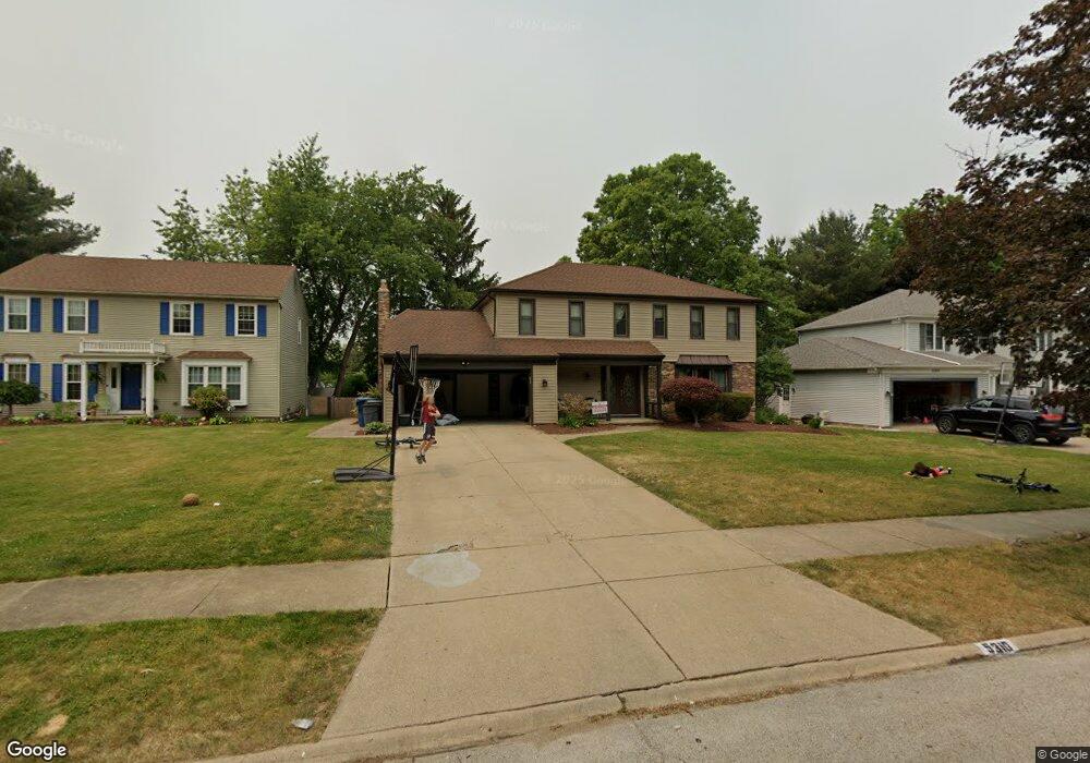
5310 Kings Hwy Cleveland, OH 44126
Estimated Value: $372,135 - $471,000
4
Beds
3
Baths
1,949
Sq Ft
$212/Sq Ft
Est. Value
About This Home
This home is located at 5310 Kings Hwy, Cleveland, OH 44126 and is currently estimated at $413,784, approximately $212 per square foot. 5310 Kings Hwy is a home located in Cuyahoga County with nearby schools including Gilles-Sweet Elementary School, Lewis F Mayer Middle School, and Fairview High School.
Ownership History
Date
Name
Owned For
Owner Type
Purchase Details
Closed on
Feb 22, 2001
Sold by
Spoth Frank J
Bought by
Lamb Christopher R and Lamb Crystal
Current Estimated Value
Home Financials for this Owner
Home Financials are based on the most recent Mortgage that was taken out on this home.
Original Mortgage
$130,000
Outstanding Balance
$46,360
Interest Rate
6.91%
Estimated Equity
$367,424
Purchase Details
Closed on
Dec 14, 1995
Sold by
Tabar Richard M
Bought by
Spoth Frank J
Home Financials for this Owner
Home Financials are based on the most recent Mortgage that was taken out on this home.
Original Mortgage
$146,800
Interest Rate
7.45%
Mortgage Type
New Conventional
Purchase Details
Closed on
Mar 26, 1985
Sold by
Tabar Richard M
Bought by
Tabar Richard M
Purchase Details
Closed on
Jun 7, 1984
Bought by
Tabar Richard M
Purchase Details
Closed on
Jan 1, 1983
Bought by
Fairland Builders Inc
Create a Home Valuation Report for This Property
The Home Valuation Report is an in-depth analysis detailing your home's value as well as a comparison with similar homes in the area
Home Values in the Area
Average Home Value in this Area
Purchase History
| Date | Buyer | Sale Price | Title Company |
|---|---|---|---|
| Lamb Christopher R | $200,000 | U S Title Agency Inc | |
| Spoth Frank J | $183,500 | -- | |
| Tabar Richard M | -- | -- | |
| Tabar Richard M | $118,600 | -- | |
| Fairland Builders Inc | -- | -- |
Source: Public Records
Mortgage History
| Date | Status | Borrower | Loan Amount |
|---|---|---|---|
| Open | Lamb Christopher R | $130,000 | |
| Previous Owner | Spoth Frank J | $146,800 |
Source: Public Records
Tax History Compared to Growth
Tax History
| Year | Tax Paid | Tax Assessment Tax Assessment Total Assessment is a certain percentage of the fair market value that is determined by local assessors to be the total taxable value of land and additions on the property. | Land | Improvement |
|---|---|---|---|---|
| 2024 | $8,493 | $124,460 | $19,285 | $105,175 |
| 2023 | $7,749 | $97,200 | $15,540 | $81,660 |
| 2022 | $7,565 | $97,200 | $15,540 | $81,660 |
| 2021 | $7,744 | $97,200 | $15,540 | $81,660 |
| 2020 | $8,615 | $95,270 | $15,230 | $80,050 |
| 2019 | $7,649 | $272,200 | $43,500 | $228,700 |
| 2018 | $7,361 | $95,270 | $15,230 | $80,050 |
| 2017 | $7,417 | $85,400 | $14,490 | $70,910 |
| 2016 | $7,367 | $85,400 | $14,490 | $70,910 |
| 2015 | $6,357 | $85,400 | $14,490 | $70,910 |
| 2014 | $6,357 | $74,270 | $12,600 | $61,670 |
Source: Public Records
Map
Nearby Homes
- 20930 Mastick Rd
- 5951 Rockport Ln
- 22534 Bard Ave
- 22506 Sharon Ln
- 22503 Sandy Ln
- 22247 Mastick Rd
- 22045 Morton Ave
- 4627 W 223rd St
- 4464 W 224th St
- 21437 Hillsdale Ave
- 21763 Hillsdale Ave
- 22934 Mastick Rd Unit 102
- 4710 Grayton Rd
- 4720 Grayton Rd
- 4514 Orchard Rd
- 4309 W 222nd St
- 4401 Fairview Park
- 22968 Maple Ridge Rd Unit 103
- 22895 Mastick Rd
- 22976 Maple Ridge Rd Unit B 105
- 5300 Kings Hwy
- 5320 Kings Hwy
- 5341 Sherwood Dr
- 5290 Kings Hwy
- 5361 Sherwood Dr
- 5321 Sherwood Dr
- 21430 Kings Hwy
- 5330 Kings Hwy
- 5381 Sherwood Dr
- 5301 Sherwood Dr
- 21395 Queen Anns Way
- 5401 Sherwood Dr
- 5280 Kings Hwy
- 5281 Sherwood Dr
- 21440 Kings Hwy
- 21425 Kings Hwy
- 21435 Kings Hwy
- 21385 Queen Anns Way
- 5421 Sherwood Dr
- 21445 Kings Hwy