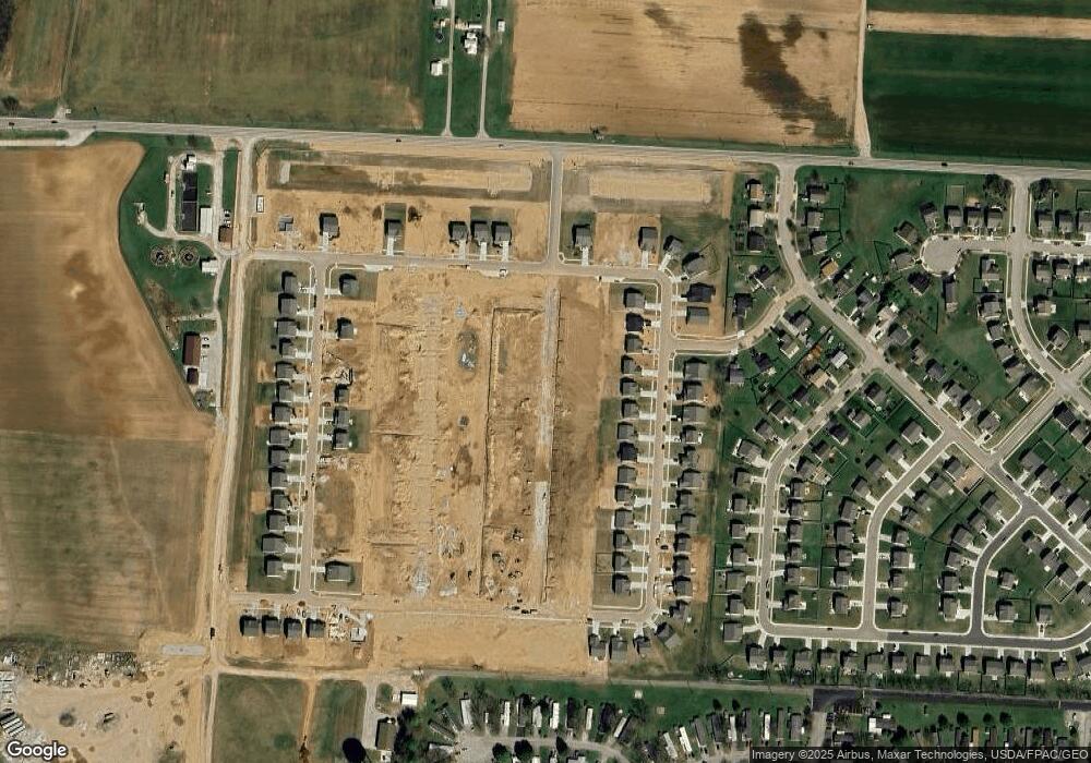
5315 Pear Ln South Bloomfield, OH 43103
Estimated Value: $317,000 - $1,097,452
3
Beds
3
Baths
1,760
Sq Ft
$493/Sq Ft
Est. Value
About This Home
This home is located at 5315 Pear Ln, South Bloomfield, OH 43103 and is currently estimated at $868,113, approximately $493 per square foot. 5315 Pear Ln is a home located in Pickaway County.
Ownership History
Date
Name
Owned For
Owner Type
Purchase Details
Closed on
Nov 4, 2024
Sold by
Arbor Homes and Clayton Properties Group Inc
Bought by
White Sandra and White Jamee
Current Estimated Value
Home Financials for this Owner
Home Financials are based on the most recent Mortgage that was taken out on this home.
Original Mortgage
$198,882
Outstanding Balance
$196,887
Interest Rate
6.08%
Mortgage Type
New Conventional
Estimated Equity
$671,226
Purchase Details
Closed on
Jun 27, 2022
Sold by
Southern Spring Llc
Bought by
Fischer Homes Columbus Ii Llc
Purchase Details
Closed on
Mar 24, 2021
Sold by
Day David L and Day Terri L
Bought by
Southern Spring Llc
Purchase Details
Closed on
Aug 1, 1988
Bought by
Day David L
Create a Home Valuation Report for This Property
The Home Valuation Report is an in-depth analysis detailing your home's value as well as a comparison with similar homes in the area
Home Values in the Area
Average Home Value in this Area
Purchase History
| Date | Buyer | Sale Price | Title Company |
|---|---|---|---|
| White Sandra | $318,900 | Simply Service Title | |
| White Sandra | $318,900 | Simply Service Title | |
| Fischer Homes Columbus Ii Llc | $333 | Magnuson & Barone | |
| Southern Spring Llc | $800,000 | None Available | |
| Day David L | $164,000 | -- |
Source: Public Records
Mortgage History
| Date | Status | Borrower | Loan Amount |
|---|---|---|---|
| Open | White Sandra | $198,882 | |
| Closed | White Sandra | $198,882 |
Source: Public Records
Tax History Compared to Growth
Tax History
| Year | Tax Paid | Tax Assessment Tax Assessment Total Assessment is a certain percentage of the fair market value that is determined by local assessors to be the total taxable value of land and additions on the property. | Land | Improvement |
|---|---|---|---|---|
| 2024 | -- | $0 | $0 | $0 |
| 2023 | $0 | $0 | $0 | $0 |
| 2022 | $0 | $177,670 | $123,570 | $54,100 |
| 2021 | $3,502 | $177,670 | $123,570 | $54,100 |
| 2020 | $3,512 | $177,670 | $123,570 | $54,100 |
| 2019 | $4,015 | $160,500 | $113,290 | $47,210 |
| 2018 | $3,898 | $160,500 | $113,290 | $47,210 |
| 2017 | $5,535 | $160,500 | $113,290 | $47,210 |
| 2016 | $4,194 | $138,660 | $97,090 | $41,570 |
| 2015 | $4,196 | $138,660 | $97,090 | $41,570 |
| 2014 | $4,198 | $138,660 | $97,090 | $41,570 |
| 2013 | $3,412 | $128,770 | $83,770 | $45,000 |
Source: Public Records
Map
Nearby Homes
- 5327 Pear Ln
- 5310 Pear Ln Unit Lot 127
- Chestnut Plan at Day Farm
- Cooper Plan at Day Farm
- Bradford Plan at Day Farm
- Ironwood Plan at Day Farm
- Ashton Plan at Day Farm
- Empress Plan at Day Farm
- Norway Plan at Day Farm
- Spruce Plan at Day Farm
- Juniper Plan at Day Farm
- Palmetto Plan at Day Farm
- Aspen II Plan at Day Farm
- 5026 Farmhouse Rd
- Walnut Plan at Day Farm
- 5211 Apple Ln
- 5226 Apple Ln
- 5203 Apple Ln
- 5202 Apple Ln
- 5122 Harvest Ln
- 5316 Pear Ln Unit Lot 130
- 5321 Pear Ln
- 5107 Harvest Ln
- 5114 Harvest Ln
- 5428 Gordon St
- 5402 Gordon St
- 5111 Harvest Ln
- 5020 Farmhouse Rd
- 43 River Ct
- 44 River Ct
- 5116 Harvest Ln
- 44 River Ct
- 5526 Apple Ln
- 5061 River Bend Dr
- 5063 River Bend Dr
- 5103 Harvest Ln
- 57 River Bend Dr
- 905 Ohio 316
- 5022 Farmhouse Rd Unit 36658583
- 5022 Farmhouse Rd Unit 36658593
