Estimated Value: $234,926 - $273,000
3
Beds
2
Baths
2,576
Sq Ft
$98/Sq Ft
Est. Value
About This Home
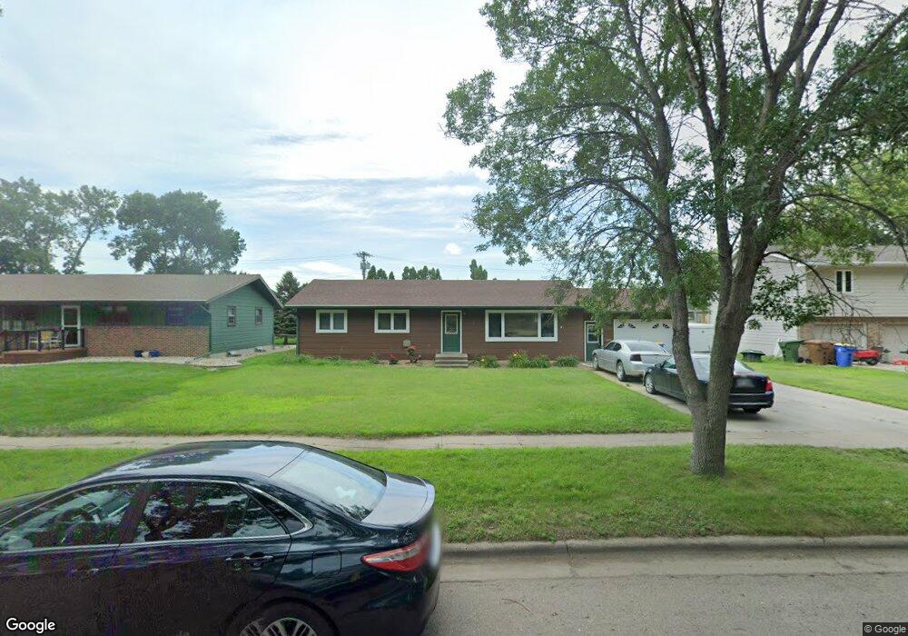
This home is located at 532 20th St SW, Huron, SD 57350 and is currently estimated at $251,982, approximately $97 per square foot. 532 20th St SW is a home with nearby schools including Huron High School, Holy Trinity Catholic Elementary School, and James Valley Christian School.
Ownership History
Date
Name
Owned For
Owner Type
Purchase Details
Closed on
Jul 1, 2011
Sold by
Sperry Donita
Bought by
Paul John and Nyunt Ma Tin
Current Estimated Value
Home Financials for this Owner
Home Financials are based on the most recent Mortgage that was taken out on this home.
Original Mortgage
$127,600
Outstanding Balance
$94,333
Interest Rate
4.56%
Mortgage Type
USDA
Estimated Equity
$157,649
Purchase Details
Closed on
Nov 5, 2009
Sold by
Brueggeman Damon and Brueggeman Jamie L
Bought by
Sperry Donita
Home Financials for this Owner
Home Financials are based on the most recent Mortgage that was taken out on this home.
Original Mortgage
$91,200
Interest Rate
4.9%
Mortgage Type
Stand Alone First
Create a Home Valuation Report for This Property
The Home Valuation Report is an in-depth analysis detailing your home's value as well as a comparison with similar homes in the area
Home Values in the Area
Average Home Value in this Area
Purchase History
| Date | Buyer | Sale Price | Title Company |
|---|---|---|---|
| Paul John | $131,000 | Huron Title | |
| Sperry Donita | -- | Huron Title |
Source: Public Records
Mortgage History
| Date | Status | Borrower | Loan Amount |
|---|---|---|---|
| Open | Paul John | $127,600 | |
| Previous Owner | Sperry Donita | $91,200 |
Source: Public Records
Tax History
| Year | Tax Paid | Tax Assessment Tax Assessment Total Assessment is a certain percentage of the fair market value that is determined by local assessors to be the total taxable value of land and additions on the property. | Land | Improvement |
|---|---|---|---|---|
| 2025 | $3,269 | $208,322 | $10,125 | $198,197 |
| 2024 | $3,360 | $198,884 | $10,125 | $188,759 |
| 2023 | $2,335 | $189,895 | $10,125 | $179,770 |
| 2022 | $2,363 | $127,066 | $10,125 | $116,941 |
| 2021 | $2,342 | $127,066 | $10,125 | $116,941 |
| 2020 | $2,374 | $127,066 | $10,125 | $116,941 |
| 2019 | $2,406 | $127,066 | $10,125 | $116,941 |
| 2018 | -- | $127,066 | $10,125 | $116,941 |
| 2017 | -- | $127,066 | $10,125 | $116,941 |
| 2016 | -- | $121,497 | $10,125 | $111,372 |
| 2015 | -- | $117,649 | $10,125 | $107,524 |
| 2014 | -- | $117,649 | $10,125 | $107,524 |
| 2013 | -- | $110,615 | $10,125 | $100,490 |
Source: Public Records
Map
Nearby Homes
- 540 18th St SW
- 1980 Meadowlark Ln Unit 302
- 0 Lot 6 Blk 1 McDonald Dr
- 0 Lot 7 Blk 1 McDonald Dr
- 0 Lot 10 Blk 1 McDonald Dr
- 0 Lot 6 Blk 2 McDonald Dr
- 0 Lot 7 Blk 2 McDonald Dr
- 1836 Illinois Ave SW
- 2405 Prairie Eagle Cir
- 0 Prairie Eagle Cir Unit 25-2
- 69 21st St SE
- 1810 Kansas Ave
- 1949 Lampert Dr
- 0 S Dakota 37
- 0 24th St St
- 280 20th St
- 1776 Idaho Ave SE
- 1865 Utah Ave SE
- 0 Southtown Addition Lots Unit 25-310
- 0 Southtown Addition Lots Unit 25-312
- 518 20th St SW
- 550 20th St SW
- 502 20th St SW
- 559 20th St SW
- 527 20th St SW
- 590 20th St SW
- 509 20th St SW
- 1968 McDonald Dr
- 1975 McDonald Dr
- 1929 Eilers Ct
- 610 20th St SW
- 1948 McDonald Dr
- 1955 McDonald Dr
- 445 20th St SW
- 1925 Eilers Ct
- 1920 McDonald Dr
- 630 20th St SW
- 1939 McDonald Dr
- 435 20th St SW
- 1914 McDonald Dr
Your Personal Tour Guide
Ask me questions while you tour the home.