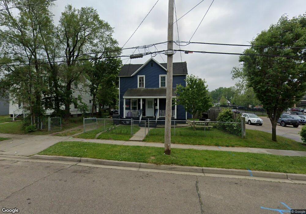
532 Bryant St Kalamazoo, MI 49001
Edison NeighborhoodEstimated Value: $116,653 - $158,000
3
Beds
1
Bath
1,650
Sq Ft
$82/Sq Ft
Est. Value
About This Home
This home is located at 532 Bryant St, Kalamazoo, MI 49001 and is currently estimated at $135,163, approximately $81 per square foot. 532 Bryant St is a home located in Kalamazoo County with nearby schools including Washington Writers' Academy, Milwood Magnet School, and Loy Norrix High School.
Ownership History
Date
Name
Owned For
Owner Type
Purchase Details
Closed on
Oct 25, 2017
Sold by
Jaynes Jeremy
Bought by
Branson Otha L and Branson Mary
Current Estimated Value
Purchase Details
Closed on
Aug 8, 2012
Sold by
Jaynes Jeremy
Bought by
Branson Otha L and Branson Mary
Purchase Details
Closed on
Apr 11, 2011
Sold by
Morrison Dale and Morrison Linda
Bought by
Jaynes Usot Jeremy
Purchase Details
Closed on
Oct 15, 2007
Sold by
Morrison Dale and Morrison Linda
Bought by
City Of Kalamazoo
Purchase Details
Closed on
Oct 16, 2006
Sold by
Morrison Dale and Morrison Linda
Bought by
City Of Kalamazoo
Purchase Details
Closed on
May 21, 2003
Sold by
Cobb William N and Cobb Annabell
Bought by
Morrison Dale and Morrison Linda
Create a Home Valuation Report for This Property
The Home Valuation Report is an in-depth analysis detailing your home's value as well as a comparison with similar homes in the area
Home Values in the Area
Average Home Value in this Area
Purchase History
| Date | Buyer | Sale Price | Title Company |
|---|---|---|---|
| Branson Otha L | -- | None Available | |
| Branson Otha L | -- | None Available | |
| Jaynes Usot Jeremy | -- | None Available | |
| City Of Kalamazoo | -- | None Available | |
| City Of Kalamazoo | -- | None Available | |
| Morrison Dale | -- | -- |
Source: Public Records
Mortgage History
| Date | Status | Borrower | Loan Amount |
|---|---|---|---|
| Closed | Branson Otha L | $0 |
Source: Public Records
Tax History Compared to Growth
Tax History
| Year | Tax Paid | Tax Assessment Tax Assessment Total Assessment is a certain percentage of the fair market value that is determined by local assessors to be the total taxable value of land and additions on the property. | Land | Improvement |
|---|---|---|---|---|
| 2025 | $1,580 | $50,200 | $0 | $0 |
| 2024 | $750 | $40,000 | $0 | $0 |
| 2023 | $560 | $35,600 | $0 | $0 |
| 2022 | $1,286 | $30,300 | $0 | $0 |
| 2021 | $1,244 | $29,200 | $0 | $0 |
| 2020 | $1,220 | $25,900 | $0 | $0 |
| 2019 | $1,250 | $21,400 | $0 | $0 |
| 2018 | $1,450 | $17,700 | $0 | $0 |
| 2017 | $1,158 | $18,100 | $0 | $0 |
| 2016 | $1,158 | $17,700 | $0 | $0 |
| 2015 | $1,158 | $17,500 | $0 | $0 |
| 2014 | $1,158 | $16,200 | $0 | $0 |
Source: Public Records
Map
Nearby Homes
- 1820 Elgin St
- 615 Lay Blvd
- 607 Reed Ave
- 839 Lay Blvd
- 855 Lay Blvd
- 913 Bryant St
- 826 Fulton St
- 739 Egleston Ave
- 2303 Portage St
- 10000 State St Unit Bus & ALL RE
- 1114 Lane Blvd
- 816 E Stockbridge Ave
- 141 Reed Ave
- 117 E Stockbridge Ave
- 1028 Clinton Ave
- 1118 E Alcott St
- 1336 Portage St
- 2120 S Burdick St
- 923 E Stockbridge Ave
- 1850 S Burdick St