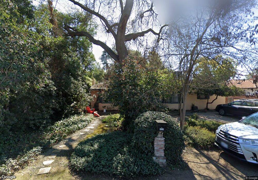
532 Circle Dr S Fresno, CA 93704
Fig Garden NeighborhoodEstimated Value: $436,000 - $472,916
2
Beds
2
Baths
2,199
Sq Ft
$205/Sq Ft
Est. Value
About This Home
This home is located at 532 Circle Dr S, Fresno, CA 93704 and is currently estimated at $450,639, approximately $204 per square foot. 532 Circle Dr S is a home located in Fresno County with nearby schools including Del Mar Elementary School, Fort Miller Middle School, and Fresno High School.
Ownership History
Date
Name
Owned For
Owner Type
Purchase Details
Closed on
Apr 6, 2011
Sold by
West Mary S
Bought by
Lang Donald
Current Estimated Value
Home Financials for this Owner
Home Financials are based on the most recent Mortgage that was taken out on this home.
Original Mortgage
$149,400
Interest Rate
4.75%
Mortgage Type
FHA
Purchase Details
Closed on
Apr 18, 2000
Sold by
Michael Deis
Bought by
West Mary S
Home Financials for this Owner
Home Financials are based on the most recent Mortgage that was taken out on this home.
Original Mortgage
$116,550
Interest Rate
8.08%
Create a Home Valuation Report for This Property
The Home Valuation Report is an in-depth analysis detailing your home's value as well as a comparison with similar homes in the area
Home Values in the Area
Average Home Value in this Area
Purchase History
| Date | Buyer | Sale Price | Title Company |
|---|---|---|---|
| Lang Donald | $166,000 | Multiple | |
| West Mary S | $129,500 | First American Title Co |
Source: Public Records
Mortgage History
| Date | Status | Borrower | Loan Amount |
|---|---|---|---|
| Previous Owner | Lang Donald | $149,400 | |
| Previous Owner | West Mary S | $116,550 |
Source: Public Records
Tax History
| Year | Tax Paid | Tax Assessment Tax Assessment Total Assessment is a certain percentage of the fair market value that is determined by local assessors to be the total taxable value of land and additions on the property. | Land | Improvement |
|---|---|---|---|---|
| 2025 | $2,711 | $212,664 | $51,240 | $161,424 |
| 2023 | $2,558 | $204,407 | $49,251 | $155,156 |
| 2022 | $2,523 | $200,400 | $48,286 | $152,114 |
| 2021 | $2,454 | $196,472 | $47,340 | $149,132 |
| 2020 | $2,444 | $194,458 | $46,855 | $147,603 |
| 2019 | $2,349 | $190,646 | $45,937 | $144,709 |
| 2018 | $2,298 | $186,909 | $45,037 | $141,872 |
| 2017 | $2,259 | $183,245 | $44,154 | $139,091 |
| 2016 | $2,184 | $179,653 | $43,289 | $136,364 |
| 2015 | $2,151 | $176,955 | $42,639 | $134,316 |
| 2014 | $2,109 | $173,489 | $41,804 | $131,685 |
Source: Public Records
Map
Nearby Homes
- 236 E Garland Ave
- 3519 N Van Ness Blvd
- 117 E Fedora Ave
- 72 E Dakota Ave
- 820 E Cortland Ave
- 935 E Fedora Ave
- 4012 N Wishon Ave
- 816 E Andrews Ave
- 3606 N College Ave
- 217 W Cortland Ave
- 4121 N Palm Ave
- 303 W Fedora Ave
- 1146 E Cortland Ave
- 4175 N Van Ness Blvd
- 1305 E Fedora Ave
- 322 W Fountain Way
- 3109 N Thorne Ave
- 433 W Robinson Ave
- 3004 N Thorne Ave
- B N Fruit Ave
- 544 Circle Dr S
- 518 Circle Dr S
- 508 Circle Dr S
- 525 Circle Dr S
- 543 Circle Dr S
- 530 E Garland Ave
- 560 Circle Dr S
- 540 E Garland Ave
- 520 E Garland Ave
- 546 E Garland Ave
- 510 E Garland Ave
- 553 Circle Dr S
- 3725 Circle Dr W
- 504 E Garland Ave
- 556 E Garland Ave
- 3740 Circle Dr W
- 3729 Circle Dr W
- 564 E Garland Ave
- 540 Circle Dr N
- 520 Circle Dr N
Your Personal Tour Guide
Ask me questions while you tour the home.