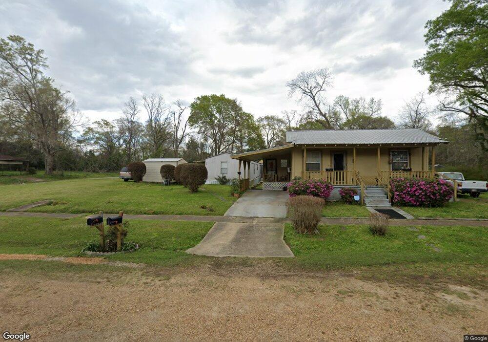
532 Elmwood St McComb, MS 39648
Estimated Value: $65,000 - $144,891
--
Bed
--
Bath
1,438
Sq Ft
$79/Sq Ft
Est. Value
About This Home
This home is located at 532 Elmwood St, McComb, MS 39648 and is currently estimated at $113,223, approximately $78 per square foot. 532 Elmwood St is a home with nearby schools including Higgins Middle School, Otken Elementary School, and Denman Junior High School.
Ownership History
Date
Name
Owned For
Owner Type
Purchase Details
Closed on
Dec 12, 2023
Sold by
Jackson Beverly
Bought by
Crossley Lonnie M
Current Estimated Value
Purchase Details
Closed on
Aug 8, 2022
Sold by
Beverly Jackson
Bought by
Jackson Beverly
Purchase Details
Closed on
Aug 20, 2021
Sold by
Crossley Lonnie M
Bought by
Jackson Beverly
Purchase Details
Closed on
Jun 27, 2017
Sold by
Jackson Beverly
Bought by
Crossley Lonnie G and Crossley Antisia
Create a Home Valuation Report for This Property
The Home Valuation Report is an in-depth analysis detailing your home's value as well as a comparison with similar homes in the area
Home Values in the Area
Average Home Value in this Area
Purchase History
| Date | Buyer | Sale Price | Title Company |
|---|---|---|---|
| Crossley Lonnie M | -- | None Listed On Document | |
| Jackson Beverly | -- | Honea Law Firm Pllc | |
| Jackson Beverly | -- | None Listed On Document | |
| Crossley Lonnie G | -- | None Available |
Source: Public Records
Tax History Compared to Growth
Tax History
| Year | Tax Paid | Tax Assessment Tax Assessment Total Assessment is a certain percentage of the fair market value that is determined by local assessors to be the total taxable value of land and additions on the property. | Land | Improvement |
|---|---|---|---|---|
| 2025 | $858 | $14,754 | $0 | $0 |
| 2024 | $858 | $12,307 | $0 | $0 |
| 2023 | -- | $311 | $0 | $0 |
| 2022 | $0 | $1,352 | $0 | $0 |
| 2021 | $0 | $1,352 | $0 | $0 |
| 2020 | $0 | $1,298 | $0 | $0 |
| 2019 | $162 | $1,298 | $0 | $0 |
| 2018 | $155 | $1,298 | $0 | $0 |
| 2017 | $183 | $1,498 | $0 | $0 |
| 2016 | $181 | $1,498 | $0 | $0 |
| 2015 | $169 | $1,428 | $0 | $0 |
| 2014 | $169 | $1,428 | $0 | $0 |
| 2013 | -- | $1,344 | $0 | $0 |
Source: Public Records
Map
Nearby Homes
- 415 N Magnolia St
- 0 Johnson Ave
- 143 N Myrtle St
- 507 W Georgia Ave
- 600 Jackson Ave
- 133 N Live Oak St
- 509 Jackson Ave
- 1002 Avenue F
- 1002 Avenue F None
- 133 N Chestnut St
- 126 Aston Ave
- 635 Delaware Ave
- 1031 Pearl River Ave
- 900 N James Ave
- 220 N James Ave
- 0 Summit Holmesville Rd
- 1102 Pearl River Ave
- 402 Laurel St
- 200-208 5th Ave
- 1019 Pearl River Avenue Extension