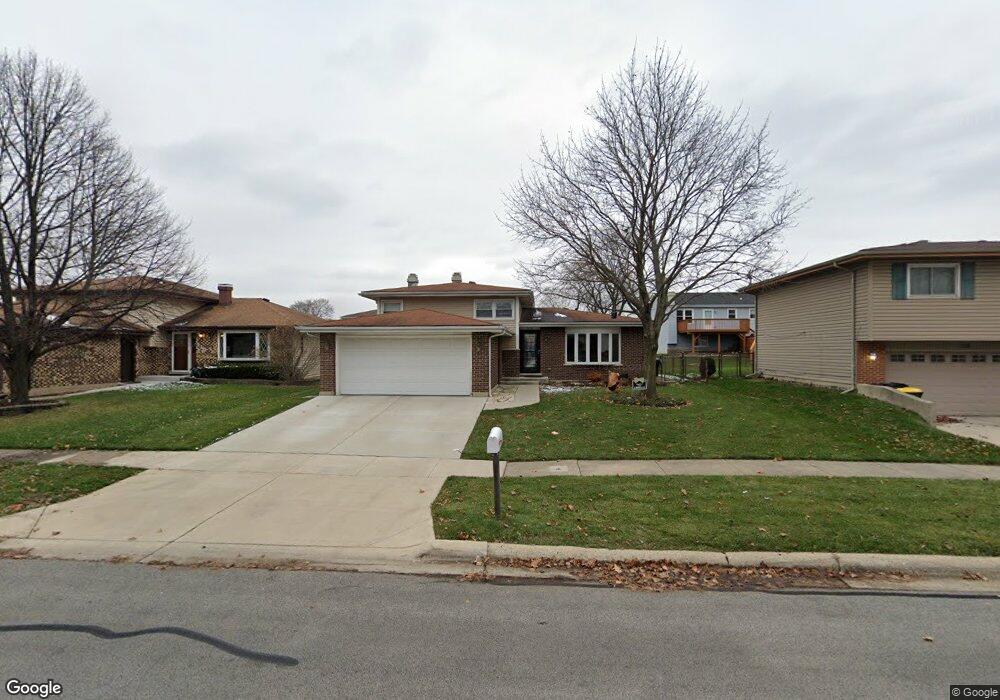
532 Flint Trail Carol Stream, IL 60188
Estimated Value: $386,000 - $392,000
3
Beds
2
Baths
1,857
Sq Ft
$210/Sq Ft
Est. Value
About This Home
This home is located at 532 Flint Trail, Carol Stream, IL 60188 and is currently estimated at $389,884, approximately $209 per square foot. 532 Flint Trail is a home located in DuPage County with nearby schools including Field Kindergarten Center, Western Trails Elementary School, and Jay Stream Middle School.
Ownership History
Date
Name
Owned For
Owner Type
Purchase Details
Closed on
Oct 28, 2005
Sold by
Richter Roger E and Richter Darlene M
Bought by
Colman Shawn P and Colman Dia M
Current Estimated Value
Home Financials for this Owner
Home Financials are based on the most recent Mortgage that was taken out on this home.
Original Mortgage
$234,000
Outstanding Balance
$127,742
Interest Rate
5.98%
Mortgage Type
Fannie Mae Freddie Mac
Estimated Equity
$262,142
Create a Home Valuation Report for This Property
The Home Valuation Report is an in-depth analysis detailing your home's value as well as a comparison with similar homes in the area
Home Values in the Area
Average Home Value in this Area
Purchase History
| Date | Buyer | Sale Price | Title Company |
|---|---|---|---|
| Colman Shawn P | $260,000 | First American Title Ins Co |
Source: Public Records
Mortgage History
| Date | Status | Borrower | Loan Amount |
|---|---|---|---|
| Open | Colman Shawn P | $234,000 |
Source: Public Records
Tax History Compared to Growth
Tax History
| Year | Tax Paid | Tax Assessment Tax Assessment Total Assessment is a certain percentage of the fair market value that is determined by local assessors to be the total taxable value of land and additions on the property. | Land | Improvement |
|---|---|---|---|---|
| 2024 | $9,300 | $116,403 | $32,903 | $83,500 |
| 2023 | $8,797 | $106,450 | $30,090 | $76,360 |
| 2022 | $9,054 | $104,140 | $29,890 | $74,250 |
| 2021 | $8,634 | $98,950 | $28,400 | $70,550 |
| 2020 | $8,493 | $96,540 | $27,710 | $68,830 |
| 2019 | $8,170 | $92,770 | $26,630 | $66,140 |
| 2018 | $7,281 | $84,370 | $25,930 | $58,440 |
| 2017 | $6,880 | $78,200 | $24,030 | $54,170 |
| 2016 | $6,512 | $72,370 | $22,240 | $50,130 |
| 2015 | $6,359 | $67,530 | $20,750 | $46,780 |
| 2014 | $6,319 | $66,030 | $20,290 | $45,740 |
| 2013 | $6,356 | $68,290 | $20,980 | $47,310 |
Source: Public Records
Map
Nearby Homes
- 852 Napa St
- 911 Hampton Dr
- 975 Merbach Ct
- 351 Juniper Ct
- 720 Hoover Dr Unit 124
- 1065 Brighton Dr
- 312 Dancing Water Ct
- 654 Tacoma Dr
- 787 Daybreak Ln Unit 207
- 969 Dearborn Cir
- 808 Trinity Ct
- 848 Birchbark Trail
- 607 Kingsbridge Dr
- 686 Legends Dr
- 601 Bluff St
- 716 Sand Creek Dr
- 641 Kingsbridge Dr
- 129 W Elk Trail Unit 329
- 125 W Elk Trail Unit 124
- 107 W Elk Trail Unit 106
- 530 Flint Trail
- 534 Flint Trail
- 883 Yellowstone St
- 889 Yellowstone St
- 877 Yellowstone St
- 528 Flint Trail
- 548 Deerskin Trail
- 557 Delaware Trail
- 529 Flint Trail Unit 1
- 531 Flint Trail
- 527 Flint Trail
- 895 Yellowstone St
- 533 Flint Trail
- 535 Delaware Trail
- 882 Yellowstone St
- 876 Yellowstone St
- 888 Yellowstone St
- 558 Delaware Trail
- 546 Canyon Trail
- 543 Canyon Trail