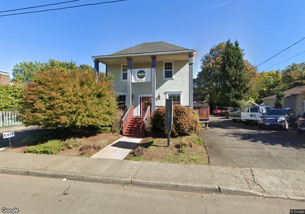
532 N Main Ave Gresham, OR 97030
Downtown Gresham NeighborhoodEstimated Value: $833,253
3
Beds
2
Baths
3,968
Sq Ft
$210/Sq Ft
Est. Value
About This Home
This home is located at 532 N Main Ave, Gresham, OR 97030 and is currently estimated at $833,253, approximately $209 per square foot. 532 N Main Ave is a home located in Multnomah County with nearby schools including Highland Elementary School, Clear Creek Middle School, and Gresham High School.
Ownership History
Date
Name
Owned For
Owner Type
Purchase Details
Closed on
Jul 21, 2016
Sold by
Baillie Jami L and Baillie Bryce J
Bought by
Alyce G Irving Trust
Current Estimated Value
Purchase Details
Closed on
Mar 27, 2009
Sold by
Hartner Frank F and Hartner Jennifer C
Bought by
Baillie Jami L and Baillie Bryce J
Home Financials for this Owner
Home Financials are based on the most recent Mortgage that was taken out on this home.
Original Mortgage
$488,900
Interest Rate
5.06%
Mortgage Type
Construction
Create a Home Valuation Report for This Property
The Home Valuation Report is an in-depth analysis detailing your home's value as well as a comparison with similar homes in the area
Home Values in the Area
Average Home Value in this Area
Purchase History
| Date | Buyer | Sale Price | Title Company |
|---|---|---|---|
| Alyce G Irving Trust | $519,000 | First American | |
| Baillie Jami L | $329,000 | First American |
Source: Public Records
Mortgage History
| Date | Status | Borrower | Loan Amount |
|---|---|---|---|
| Previous Owner | Baillie Jami L | $488,900 |
Source: Public Records
Tax History
| Year | Tax Paid | Tax Assessment Tax Assessment Total Assessment is a certain percentage of the fair market value that is determined by local assessors to be the total taxable value of land and additions on the property. | Land | Improvement |
|---|---|---|---|---|
| 2025 | $6,226 | $305,960 | -- | -- |
| 2024 | $5,960 | $297,050 | -- | -- |
| 2023 | $5,430 | $288,400 | $0 | $0 |
| 2022 | $5,278 | $280,000 | $0 | $0 |
| 2021 | $5,145 | $271,850 | $0 | $0 |
| 2020 | $4,841 | $263,940 | $0 | $0 |
| 2019 | $4,715 | $256,260 | $0 | $0 |
| 2018 | $4,495 | $248,800 | $0 | $0 |
| 2017 | $4,313 | $241,560 | $0 | $0 |
| 2016 | $3,803 | $234,530 | $0 | $0 |
| 2015 | $3,721 | $227,700 | $0 | $0 |
Source: Public Records
Map
Nearby Homes
- 0 NE 5th St
- 318 NE Roberts Ave Unit 308
- 318 NE Roberts Ave Unit 203
- 491 NE Elliott Ave
- 660 NE 9th St
- 54 NW 13th St
- 894 NE Linden Ave
- 645 W Powell Blvd
- 234 NE Cleveland Ave
- 415 SE Roberts Ave
- 417 SE Roberts Ave
- 0 NE 6th St
- 1783 1791 NE Beech Place
- 349 NE 18th St
- 638 SW 7th St
- 1113 W Powell Blvd
- 159 SW Florence Ave Unit 64
- 159 SW Florence Ave
- 994 NW Wallula Ave
- 450 NE 22nd St
- 516 N Main Ave
- 610 N Main Ave
- 577 NE Roberts Ave
- 557 NE Roberts Ave
- 559 NE Roberts Ave
- 571 NE Roberts Ave
- 502 N Main Ave
- 27 NE 5th St
- 21 NE 5th St
- 541 NE Roberts Ave Unit 579
- 579 NE Roberts Ave
- 567 NE Roberts Ave
- 573 NE Roberts Ave
- 563 NE Roberts Ave
- 553 NE Roberts Ave
- 561 NE Roberts Ave
- 551 NE Roberts Ave
- 549 NE Roberts Ave
- 622 N Main Ave
- 543 NE Roberts Ave
Your Personal Tour Guide
Ask me questions while you tour the home.