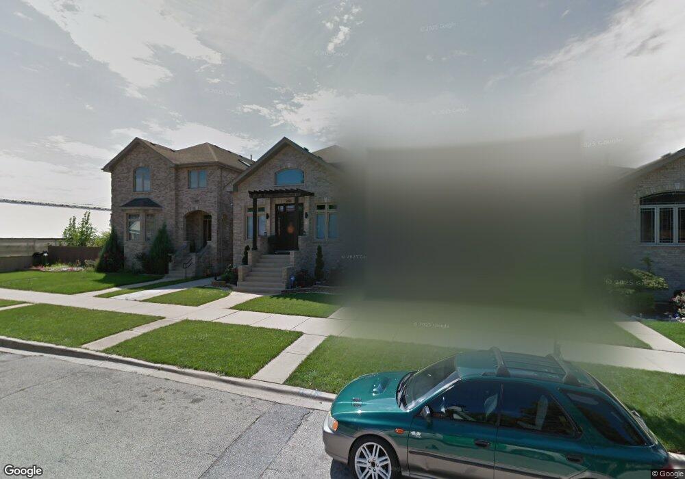
5320 S Mason Ave Chicago, IL 60638
Garfield Ridge NeighborhoodEstimated Value: $654,000 - $862,000
4
Beds
5
Baths
2,808
Sq Ft
$259/Sq Ft
Est. Value
About This Home
This home is located at 5320 S Mason Ave, Chicago, IL 60638 and is currently estimated at $727,394, approximately $259 per square foot. 5320 S Mason Ave is a home located in Cook County with nearby schools including Twain Elementary School, Kennedy High School, and Gloria Dei Lutheran School.
Ownership History
Date
Name
Owned For
Owner Type
Purchase Details
Closed on
Jan 3, 2019
Sold by
Avitia Sandra and Torres Jorge A
Bought by
Trust Number 8002379884 and Chicago Title Land Trust Company
Current Estimated Value
Purchase Details
Closed on
Feb 5, 2013
Sold by
Mason Avenue Development Llc
Bought by
Avitia Sandra and Torres Jorge A
Purchase Details
Closed on
Oct 20, 2006
Sold by
Chicago Title Land Trust Co
Bought by
Mason Avenue Development Llc
Create a Home Valuation Report for This Property
The Home Valuation Report is an in-depth analysis detailing your home's value as well as a comparison with similar homes in the area
Home Values in the Area
Average Home Value in this Area
Purchase History
| Date | Buyer | Sale Price | Title Company |
|---|---|---|---|
| Trust Number 8002379884 | -- | Chicago Title | |
| Avitia Sandra | $380,000 | None Available | |
| Mason Avenue Development Llc | -- | None Available |
Source: Public Records
Tax History Compared to Growth
Tax History
| Year | Tax Paid | Tax Assessment Tax Assessment Total Assessment is a certain percentage of the fair market value that is determined by local assessors to be the total taxable value of land and additions on the property. | Land | Improvement |
|---|---|---|---|---|
| 2024 | $9,006 | $55,753 | $4,876 | $50,877 |
| 2023 | $8,758 | $46,000 | $4,354 | $41,646 |
| 2022 | $8,758 | $46,000 | $4,354 | $41,646 |
| 2021 | $8,580 | $45,999 | $4,353 | $41,646 |
| 2020 | $8,004 | $39,032 | $3,483 | $35,549 |
| 2019 | $8,219 | $44,339 | $3,483 | $40,856 |
| 2018 | $8,080 | $44,339 | $3,483 | $40,856 |
| 2017 | $6,797 | $34,949 | $3,134 | $31,815 |
| 2016 | $6,500 | $34,949 | $3,134 | $31,815 |
| 2015 | $5,924 | $34,949 | $3,134 | $31,815 |
| 2014 | $6,265 | $33,764 | $2,960 | $30,804 |
| 2013 | $5,260 | $28,922 | $2,960 | $25,962 |
Source: Public Records
Map
Nearby Homes
- 5245 S Mayfield Ave
- 5850 W 55th St Unit 3D
- 5417 S Melvina Ave Unit 102
- 5533 S Menard Ave
- 5128 S Meade Ave
- 5712 W 56th St
- 5621 S Moody Ave
- 5108 S Massasoit Ave
- 5253 S Mobile Ave
- 5141 S Merrimac Ave
- 5700 S Monitor Ave
- 6340 S Archer Ave
- 5421 S Mulligan Ave
- 5727 S Meade Ave
- 5127 S Parkside Ave
- 5118 S Mobile Ave
- 4439 & 4441 S Lawler Ave
- 5121 S Central Ave
- 5142 S Mulligan Ave
- 5248 S Narragansett Ave
- 5320 S Mason Ave
- 5324 S Mason Ave
- 5316 S Mason Ave
- 5324 S Mason Ave
- 5316 S Mason Ave
- 5314 S Mason Ave
- 5314 S Mason Ave
- 5340 S Mason Ave
- 5327 S Austin Ave
- 5325 S Austin Ave
- 5310 S Mason Ave
- 5331 S Austin Ave
- 5321 S Austin Ave
- 5317 S Austin Ave
- 5317 S Austin Ave
- 5342 S Mason Ave
- 5304 S Mason Ave
- 5335 S Austin Ave
- 5335 S Austin Ave
- 5327 S Mason Ave