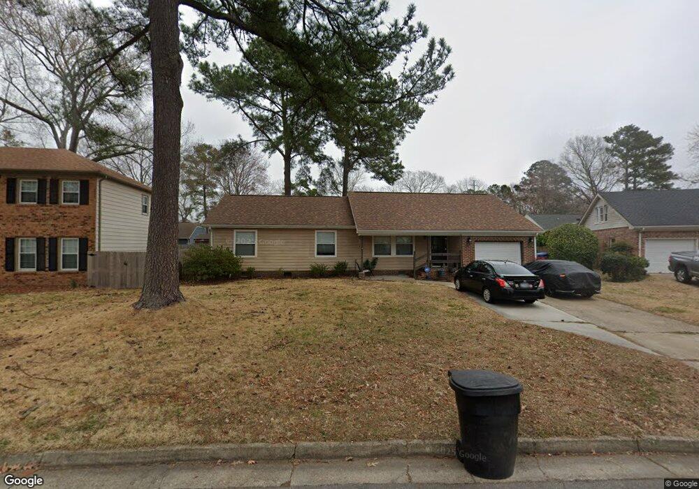
5321 Angus Dr Virginia Beach, VA 23464
Brigadoon NeighborhoodEstimated Value: $399,000 - $411,000
4
Beds
2
Baths
1,538
Sq Ft
$263/Sq Ft
Est. Value
About This Home
This home is located at 5321 Angus Dr, Virginia Beach, VA 23464 and is currently estimated at $404,855, approximately $263 per square foot. 5321 Angus Dr is a home located in Virginia Beach City with nearby schools including Centerville Elementary, Brandon Middle School, and Tallwood High School.
Ownership History
Date
Name
Owned For
Owner Type
Purchase Details
Closed on
Oct 29, 2021
Sold by
Caseio Jason M
Bought by
Stephen Emily Brashear
Current Estimated Value
Home Financials for this Owner
Home Financials are based on the most recent Mortgage that was taken out on this home.
Original Mortgage
$312,015
Outstanding Balance
$284,858
Interest Rate
2.88%
Mortgage Type
VA
Estimated Equity
$119,997
Purchase Details
Closed on
Jun 10, 2008
Sold by
Mcmahon Patrick M
Bought by
Cascio Jason M
Home Financials for this Owner
Home Financials are based on the most recent Mortgage that was taken out on this home.
Original Mortgage
$265,590
Interest Rate
6.13%
Mortgage Type
VA
Purchase Details
Closed on
Jan 10, 2002
Sold by
Thacker Ronald E
Bought by
Dela Cruz Bobb L
Home Financials for this Owner
Home Financials are based on the most recent Mortgage that was taken out on this home.
Original Mortgage
$138,720
Interest Rate
7.15%
Mortgage Type
VA
Create a Home Valuation Report for This Property
The Home Valuation Report is an in-depth analysis detailing your home's value as well as a comparison with similar homes in the area
Home Values in the Area
Average Home Value in this Area
Purchase History
| Date | Buyer | Sale Price | Title Company |
|---|---|---|---|
| Stephen Emily Brashear | $305,000 | Westcor Land Title Ins Co | |
| Cascio Jason M | $260,000 | -- | |
| Dela Cruz Bobb L | $136,000 | -- |
Source: Public Records
Mortgage History
| Date | Status | Borrower | Loan Amount |
|---|---|---|---|
| Open | Stephen Emily Brashear | $312,015 | |
| Previous Owner | Cascio Jason M | $265,590 | |
| Previous Owner | Dela Cruz Bobb L | $138,720 |
Source: Public Records
Tax History Compared to Growth
Tax History
| Year | Tax Paid | Tax Assessment Tax Assessment Total Assessment is a certain percentage of the fair market value that is determined by local assessors to be the total taxable value of land and additions on the property. | Land | Improvement |
|---|---|---|---|---|
| 2025 | $3,184 | $351,100 | $157,500 | $193,600 |
| 2024 | $3,184 | $328,200 | $150,000 | $178,200 |
| 2023 | $3,051 | $308,200 | $130,000 | $178,200 |
| 2022 | $2,835 | $286,400 | $120,000 | $166,400 |
| 2021 | $2,508 | $253,300 | $104,000 | $149,300 |
| 2020 | $2,352 | $231,200 | $93,000 | $138,200 |
| 2019 | $2,332 | $226,500 | $88,000 | $138,500 |
| 2018 | $2,271 | $226,500 | $88,000 | $138,500 |
| 2017 | $2,219 | $221,300 | $88,000 | $133,300 |
| 2016 | $2,191 | $221,300 | $88,000 | $133,300 |
| 2015 | $2,224 | $224,600 | $87,800 | $136,800 |
| 2014 | $1,883 | $212,200 | $101,300 | $110,900 |
Source: Public Records
Map
Nearby Homes
- 1632 Black Watch Ln
- 5217 Brockie St
- 5204 Brockie St
- 1652 Ashton Dr
- 1721 Dancers Ct
- 2165 Bizzone Cir
- 5441 Brookfield Dr
- 900 Murphy Ln
- 1716 Chilhowie Cir
- 900 Whitbeck Ct
- 5545 MacGuffie St
- 909 Daniel Maloney Dr
- 912 Dallas Ct
- 957 Avery Way
- 5031 Indian River Rd
- 1507 Heritage Ave
- 5102 Settlers Park Dr
- 5593 Stonehaven Dr
- 1969 Lisa Ct
- 1449 Thamesford Dr
- 5317 Angus Dr
- 5325 Angus Dr
- 5301 Brockie St
- 5237 Brockie St
- 5305 Brockie St
- 5233 Brockie St
- 5313 Angus Dr
- 5329 Angus Dr
- 5309 Brockie St
- 5309 Angus Dr
- 5229 Brockie St
- 5336 Angus Dr
- 5225 Brockie St
- 5333 Angus Dr
- 5304 Angus Dr
- 5300 Brockie St
- 5260 Brockie St
- 5313 Brockie St
- 5221 Brockie St
- 1604 Angus Ct