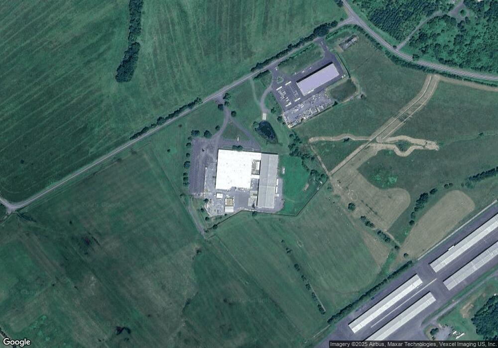
5321 Midland Rd Midland, VA 22728
--
Bed
--
Bath
93,580
Sq Ft
25.51
Acres
About This Home
This home is located at 5321 Midland Rd, Midland, VA 22728. 5321 Midland Rd is a home located in Fauquier County with nearby schools including H.M. Pearson Elementary School, Cedar Lee Middle School, and Liberty High School.
Ownership History
Date
Name
Owned For
Owner Type
Purchase Details
Closed on
Jul 15, 2020
Sold by
Ross Industrial Development Inc
Bought by
Midland Industrial Development Llc
Home Financials for this Owner
Home Financials are based on the most recent Mortgage that was taken out on this home.
Original Mortgage
$664,500
Outstanding Balance
$589,235
Interest Rate
3.1%
Mortgage Type
Commercial
Create a Home Valuation Report for This Property
The Home Valuation Report is an in-depth analysis detailing your home's value as well as a comparison with similar homes in the area
Home Values in the Area
Average Home Value in this Area
Purchase History
| Date | Buyer | Sale Price | Title Company |
|---|---|---|---|
| Midland Industrial Development Llc | $1,050,000 | None Available |
Source: Public Records
Mortgage History
| Date | Status | Borrower | Loan Amount |
|---|---|---|---|
| Open | Midland Industrial Development Llc | $664,500 |
Source: Public Records
Tax History Compared to Growth
Tax History
| Year | Tax Paid | Tax Assessment Tax Assessment Total Assessment is a certain percentage of the fair market value that is determined by local assessors to be the total taxable value of land and additions on the property. | Land | Improvement |
|---|---|---|---|---|
| 2025 | $29,151 | $3,014,600 | $1,275,500 | $1,739,100 |
| 2024 | $28,441 | $3,014,600 | $1,275,500 | $1,739,100 |
| 2023 | $27,235 | $3,014,600 | $1,275,500 | $1,739,100 |
| 2022 | $27,235 | $3,014,600 | $1,275,500 | $1,739,100 |
| 2021 | $23,272 | $2,339,900 | $645,500 | $1,694,400 |
| 2020 | $23,272 | $2,339,900 | $645,500 | $1,694,400 |
| 2019 | $23,272 | $2,339,900 | $645,500 | $1,694,400 |
| 2018 | $22,991 | $2,339,900 | $645,500 | $1,694,400 |
| 2016 | $26,753 | $2,573,600 | $645,500 | $1,928,100 |
| 2015 | -- | $2,573,600 | $645,500 | $1,928,100 |
| 2014 | -- | $2,573,600 | $645,500 | $1,928,100 |
Source: Public Records
Map
Nearby Homes
- 11326-LAND SOUTH Rogues Rd
- 0 Unassigned Unit VAFQ2013780
- 10346 Groves Farm Rd
- 5426 Germantown Rd
- 9960 Meetze Rd
- 11378 Timbuktu Ln
- 11243 Blackwelltown Rd
- 11312 Timbuktu Ln
- 0 Timbuktu Ln
- 11326-BUILD SOUTH Rogues Rd
- 10150 Hedrick Farm Ln
- 10816 King Nobel Ln
- 9653 Woodbrook Ln
- 10816 Grimbert Ct
- 10819 Grimbert Ct
- 10853 King Nobel Ln
- 10843 Spencer St
- 6152 Newton Ln
- 6188 Library Ln
- 6161 Willow Place Unit 305
- Hitt Property Parcel Midland Rd
- Hitt Property Parcel Midland Rd
- 5083 Airport Rd
- 5081 Airport Rd
- 5086 Germantown Rd
- 5107 Airport Rd
- 5105 Airport Rd
- 5075 Airport Rd Unit 76
- 5151 Germantown Rd
- 5053 Airport Rd
- 5212 Midland Rd
- Parcel A Rogues Rd
- 5435 Midland Rd
- 5150 Germantown Rd
- 5010 Airport Rd
- 5215 Chestnut St
- 5211 Chestnut St
- 10526 Second St
- 5449 Midland Rd
- 10637 Rogues Rd