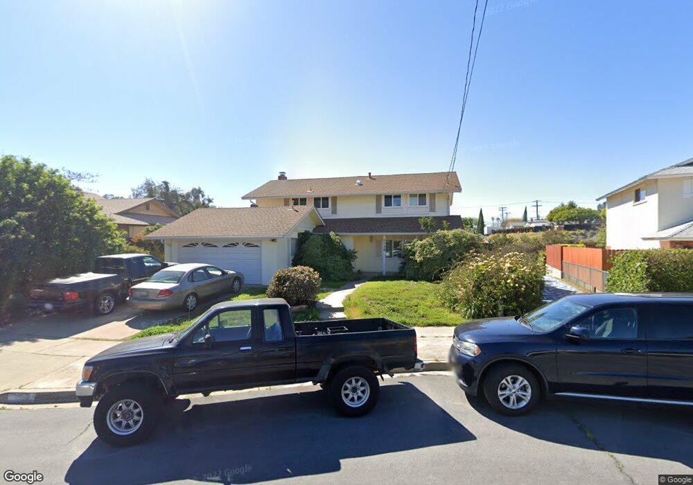
5324 Tufts St La Mesa, CA 91942
Estimated Value: $1,005,866 - $1,211,000
5
Beds
3
Baths
2,064
Sq Ft
$531/Sq Ft
Est. Value
About This Home
This home is located at 5324 Tufts St, La Mesa, CA 91942 and is currently estimated at $1,094,967, approximately $530 per square foot. 5324 Tufts St is a home located in San Diego County with nearby schools including Maryland Avenue Elementary School, Parkway Academy, and Grossmont High School.
Ownership History
Date
Name
Owned For
Owner Type
Purchase Details
Closed on
Sep 17, 2024
Sold by
Bosley John J
Bought by
John Bosley Trust and Bosley
Current Estimated Value
Purchase Details
Closed on
Sep 9, 2020
Sold by
Bosley John J and Stromberg Karen Jean
Bought by
Bosley John J
Purchase Details
Closed on
Jul 19, 1991
Bought by
Bosley John J Stromberg Karen
Create a Home Valuation Report for This Property
The Home Valuation Report is an in-depth analysis detailing your home's value as well as a comparison with similar homes in the area
Home Values in the Area
Average Home Value in this Area
Purchase History
| Date | Buyer | Sale Price | Title Company |
|---|---|---|---|
| John Bosley Trust | -- | None Listed On Document | |
| Bosley John J | -- | None Available | |
| Bosley John J Stromberg Karen | $195,500 | -- |
Source: Public Records
Tax History Compared to Growth
Tax History
| Year | Tax Paid | Tax Assessment Tax Assessment Total Assessment is a certain percentage of the fair market value that is determined by local assessors to be the total taxable value of land and additions on the property. | Land | Improvement |
|---|---|---|---|---|
| 2025 | $4,406 | $345,684 | $176,823 | $168,861 |
| 2024 | $4,406 | $338,906 | $173,356 | $165,550 |
| 2023 | $4,259 | $332,261 | $169,957 | $162,304 |
| 2022 | $4,229 | $325,747 | $166,625 | $159,122 |
| 2021 | $4,192 | $319,360 | $163,358 | $156,002 |
| 2020 | $4,084 | $316,086 | $161,683 | $154,403 |
| 2019 | $4,026 | $309,889 | $158,513 | $151,376 |
| 2018 | $3,962 | $303,813 | $155,405 | $148,408 |
| 2017 | $3,897 | $297,857 | $152,358 | $145,499 |
| 2016 | $3,785 | $292,018 | $149,371 | $142,647 |
| 2015 | $3,797 | $287,633 | $147,128 | $140,505 |
| 2014 | $3,754 | $281,999 | $144,246 | $137,753 |
Source: Public Records
Map
Nearby Homes
- 7495 Oakland Rd Unit 33
- 7495 Oakland Rd Unit 23
- 7506 Parkway Dr Unit 202
- 7506 Parkway Dr Unit 104
- 7500 Parkway Dr Unit 306
- 5590 Shasta Ln
- 5450 Kiowa Dr Unit 81
- 7240 Baldrich St
- 5470 Baltimore Dr Unit 8
- 5430 Baltimore Dr Unit 51
- 7195 Macquarie St
- 7700 Parkway Dr Unit 17
- 5440 Baltimore Dr Unit 90
- 5440 Baltimore Dr Unit 178
- 5366 Lake Murray Blvd
- 7780 Parkway Dr Unit 304
- 5350 Baltimore Dr Unit 47
- 5350 Baltimore Dr Unit 20
- 5707 Baltimore Dr Unit 12
- 5015 Comanche Dr