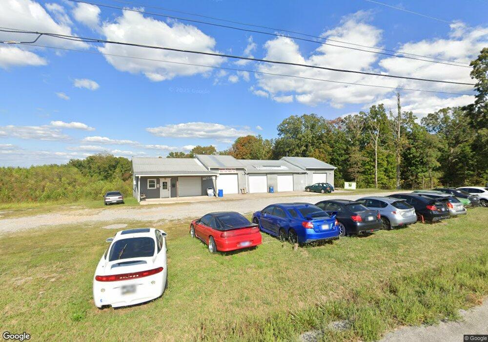
5325 Highway 49 Tennessee Ridge, TN 37178
Estimated Value: $177,040
--
Bed
--
Bath
3,400
Sq Ft
$52/Sq Ft
Est. Value
About This Home
This home is located at 5325 Highway 49, Tennessee Ridge, TN 37178 and is currently estimated at $177,040, approximately $52 per square foot. 5325 Highway 49 is a home located in Stewart County with nearby schools including Dover Elementary School, Stewart County Middle School, and Stewart County High School.
Ownership History
Date
Name
Owned For
Owner Type
Purchase Details
Closed on
Jun 8, 2023
Sold by
Schmidt Jason and Schmidt Lori
Bought by
Ferrell Timothy Shannon and Ferrell Christie
Current Estimated Value
Purchase Details
Closed on
Apr 16, 2021
Sold by
Smith Jeffrey M and Smith Ann B
Bought by
Moss Stephen C and Moss Kelly C
Home Financials for this Owner
Home Financials are based on the most recent Mortgage that was taken out on this home.
Original Mortgage
$133,600
Interest Rate
3.05%
Mortgage Type
Commercial
Create a Home Valuation Report for This Property
The Home Valuation Report is an in-depth analysis detailing your home's value as well as a comparison with similar homes in the area
Home Values in the Area
Average Home Value in this Area
Purchase History
| Date | Buyer | Sale Price | Title Company |
|---|---|---|---|
| Ferrell Timothy Shannon | $105,000 | 5 Star Title Of Tennessee | |
| Moss Stephen C | $167,000 | Freedom Title Services Llc |
Source: Public Records
Mortgage History
| Date | Status | Borrower | Loan Amount |
|---|---|---|---|
| Previous Owner | Moss Stephen C | $133,600 |
Source: Public Records
Tax History Compared to Growth
Tax History
| Year | Tax Paid | Tax Assessment Tax Assessment Total Assessment is a certain percentage of the fair market value that is determined by local assessors to be the total taxable value of land and additions on the property. | Land | Improvement |
|---|---|---|---|---|
| 2024 | $678 | $45,600 | $9,840 | $35,760 |
| 2023 | $780 | $33,040 | $9,840 | $23,200 |
| 2022 | $780 | $33,040 | $9,840 | $23,200 |
| 2021 | $780 | $33,040 | $9,840 | $23,200 |
| 2020 | $817 | $33,040 | $9,840 | $23,200 |
| 2019 | $856 | $33,600 | $9,840 | $23,760 |
| 2018 | $856 | $33,600 | $9,840 | $23,760 |
| 2017 | $856 | $33,600 | $9,840 | $23,760 |
| 2016 | $678 | $26,600 | $9,840 | $16,760 |
| 2015 | $571 | $23,120 | $9,840 | $13,280 |
Source: Public Records
Map
Nearby Homes
- 104 Oak Crest Dr
- 169 Oak Crest Dr
- 187 Oak Crest Dr
- 1165 Green Shanty Rd
- 1290 Highway 49
- 135 Locust Dr
- 193 A W Schmidt Rd
- 745 Moore Hollow Rd
- 316 N Main St
- 4 Clyde Webb Rd
- 1 Clyde Webb Rd
- 6 Clyde Webb Rd
- 5 Clyde Webb Rd
- 793 Preston Baggett Rd
- 1440 Highway 49
- 0 Old Lockhart Rd
- 630 Lakeview Cir
- 550 Lakeview Cir
- 0 Taylor St Unit RTC2764411
- 0 Taylor St Unit RTC2764420
- 105 Oak Crest Dr
- 113 Oak Crest Dr
- 119 Oak Crest Dr
- 112 Oak Crest Dr
- 62 Highway 49
- 112 Preston Baggett Rd
- 2 Preston Baggett Rd
- 0 Preston Baggett Rd
- 125 Oak Crest Dr
- 75 Highway 49
- 126 Oak Crest Dr
- 0 Green Shanty Rd
- 132 Oak Crest Dr
- 131 Oak Crest Dr
- 106 Oak Ln
- 146 Oak Crest Dr
- 151 Oak Crest Dr
- 99 Green Shanty Rd
- 99 Green Shanty Rd
- 133 Preston Baggett Rd
