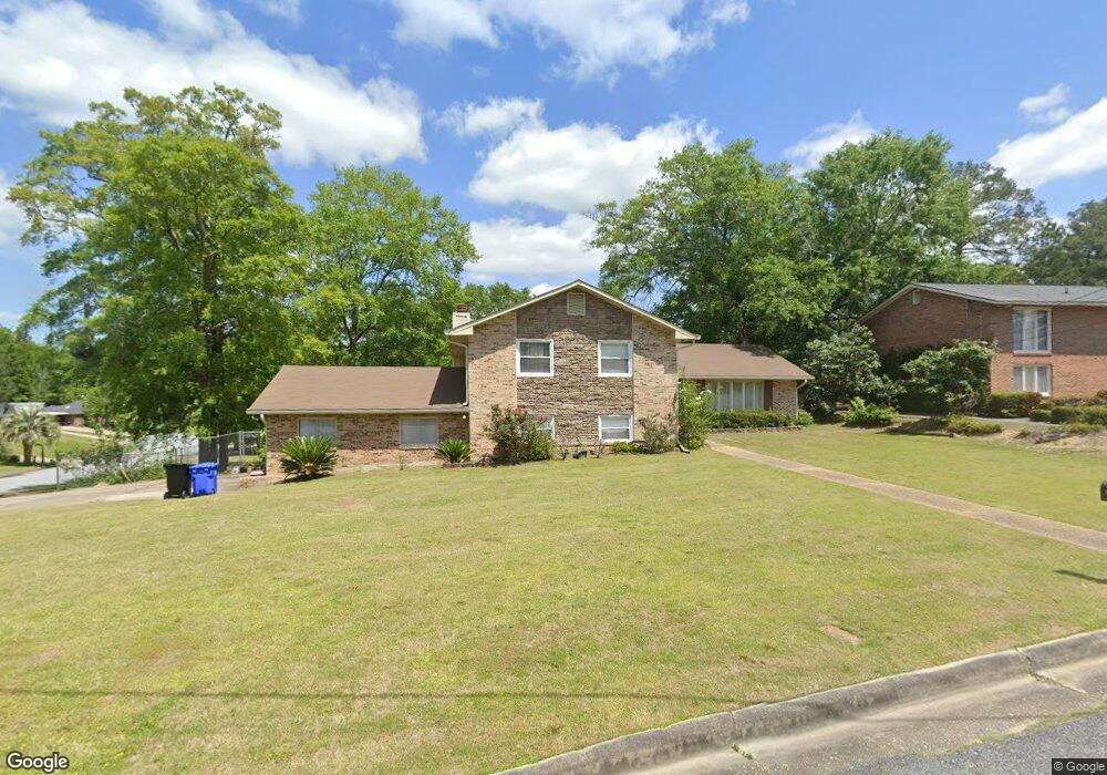
5327 Cleveland St Columbus, GA 31907
Eastern Columbus NeighborhoodEstimated Value: $226,000 - $296,000
4
Beds
4
Baths
3,036
Sq Ft
$88/Sq Ft
Est. Value
About This Home
This home is located at 5327 Cleveland St, Columbus, GA 31907 and is currently estimated at $267,434, approximately $88 per square foot. 5327 Cleveland St is a home located in Muscogee County with nearby schools including Dawson Elementary School, East Columbus Magnet Academy, and Kendrick High School.
Ownership History
Date
Name
Owned For
Owner Type
Purchase Details
Closed on
Apr 15, 2014
Sold by
Lyles Damita
Bought by
Lyles Damita and Lyles Vivian
Current Estimated Value
Purchase Details
Closed on
Feb 21, 2014
Sold by
Lyles Roland
Bought by
Lyles Damita
Purchase Details
Closed on
Aug 29, 2013
Sold by
Lyles Robert
Bought by
Lyles Danita and Lyles Roland
Purchase Details
Closed on
Aug 6, 2013
Sold by
Lyles Robert
Bought by
Lyles Damita
Create a Home Valuation Report for This Property
The Home Valuation Report is an in-depth analysis detailing your home's value as well as a comparison with similar homes in the area
Home Values in the Area
Average Home Value in this Area
Purchase History
| Date | Buyer | Sale Price | Title Company |
|---|---|---|---|
| Lyles Damita | -- | -- | |
| Lyles Damita | -- | -- | |
| Lyles Danita | -- | -- | |
| Lyles Damita | -- | -- |
Source: Public Records
Tax History Compared to Growth
Tax History
| Year | Tax Paid | Tax Assessment Tax Assessment Total Assessment is a certain percentage of the fair market value that is determined by local assessors to be the total taxable value of land and additions on the property. | Land | Improvement |
|---|---|---|---|---|
| 2025 | $2,820 | $72,040 | $11,984 | $60,056 |
| 2024 | $28 | $72,040 | $11,984 | $60,056 |
| 2023 | $2,838 | $72,040 | $11,984 | $60,056 |
| 2022 | $2,168 | $53,104 | $11,984 | $41,120 |
| 2021 | $2,014 | $49,324 | $11,984 | $37,340 |
| 2020 | $1,699 | $41,600 | $11,984 | $29,616 |
| 2019 | $1,704 | $41,600 | $11,984 | $29,616 |
| 2018 | $1,704 | $41,600 | $11,984 | $29,616 |
| 2017 | $1,710 | $41,600 | $11,984 | $29,616 |
| 2016 | $1,729 | $41,920 | $5,652 | $36,268 |
| 2015 | $693 | $41,920 | $5,652 | $36,268 |
| 2014 | $648 | $41,920 | $5,652 | $36,268 |
| 2013 | -- | $41,920 | $5,652 | $36,268 |
Source: Public Records
Map
Nearby Homes
- 31 R C Allen Dr
- 300 Jefferson Dr
- 4965 Brightstar Ln
- 100 R C Allen Dr
- 780 Honey Do Ct
- 5021 Shirley Ann Dr
- 4917 Brightstar Ln
- 4930 Capricorn Ct
- 5003 Shirley Ann Dr
- 59 Apollo Dr
- 4201 Valley Crest Dr
- 4408 Walking Stick Way
- 5234 Saint Marys Rd
- 849 Bunker Hill Rd
- 4939 Aaron Dr
- 4846 Maplewood Dr
- 906 Bunker Hill Rd
- 4462 Walking Stick Way
- 1513 Alamo Dr
- 811 Pheasant Loop
- 0 Longshore Dr Unit 7180792
- 0 Longshore Dr
- 5335 Cleveland St
- 5404 Pierson Dr
- 5400 Pierson Dr
- 5408 Pierson Dr
- 117 Longshore Dr
- 121 Longshore Dr
- 5343 Cleveland St
- 5332 Cleveland St
- 113 Longshore Dr
- 125 Longshore Dr
- 5412 Pierson Dr
- 5340 Cleveland St
- 129 Longshore Dr
- 5403 Cleveland St
- 103 Longshore Dr
- 0 Pierson Dr
- 5407 Pierson Dr
- 5403 Pierson Dr