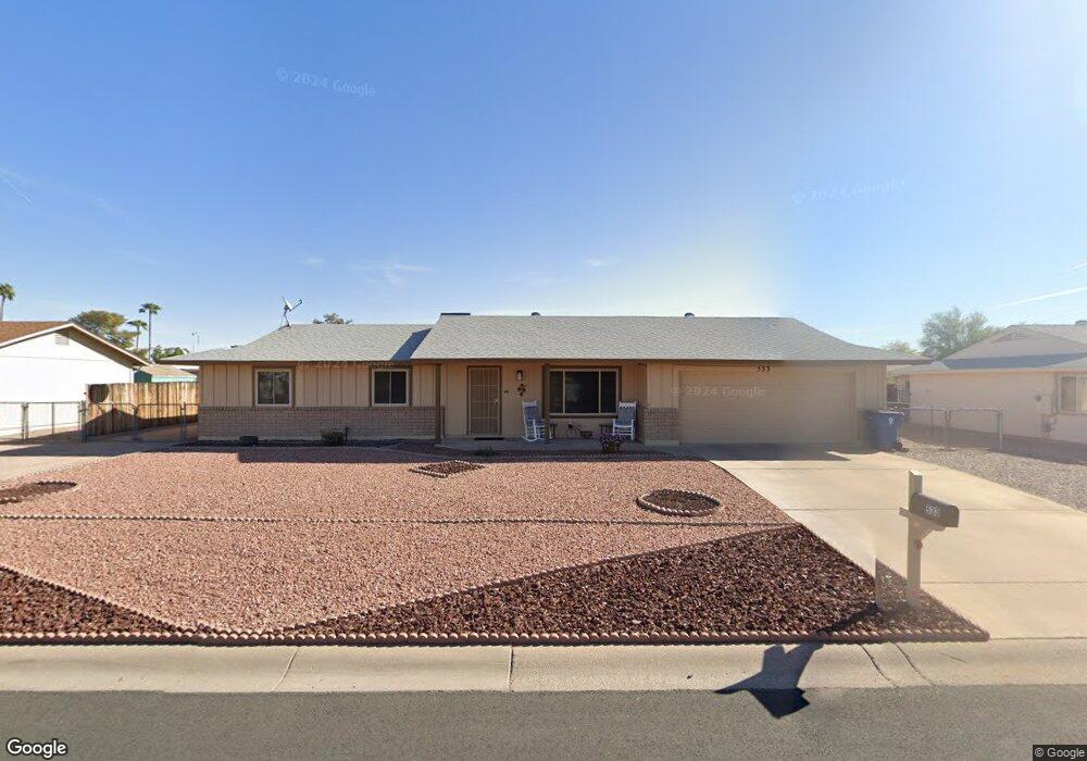
533 S Silver Dr Apache Junction, AZ 85120
Estimated Value: $278,493 - $338,000
2
Beds
2
Baths
1,080
Sq Ft
$292/Sq Ft
Est. Value
About This Home
This home is located at 533 S Silver Dr, Apache Junction, AZ 85120 and is currently estimated at $315,123, approximately $291 per square foot. 533 S Silver Dr is a home located in Pinal County with nearby schools including Four Peaks Elementary School, Cactus Canyon Junior High School, and Apache Junction High School.
Ownership History
Date
Name
Owned For
Owner Type
Purchase Details
Closed on
Mar 17, 2025
Sold by
Herron Patricia Louise
Bought by
Herron Patricia Louise and Goodwin Cindy Michele
Current Estimated Value
Purchase Details
Closed on
Dec 9, 2024
Sold by
Herron Patricia Louise
Bought by
Herron Patricia Louise and Goodwin Cindy Michele
Purchase Details
Closed on
May 14, 2004
Sold by
Herron Joseph and Herron Shelly
Bought by
Herron Lanny M and Herron Patricia L
Home Financials for this Owner
Home Financials are based on the most recent Mortgage that was taken out on this home.
Original Mortgage
$89,000
Interest Rate
5.5%
Mortgage Type
New Conventional
Purchase Details
Closed on
Apr 14, 2003
Sold by
Shepherd Denman G
Bought by
Herron Joseph and Herron Shelly
Home Financials for this Owner
Home Financials are based on the most recent Mortgage that was taken out on this home.
Original Mortgage
$101,097
Interest Rate
5.6%
Mortgage Type
FHA
Create a Home Valuation Report for This Property
The Home Valuation Report is an in-depth analysis detailing your home's value as well as a comparison with similar homes in the area
Home Values in the Area
Average Home Value in this Area
Purchase History
| Date | Buyer | Sale Price | Title Company |
|---|---|---|---|
| Herron Patricia Louise | -- | None Listed On Document | |
| Herron Patricia Louise | -- | None Listed On Document | |
| Herron Lanny M | $100,000 | Fidelity National Title Agen | |
| Herron Joseph | $102,000 | Fidelity Natl Title Agency |
Source: Public Records
Mortgage History
| Date | Status | Borrower | Loan Amount |
|---|---|---|---|
| Previous Owner | Herron Lanny M | $89,000 | |
| Previous Owner | Herron Joseph | $101,097 | |
| Closed | Herron Joseph | $5,054 |
Source: Public Records
Tax History
| Year | Tax Paid | Tax Assessment Tax Assessment Total Assessment is a certain percentage of the fair market value that is determined by local assessors to be the total taxable value of land and additions on the property. | Land | Improvement |
|---|---|---|---|---|
| 2025 | $269 | $23,995 | -- | -- |
| 2024 | $236 | $24,367 | -- | -- |
| 2023 | $250 | $17,159 | $3,573 | $13,586 |
| 2022 | $236 | $12,360 | $3,573 | $8,787 |
| 2021 | $222 | $11,669 | $0 | $0 |
| 2020 | $197 | $11,243 | $0 | $0 |
| 2019 | $172 | $11,018 | $0 | $0 |
| 2018 | $133 | $7,774 | $0 | $0 |
| 2017 | $111 | $6,785 | $0 | $0 |
| 2016 | $89 | $6,652 | $1,100 | $5,552 |
| 2014 | $609 | $3,995 | $1,100 | $2,895 |
Source: Public Records
Map
Nearby Homes
- 637 S Copper Dr
- 449 S Gold Dr
- 1183 W Rosal Ave
- 1181 W 4th Ave
- 1059 W 5th Ave
- 337 S Thunderbird Dr
- XXX E Compound Lot 2 B Trail Unit B
- 861 W 5th Ave
- 938 S Palo Verde Dr
- 1694 W 13th Ave
- 110 S Palo Verde Dr
- 1108 W 13th Ave
- 880 S Buena Vista Dr
- 324 S Ocotillo Dr
- 1745 W 13th Ave
- 292 S Ocotillo Dr Unit 41
- 894 S Buena Vista Dr
- 1881 W 12th Ave
- 908 S Ocotillo Dr
- 955 W 12th Ave
- 559 S Silver Dr
- 505 S Silver Dr
- 534 S Gold Dr
- 510 S Gold Dr
- 558 S Gold Dr
- 518 S Silver Dr
- 544 S Silver Dr
- 502 S Silver Dr
- 475 S Silver Dr
- 585 S Silver Dr
- 564 S Silver Dr
- 155 S El Dorado Rd
- 484 S Gold Dr
- 592 S Gold Dr
- 531 S Gold Dr
- 480 S Silver Dr
- 511 S Gold Dr
- 557 S Gold Dr
- 604 S Silver Dr
- 611 S Silver Dr
Your Personal Tour Guide
Ask me questions while you tour the home.