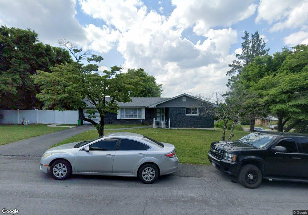
533 W Leslie St Unit 545 Allentown, PA 18103
Southside NeighborhoodEstimated Value: $331,000 - $353,000
3
Beds
2
Baths
1,122
Sq Ft
$305/Sq Ft
Est. Value
About This Home
This home is located at 533 W Leslie St Unit 545, Allentown, PA 18103 and is currently estimated at $341,783, approximately $304 per square foot. 533 W Leslie St Unit 545 is a home located in Lehigh County with nearby schools including Hiram W Dodd Elementary School, South Mountain Middle School, and Louis E. Dieruff High School.
Ownership History
Date
Name
Owned For
Owner Type
Purchase Details
Closed on
Sep 30, 2021
Sold by
Gedle Yohannes and Gedle Yahannes
Bought by
Crespo Yolanda and Vega Andy
Current Estimated Value
Home Financials for this Owner
Home Financials are based on the most recent Mortgage that was taken out on this home.
Original Mortgage
$282,783
Outstanding Balance
$257,872
Interest Rate
2.8%
Mortgage Type
FHA
Estimated Equity
$83,911
Purchase Details
Closed on
Dec 21, 2004
Sold by
Cerciello Elizabeth L and Ernst Cynthia E
Bought by
Gedle Yohannes and Gedle Yahannes
Home Financials for this Owner
Home Financials are based on the most recent Mortgage that was taken out on this home.
Original Mortgage
$148,500
Interest Rate
5.74%
Mortgage Type
Purchase Money Mortgage
Purchase Details
Closed on
May 19, 1993
Sold by
Cerciello Anthony and Cerciello Anna
Bought by
Cerciello Mark J and Cerciello Elizabeth L
Create a Home Valuation Report for This Property
The Home Valuation Report is an in-depth analysis detailing your home's value as well as a comparison with similar homes in the area
Home Values in the Area
Average Home Value in this Area
Purchase History
| Date | Buyer | Sale Price | Title Company |
|---|---|---|---|
| Crespo Yolanda | $288,000 | First United Land Transfer I | |
| Gedle Yohannes | $159,000 | -- | |
| Cerciello Mark J | -- | -- |
Source: Public Records
Mortgage History
| Date | Status | Borrower | Loan Amount |
|---|---|---|---|
| Open | Crespo Yolanda | $282,783 | |
| Previous Owner | Gedle Yohannes | $148,500 |
Source: Public Records
Tax History Compared to Growth
Tax History
| Year | Tax Paid | Tax Assessment Tax Assessment Total Assessment is a certain percentage of the fair market value that is determined by local assessors to be the total taxable value of land and additions on the property. | Land | Improvement |
|---|---|---|---|---|
| 2025 | $5,471 | $149,700 | $44,500 | $105,200 |
| 2024 | $5,471 | $149,700 | $44,500 | $105,200 |
| 2023 | $5,471 | $149,700 | $44,500 | $105,200 |
| 2022 | $5,301 | $149,700 | $105,200 | $44,500 |
| 2021 | $5,207 | $149,700 | $44,500 | $105,200 |
| 2020 | $5,087 | $149,700 | $44,500 | $105,200 |
| 2019 | $5,014 | $149,700 | $44,500 | $105,200 |
| 2018 | $4,595 | $149,700 | $44,500 | $105,200 |
| 2017 | $4,490 | $149,700 | $44,500 | $105,200 |
| 2016 | -- | $149,700 | $44,500 | $105,200 |
| 2015 | -- | $149,700 | $44,500 | $105,200 |
| 2014 | -- | $149,700 | $44,500 | $105,200 |
Source: Public Records
Map
Nearby Homes
- 2416 S Alice St Unit 2418
- 2441 S 4th St
- 316 W Mountain Rd
- 2347 S Law St Unit 2349
- 618 Clifford St
- 2413 S Church St
- 2401 S Church St
- 566 W Emaus Ave
- 566 588 W Emaus Ave
- 2429 S Front St
- 2421 S Wood St
- 642 W Emaus Ave
- 206 208 W Emaus Ave
- 121 Woodcrest Cir
- 2531 S Carbon St
- 1852 S 2nd St
- 2343 S 9th St
- 148 W Brookdale St
- 102 W Brookdale St
- 203 W Brookdale St
- 537 W Leslie St
- 2507 S Law St
- 532 Margaret St Unit 542
- 542 Margaret St Unit 550
- 546 W Leslie St
- 2519 S Alice St Unit 2521
- 540 W Leslie St
- 2523 S Alice St Unit 2525
- 2509 S Alice St Unit 2517
- 538 W Leslie St
- 542 W Leslie St Unit 550
- 2531 S Alice St Unit 2533
- 554 Margaret St Unit 556
- 2535 S Law St
- 2503 S Alice St Unit 2507
- 2537 S Law St
- 2535 S Alice St Unit 2547
- 2544 S Alice St
- 2543 S Law St
- 2461 S Alice St Unit 2467