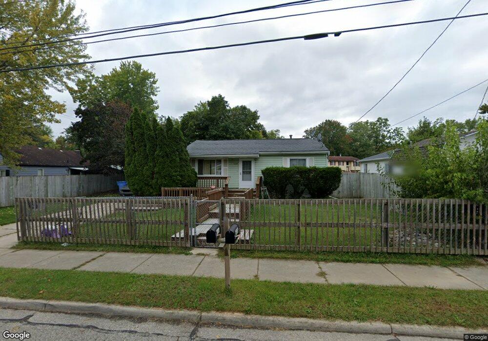
5330 Hughes Rd Lansing, MI 48911
Southern Lansing NeighborhoodEstimated Value: $140,000 - $156,000
2
Beds
1
Bath
1,048
Sq Ft
$140/Sq Ft
Est. Value
About This Home
This home is located at 5330 Hughes Rd, Lansing, MI 48911 and is currently estimated at $147,005, approximately $140 per square foot. 5330 Hughes Rd is a home located in Ingham County with nearby schools including Reo Elementary School, Attwood School, and Everett High School.
Ownership History
Date
Name
Owned For
Owner Type
Purchase Details
Closed on
Mar 12, 2016
Sold by
Estate Of Gregory James Mccloud
Bought by
Mone Littlejohn Emoni and Manns Carmen Denise
Current Estimated Value
Purchase Details
Closed on
Mar 3, 2016
Sold by
Mone Littlejohn Emoni and Manns Carmen Denise
Bought by
Beverly Barbarr Jean and Beverly Emoni Mone
Purchase Details
Closed on
Jul 1, 1995
Create a Home Valuation Report for This Property
The Home Valuation Report is an in-depth analysis detailing your home's value as well as a comparison with similar homes in the area
Home Values in the Area
Average Home Value in this Area
Purchase History
| Date | Buyer | Sale Price | Title Company |
|---|---|---|---|
| Mone Littlejohn Emoni | -- | Liberty Title | |
| Beverly Barbarr Jean | -- | Liberty Title | |
| -- | $57,900 | -- |
Source: Public Records
Tax History Compared to Growth
Tax History
| Year | Tax Paid | Tax Assessment Tax Assessment Total Assessment is a certain percentage of the fair market value that is determined by local assessors to be the total taxable value of land and additions on the property. | Land | Improvement |
|---|---|---|---|---|
| 2025 | $2,497 | $70,400 | $7,700 | $62,700 |
| 2024 | $20 | $52,200 | $7,700 | $44,500 |
| 2023 | $2,342 | $45,600 | $7,700 | $37,900 |
| 2022 | $2,113 | $44,800 | $4,900 | $39,900 |
| 2021 | $2,070 | $41,600 | $4,700 | $36,900 |
| 2020 | $2,057 | $39,700 | $4,700 | $35,000 |
| 2019 | $2,543 | $37,200 | $4,700 | $32,500 |
| 2018 | $2,411 | $30,500 | $4,700 | $25,800 |
| 2017 | $2,321 | $30,500 | $4,700 | $25,800 |
| 2016 | $1,597 | $30,000 | $4,700 | $25,300 |
| 2015 | $1,597 | $29,400 | $9,487 | $19,913 |
| 2014 | $1,597 | $27,900 | $15,416 | $12,484 |
Source: Public Records
Map
Nearby Homes
- 2045 Moffitt St
- 0 Midwood St
- 2416 Midwood St
- 5838 S Martin Luther King Junior Blvd
- 4916 Tressa Dr
- 4620 Christiansen Rd
- 5750 Ashley Dr
- 4628 Pleasant Grove Rd
- 1324 N Briarfield Dr
- 1729 Reo Rd
- 4828 Ingham St
- 0 W Jolly Rd
- 1415 Reo Rd
- 1014 W Northrup St
- 1420 Reo Rd
- 6030 Piper Ave
- 4809 Ballard Rd
- 6037 Hughes Rd
- 1429 Pierce Rd
- 5026 Delray Dr Unit A
- 2001 Bradwell Ct
- 5336 Hughes Rd
- 2015 Bradwell Ct
- 2012 Moffitt St
- 123 Mystreet
- 5335 Hughes Rd
- 2019 Bradwell Ct
- 2020 Moffitt St
- 1930 Moffitt St
- 5321 Hughes Rd
- 2001 Moffitt St
- 5312 Hughes Rd
- 2025 Bradwell Ct
- 2028 Moffitt St
- 2013 Moffitt St
- 1922 Moffitt St
- 5313 Hughes Rd
- 2018 Bradwell Ct
- 2019 Moffitt St
- 1929 Moffitt St