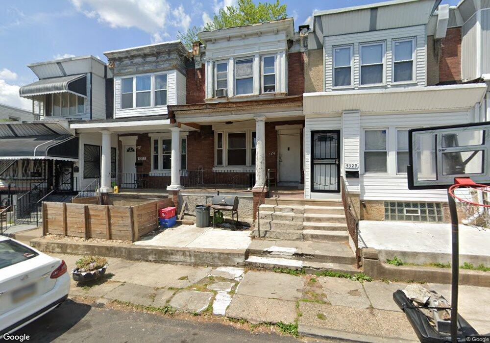
5331 Malcolm St Philadelphia, PA 19143
Kingsessing NeighborhoodEstimated Value: $124,000 - $160,000
3
Beds
1
Bath
1,120
Sq Ft
$121/Sq Ft
Est. Value
About This Home
This home is located at 5331 Malcolm St, Philadelphia, PA 19143 and is currently estimated at $136,010, approximately $121 per square foot. 5331 Malcolm St is a home located in Philadelphia County with nearby schools including Avery D. Harrington School, William L. Sayre High School, and Hardy Williams Elementary.
Ownership History
Date
Name
Owned For
Owner Type
Purchase Details
Closed on
Jan 11, 2011
Sold by
Us Bank National Association
Bought by
No Boundaries Enterprises Inc
Current Estimated Value
Purchase Details
Closed on
Jan 11, 2010
Sold by
Dayton Michael and Hsbc Bank Usa National Associa
Bought by
Us Bank National Association
Purchase Details
Closed on
Jul 1, 2005
Sold by
Coffee Thomas W
Bought by
Dayton Michael
Purchase Details
Closed on
Apr 9, 2003
Sold by
Spencer Tracey and Estate Of William Spencer Jr
Bought by
Coffee Thomas W
Create a Home Valuation Report for This Property
The Home Valuation Report is an in-depth analysis detailing your home's value as well as a comparison with similar homes in the area
Home Values in the Area
Average Home Value in this Area
Purchase History
| Date | Buyer | Sale Price | Title Company |
|---|---|---|---|
| No Boundaries Enterprises Inc | $6,000 | Land Title Svcs Of Nj Inc | |
| Us Bank National Association | $2,100 | None Available | |
| Dayton Michael | $17,500 | None Available | |
| Coffee Thomas W | $6,125 | -- |
Source: Public Records
Tax History Compared to Growth
Tax History
| Year | Tax Paid | Tax Assessment Tax Assessment Total Assessment is a certain percentage of the fair market value that is determined by local assessors to be the total taxable value of land and additions on the property. | Land | Improvement |
|---|---|---|---|---|
| 2025 | $887 | $87,000 | $17,400 | $69,600 |
| 2024 | $887 | $87,000 | $17,400 | $69,600 |
| 2023 | $887 | $63,400 | $12,680 | $50,720 |
| 2022 | $526 | $63,400 | $12,680 | $50,720 |
| 2021 | $526 | $0 | $0 | $0 |
| 2020 | $526 | $0 | $0 | $0 |
| 2019 | $486 | $0 | $0 | $0 |
| 2018 | $424 | $0 | $0 | $0 |
| 2017 | $424 | $0 | $0 | $0 |
| 2016 | $424 | $0 | $0 | $0 |
| 2015 | $235 | $0 | $0 | $0 |
| 2014 | -- | $17,500 | $4,266 | $13,234 |
| 2012 | -- | $2,688 | $672 | $2,016 |
Source: Public Records
Map
Nearby Homes
- 5334 Malcolm St
- 1029 S 54th St
- 5426 Whitby Ave
- 5343 Pentridge St
- 1014 S 53rd St
- 5338 Pentridge St
- 5336 Pentridge St
- 5312 Pentridge St
- 914 S Yewdall St
- 1041 S 53rd St
- 5437 Whitby Ave
- 1132 S 54th St
- 5428 Pentridge St
- 1018 S 55th St
- 5427 Ridgewood St
- 768 S 52nd St
- 1125 S 55th St
- 5514 Broomall St
- 1054 S 53rd St
- 1265 S Ruby St
- 5329 Malcolm St
- 5333 Malcolm St
- 5335 Malcolm St
- 5325 Malcolm St
- 5300-5310 Whitby St
- 5323 Malcolm St
- 5321 Malcolm St
- 1015 S 54th St
- 1011 S 54th St
- 1013 S 54th St
- 1017 S 54th St
- 5332 Malcolm St
- 5328 Malcolm St
- 1009 S 54th St
- 5326 Malcolm St
- 1007 S 54th St
- 5330 Malcolm St
- 5336 Malcolm St
- 5317 Malcolm St
- 1019 S 54th St