Estimated Value: $2,103,366
--
Bed
--
Bath
2,794
Sq Ft
$753/Sq Ft
Est. Value
About This Home
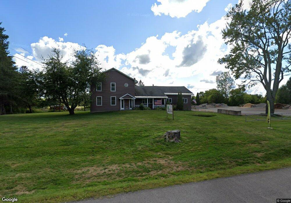
This home is located at 5332 State Route 31, Clay, NY 13041 and is currently estimated at $2,103,366, approximately $752 per square foot. 5332 State Route 31 is a home located in Onondaga County with nearby schools including North Syracuse Junior High School, Cicero North Syracuse High School, and Little Lamb Christian School.
Ownership History
Date
Name
Owned For
Owner Type
Purchase Details
Closed on
Sep 6, 2024
Sold by
Randy A & John F Vend Llc
Bought by
Seneca Savings
Current Estimated Value
Purchase Details
Closed on
Feb 23, 2015
Sold by
Charron David
Bought by
Reynolds Randy A and Reynolds John F
Purchase Details
Closed on
Apr 20, 2007
Sold by
Janowski Donald
Bought by
Charron David N
Purchase Details
Closed on
Jul 30, 2005
Purchase Details
Closed on
Jan 29, 1999
Create a Home Valuation Report for This Property
The Home Valuation Report is an in-depth analysis detailing your home's value as well as a comparison with similar homes in the area
Home Values in the Area
Average Home Value in this Area
Purchase History
| Date | Buyer | Sale Price | Title Company |
|---|---|---|---|
| Seneca Savings | $1,900,000 | None Available | |
| Reynolds Randy A | $185,000 | Stanley R. Germain | |
| Randy A Reynolds A | $185,000 | Stanley R. Germain | |
| Charron David N | $155,000 | William Baskin | |
| Charron David N | $155,000 | William Baskin | |
| -- | -- | -- | |
| -- | -- | -- | |
| -- | -- | -- | |
| -- | -- | -- |
Source: Public Records
Tax History Compared to Growth
Tax History
| Year | Tax Paid | Tax Assessment Tax Assessment Total Assessment is a certain percentage of the fair market value that is determined by local assessors to be the total taxable value of land and additions on the property. | Land | Improvement |
|---|---|---|---|---|
| 2024 | $6,225 | $7,300 | $1,700 | $5,600 |
| 2023 | $6,225 | $7,300 | $1,700 | $5,600 |
| 2022 | $6,369 | $7,300 | $1,700 | $5,600 |
| 2021 | $6,286 | $7,300 | $1,700 | $5,600 |
| 2020 | $6,073 | $7,300 | $1,700 | $5,600 |
| 2019 | $1,679 | $7,300 | $1,700 | $5,600 |
| 2018 | $5,808 | $7,300 | $1,700 | $5,600 |
| 2017 | $1,649 | $7,300 | $1,700 | $5,600 |
| 2016 | $5,619 | $7,300 | $1,700 | $5,600 |
| 2015 | -- | $7,300 | $1,700 | $5,600 |
| 2014 | -- | $7,300 | $1,700 | $5,600 |
Source: Public Records
Map
Nearby Homes
- 5402 State Route 31
- 5471 Lucknow Dr
- 5547 Rockhampton Path
- 8248 Trevi Ln
- 5423 Borgase Ln
- 0 Caughdenoy Rd Unit S1515340
- 8129 Firenze Ln
- 8179 Rizzo Dr
- 5156 Lyle Dr
- 8175 Caughdenoy Rd
- 8133 Duncowing Ln
- 5245 Potenza Dr
- 8050 Evesborough Dr
- 8201 Lawton Rd
- 8177 Avoss Ln
- 5352 Vineyard Dr
- 8084 Bamm Hollow Rd
- 5370 Vineyard Dr
- 0 Lawton Rd Unit S1581233
- 4972 State Route 31
- 5334 New York 31
- 8447 Burnet Rd
- 8419 Burnet Rd
- 8424 Burnet Rd
- 8450 Burnet Rd
- 5367 State Route 31
- 5363 State Route 31
- 5366 State Route 31
- 5284 State Route 31
- 5376 State Route 31
- 5380 State Route 31
- 5267 State Route 31
- 5267 State Route 31
- 8309 Stearns Rd
- 8501 Burnet Rd
- 8502 Burnet Rd
- 5397 State Route 31
- 8508 Burnet Rd
- 8512 Burnet Rd
- 8516 Burnet Rd