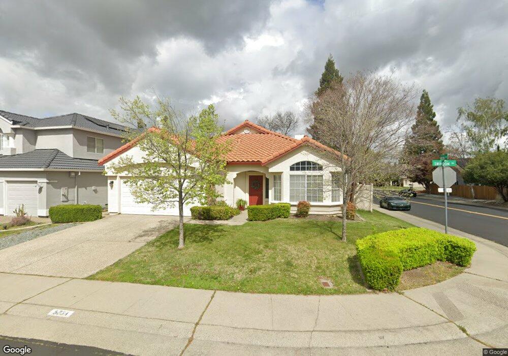
5334 Swindon Rd Rocklin, CA 95765
Stanford Ranch NeighborhoodEstimated Value: $603,714 - $659,000
3
Beds
2
Baths
1,920
Sq Ft
$325/Sq Ft
Est. Value
About This Home
This home is located at 5334 Swindon Rd, Rocklin, CA 95765 and is currently estimated at $623,679, approximately $324 per square foot. 5334 Swindon Rd is a home located in Placer County with nearby schools including Breen Elementary, Granite Oaks Middle, and Rocklin High.
Ownership History
Date
Name
Owned For
Owner Type
Purchase Details
Closed on
Mar 17, 2008
Sold by
Taylor Worden Elizabeth K and Taylor Elizabeth K
Bought by
Cole Robert K and Cole Birgit C
Current Estimated Value
Home Financials for this Owner
Home Financials are based on the most recent Mortgage that was taken out on this home.
Original Mortgage
$249,000
Interest Rate
5.12%
Mortgage Type
Purchase Money Mortgage
Purchase Details
Closed on
Nov 11, 1994
Sold by
Golden State Home Building Associates
Bought by
Taylor Elizabeth K
Home Financials for this Owner
Home Financials are based on the most recent Mortgage that was taken out on this home.
Original Mortgage
$129,950
Interest Rate
8.86%
Mortgage Type
Purchase Money Mortgage
Create a Home Valuation Report for This Property
The Home Valuation Report is an in-depth analysis detailing your home's value as well as a comparison with similar homes in the area
Home Values in the Area
Average Home Value in this Area
Purchase History
| Date | Buyer | Sale Price | Title Company |
|---|---|---|---|
| Cole Robert K | $349,000 | Financial Title Company | |
| Taylor Elizabeth K | $170,000 | Placer Title Company |
Source: Public Records
Mortgage History
| Date | Status | Borrower | Loan Amount |
|---|---|---|---|
| Closed | Cole Robert K | $249,000 | |
| Previous Owner | Taylor Elizabeth K | $129,950 |
Source: Public Records
Tax History
| Year | Tax Paid | Tax Assessment Tax Assessment Total Assessment is a certain percentage of the fair market value that is determined by local assessors to be the total taxable value of land and additions on the property. | Land | Improvement |
|---|---|---|---|---|
| 2025 | $5,052 | $458,401 | $105,072 | $353,329 |
| 2023 | $5,052 | $440,602 | $100,993 | $339,609 |
| 2022 | $4,890 | $431,963 | $99,013 | $332,950 |
| 2021 | $4,838 | $423,494 | $97,072 | $326,422 |
| 2020 | $4,831 | $419,152 | $96,077 | $323,075 |
| 2019 | $4,765 | $410,935 | $94,194 | $316,741 |
| 2018 | $4,644 | $402,879 | $92,348 | $310,531 |
| 2017 | $4,648 | $394,981 | $90,538 | $304,443 |
| 2016 | $4,518 | $387,237 | $88,763 | $298,474 |
| 2015 | $5,352 | $381,421 | $87,430 | $293,991 |
| 2014 | $5,428 | $353,000 | $80,900 | $272,100 |
Source: Public Records
Map
Nearby Homes
- 5309 Quane Ct
- 2726 Genesee Dr
- 5329 Wesley Rd
- 5316 Heritage Ct
- 5310 Heritage Ct
- 5116 Camden Rd
- 5112 Stratton Ct
- 2024 Archer Cir
- 4714 Durham Ct
- 2100 Wyckford Blvd
- 2057 Archer Cir
- 1816 Talon Rd
- 4814 Hartwick Rd
- 5401 Rock Field Ct
- 4711 Stuart St
- 3140 Golden Trail St
- 1914 Harvest Ct
- 3146 Golden Trail St
- 2712 Ashland Ct
- 1685 Iroquois Rd
- 5401 Quane Rd
- 5326 Swindon Rd
- 5338 Swindon Rd
- 5403 Quane Rd
- 5319 Quane Ct Unit 6008
- 5331 Swindon Rd
- 5405 Quane Rd
- 5333 Swindon Rd
- 5324 Swindon Rd
- 5340 Swindon Rd
- 5335 Swindon Rd
- 5329 Swindon Rd
- 5317 Quane Ct
- 5407 Quane Rd
- 5327 Swindon Rd
- 5337 Swindon Rd
- 5322 Swindon Rd
- 5342 Swindon Rd
- 2720 San Marcos Ct
Your Personal Tour Guide
Ask me questions while you tour the home.