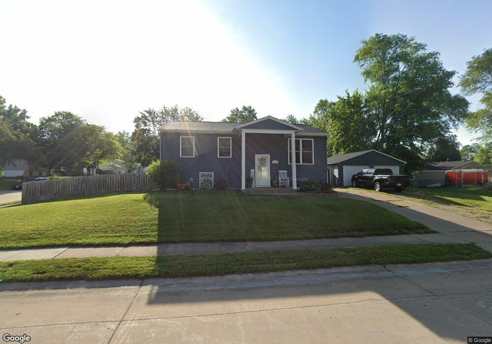
5335 N Howell St Davenport, IA 52806
North Side NeighborhoodEstimated Value: $162,000 - $175,000
4
Beds
1
Bath
925
Sq Ft
$182/Sq Ft
Est. Value
About This Home
This home is located at 5335 N Howell St, Davenport, IA 52806 and is currently estimated at $168,148, approximately $181 per square foot. 5335 N Howell St is a home located in Scott County with nearby schools including Martin Luther King Jr. Elementary School, Truman Elementary School, and Cumberland Hall School.
Ownership History
Date
Name
Owned For
Owner Type
Purchase Details
Closed on
Apr 30, 2021
Sold by
Superior Enterprise Llc
Bought by
Chapman Tiffany M and Chapman Blake A
Current Estimated Value
Home Financials for this Owner
Home Financials are based on the most recent Mortgage that was taken out on this home.
Original Mortgage
$118,804
Outstanding Balance
$107,437
Interest Rate
3.1%
Mortgage Type
FHA
Estimated Equity
$60,711
Purchase Details
Closed on
Dec 19, 2013
Sold by
Nguyen Be T
Bought by
Long Philip and Long Joan
Home Financials for this Owner
Home Financials are based on the most recent Mortgage that was taken out on this home.
Original Mortgage
$36,000
Interest Rate
4.75%
Mortgage Type
Adjustable Rate Mortgage/ARM
Create a Home Valuation Report for This Property
The Home Valuation Report is an in-depth analysis detailing your home's value as well as a comparison with similar homes in the area
Home Values in the Area
Average Home Value in this Area
Purchase History
| Date | Buyer | Sale Price | Title Company |
|---|---|---|---|
| Chapman Tiffany M | $121,000 | Gomez Title | |
| Long Philip | $45,000 | None Available |
Source: Public Records
Mortgage History
| Date | Status | Borrower | Loan Amount |
|---|---|---|---|
| Open | Chapman Tiffany M | $118,804 | |
| Previous Owner | Long Philip | $36,000 |
Source: Public Records
Tax History Compared to Growth
Tax History
| Year | Tax Paid | Tax Assessment Tax Assessment Total Assessment is a certain percentage of the fair market value that is determined by local assessors to be the total taxable value of land and additions on the property. | Land | Improvement |
|---|---|---|---|---|
| 2025 | $2,546 | $166,470 | $23,140 | $143,330 |
| 2024 | $2,340 | $152,660 | $23,140 | $129,520 |
| 2023 | $2,590 | $144,680 | $23,140 | $121,540 |
| 2022 | $2,422 | $130,170 | $18,800 | $111,370 |
| 2021 | $2,422 | $121,820 | $18,800 | $103,020 |
| 2020 | $2,779 | $117,180 | $18,800 | $98,380 |
| 2019 | $3,052 | $111,610 | $18,800 | $92,810 |
| 2018 | $645 | $111,610 | $18,800 | $92,810 |
| 2017 | $2,538 | $111,610 | $18,800 | $92,810 |
| 2016 | $2,444 | $111,610 | $0 | $0 |
| 2015 | $2,444 | $100,590 | $0 | $0 |
| 2014 | $2,234 | $100,590 | $0 | $0 |
| 2013 | $2,196 | $0 | $0 | $0 |
| 2012 | -- | $103,860 | $21,350 | $82,510 |
Source: Public Records
Map
Nearby Homes
- 1729 Welshire Dr
- 1927 W 55th St
- 5436 N Division St
- 5210 N Division St
- 5510 N Division St
- 2127 W 51st St
- 5109 N Pine St
- 28 W Village Cir
- 4705 N Sturdevant St
- 2620 W 54th St
- 2434 W 59th St
- 5556 N Thornwood Ave
- 1415 W 59th St
- 5312 Hillandale Rd
- 2514 W 60th St
- 4618 Fillmore Ln
- 5721 Taylor St
- 2508 W 60th Place
- 5735 Taylor St
- 4406 Regency Place
- 1839 W 54th St
- 5336 N Howell St
- 5323 N Howell St
- 1833 W 54th St
- 1840 Welshire Dr
- 5407 N Howell St
- 1840 W 54th St
- 5324 N Howell St
- 1834 Welshire Dr
- 1911 W 54th St
- 5406 N Howell St
- 1912 Welshire Dr
- 1828 Welshire Dr
- 1912 W 54th St
- 1919 W 54th St
- 1828 W 54th St
- 1821 W 54th St
- 5415 N Howell St
- 1920 Welshire Dr
- 1822 Welshire Dr