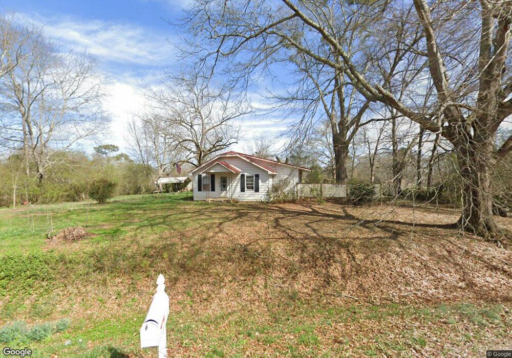
534 Old Camp Church Rd Carrollton, GA 30117
Estimated Value: $212,226 - $263,000
2
Beds
2
Baths
1,525
Sq Ft
$162/Sq Ft
Est. Value
About This Home
This home is located at 534 Old Camp Church Rd, Carrollton, GA 30117 and is currently estimated at $246,307, approximately $161 per square foot. 534 Old Camp Church Rd is a home located in Carroll County with nearby schools including Central Elementary School, Central Middle School, and Central High School.
Ownership History
Date
Name
Owned For
Owner Type
Purchase Details
Closed on
Dec 1, 2017
Sold by
Chandler Frank L
Bought by
Minton Dawnelle D
Current Estimated Value
Purchase Details
Closed on
May 12, 2009
Sold by
Chandler Karen S
Bought by
Chandler Frank L
Purchase Details
Closed on
Feb 7, 2003
Sold by
Jackson Karen S
Bought by
Chandler Karen S and Chandler Frank L
Purchase Details
Closed on
Jun 25, 2002
Sold by
Jackson Karen S
Bought by
Jackson Karen S
Purchase Details
Closed on
Jun 22, 1998
Sold by
Jackson
Bought by
Jackson Karen S
Purchase Details
Closed on
Jan 22, 1993
Bought by
Jackson
Purchase Details
Closed on
May 14, 1992
Bought by
Jackson
Create a Home Valuation Report for This Property
The Home Valuation Report is an in-depth analysis detailing your home's value as well as a comparison with similar homes in the area
Home Values in the Area
Average Home Value in this Area
Purchase History
| Date | Buyer | Sale Price | Title Company |
|---|---|---|---|
| Minton Dawnelle D | -- | -- | |
| Chandler Frank L | -- | -- | |
| Chandler Karen S | -- | -- | |
| Jackson Karen S | -- | -- | |
| Jackson Karen S | -- | -- | |
| Jackson | -- | -- | |
| Jackson | $52,000 | -- |
Source: Public Records
Tax History Compared to Growth
Tax History
| Year | Tax Paid | Tax Assessment Tax Assessment Total Assessment is a certain percentage of the fair market value that is determined by local assessors to be the total taxable value of land and additions on the property. | Land | Improvement |
|---|---|---|---|---|
| 2024 | $1,212 | $53,584 | $5,188 | $48,396 |
| 2023 | $1,212 | $48,242 | $4,150 | $44,092 |
| 2022 | $956 | $38,131 | $2,767 | $35,364 |
| 2021 | $836 | $32,618 | $2,214 | $30,404 |
| 2020 | $755 | $29,431 | $2,012 | $27,419 |
| 2019 | $697 | $26,949 | $2,012 | $24,937 |
| 2018 | $641 | $24,409 | $1,881 | $22,528 |
| 2017 | $480 | $24,409 | $1,881 | $22,528 |
| 2016 | $443 | $28,601 | $1,881 | $26,720 |
| 2015 | $360 | $16,864 | $3,593 | $13,271 |
| 2014 | $361 | $16,864 | $3,593 | $13,271 |
Source: Public Records
Map
Nearby Homes
- 399 Old Camp Church Rd
- 0 Bonner Rd Unit 10635754
- 345 Piney Grove Rd
- 105 Woodbine Dr
- 20 Camp Ct
- 95 Camp Ln
- 0 Buffalo Creek Rd Unit 10624169
- The Coleman Plan at Summerfield Place
- The Pearson Plan at Summerfield Place
- The Piedmont Plan at Summerfield Place
- The Harrington Plan at Summerfield Place
- The McGinnis Plan at Summerfield Place
- The Telfair Plan at Summerfield Place
- 533 Buffalo Creek Rd
- 21 Crabapple Place
- 115 Greenwood Ln
- 40 Red Holly Gap
- 394 Maple View Dr
- 130 Maple Crossing Unit 1
- 130 Maple Crossing Unit LOT 2
- 526 Old Camp Church Rd
- 549 Old Camp Church Rd
- 531 Old Camp Church Rd
- 525 Old Camp Church Rd
- 555 Old Camp Church Rd
- 505 Old Camp Church Rd
- 577 Old Camp Church Rd
- 22 Wooddale Ln
- 0 Boulder Dr Unit 3202002
- 0 Boulder Dr Unit 7512270
- 592 Old Camp Church Rd
- 25 Boulder Dr
- 34 Wooddale Ln
- 62 Boulder Dr
- 589 Old Camp Church Rd
- 37 Boulder Dr
- 44 Wooddale Ln
- 78 Boulder Dr
- 26 Westwood Dr
- 54 Wooddale Ln