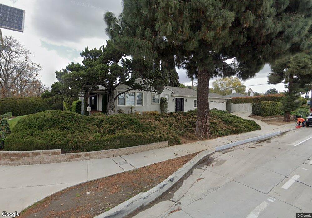
5340 Carley Ave Whittier, CA 90601
West Whittier NeighborhoodEstimated Value: $955,058 - $1,109,000
3
Beds
2
Baths
2,045
Sq Ft
$499/Sq Ft
Est. Value
About This Home
This home is located at 5340 Carley Ave, Whittier, CA 90601 and is currently estimated at $1,021,265, approximately $499 per square foot. 5340 Carley Ave is a home located in Los Angeles County with nearby schools including Mill Elementary School, Walter F. Dexter Middle School, and Whittier High School.
Ownership History
Date
Name
Owned For
Owner Type
Purchase Details
Closed on
Nov 29, 2022
Sold by
Dropulic John and Dropulic Elizabeth
Bought by
Dropulic Living Trust
Current Estimated Value
Purchase Details
Closed on
Nov 24, 2009
Sold by
Dropulic Elizabeth
Bought by
Dropulic John
Home Financials for this Owner
Home Financials are based on the most recent Mortgage that was taken out on this home.
Original Mortgage
$285,000
Interest Rate
4.99%
Mortgage Type
New Conventional
Create a Home Valuation Report for This Property
The Home Valuation Report is an in-depth analysis detailing your home's value as well as a comparison with similar homes in the area
Home Values in the Area
Average Home Value in this Area
Purchase History
| Date | Buyer | Sale Price | Title Company |
|---|---|---|---|
| Dropulic Living Trust | -- | -- | |
| Dropulic John | -- | Ortc | |
| Dropulic Elizabeth | -- | Ortc |
Source: Public Records
Mortgage History
| Date | Status | Borrower | Loan Amount |
|---|---|---|---|
| Previous Owner | Dropulic Elizabeth | $285,000 |
Source: Public Records
Tax History
| Year | Tax Paid | Tax Assessment Tax Assessment Total Assessment is a certain percentage of the fair market value that is determined by local assessors to be the total taxable value of land and additions on the property. | Land | Improvement |
|---|---|---|---|---|
| 2025 | $2,489 | $147,280 | $36,988 | $110,292 |
| 2024 | $2,489 | $144,393 | $36,263 | $108,130 |
| 2023 | $2,567 | $141,562 | $35,552 | $106,010 |
| 2022 | $940 | $138,787 | $34,855 | $103,932 |
| 2021 | $882 | $136,067 | $34,172 | $101,895 |
| 2019 | $831 | $132,033 | $33,159 | $98,874 |
| 2018 | $714 | $129,445 | $32,509 | $96,936 |
| 2016 | $697 | $124,421 | $31,248 | $93,173 |
| 2015 | $2,068 | $122,553 | $30,779 | $91,774 |
| 2014 | $708 | $120,154 | $30,177 | $89,977 |
Source: Public Records
Map
Nearby Homes
- 10605 Cordoba Ct
- 5032 Tierra Antigua Dr
- 5433 Mesagrove Ave
- 5519 Pioneer Blvd Unit 42
- 11759 S Circle Dr
- 10607 Orange Dr
- 12070 Rideout Place
- 3735 Croton Ave
- 5903 Redman Ave
- 5729 Juarez Ave
- 10608 Whittier Blvd
- 11905 Mendenhall Ln
- 12031 Beverly Blvd Unit 2F
- 12031 Beverly Blvd Unit 1D
- 4807 Cinco View Dr
- 11506 Sierra Sky Dr
- 4810 Cinco View Dr
- 4947 Tobias Ave
- 9365 Via Azul
- 12417 Rose Dr
- 5334 Carley Ave
- 10517 Beverly Blvd
- 5328 Carley Ave
- 5402 Carley Ave
- 10525 Beverly Blvd
- 5322 Carley Ave
- 5341 Carley Ave
- 5335 Carley Ave
- 5403 Mavis Ave
- 5327 Carley Ave
- 5408 Carley Ave
- 10531 Beverly Blvd
- 5316 Carley Ave
- 5403 Carley Ave
- 5409 Mavis Ave
- 5321 Carley Ave
- 10532 Deveron Dr
- 5416 Carley Ave
- 10528 Deveron Dr
- 5409 Carley Ave