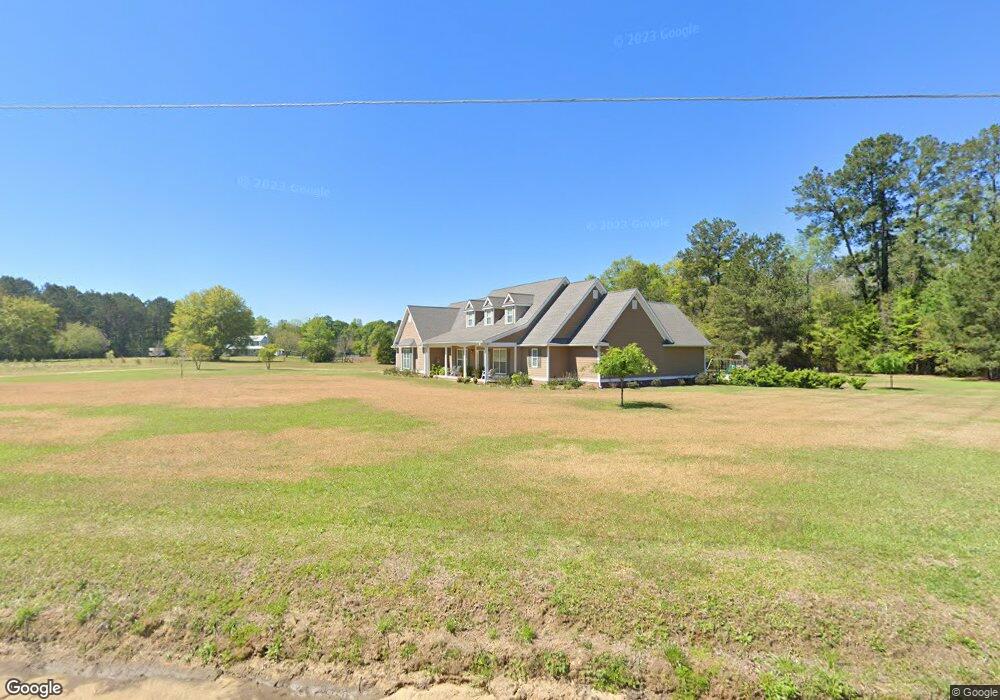
5341 Fiveash Rd Hahira, GA 31632
Estimated Value: $430,000 - $599,609
5
Beds
5
Baths
4,114
Sq Ft
$130/Sq Ft
Est. Value
About This Home
This home is located at 5341 Fiveash Rd, Hahira, GA 31632 and is currently estimated at $535,652, approximately $130 per square foot. 5341 Fiveash Rd is a home located in Lowndes County with nearby schools including Hahira Elementary School, Hahira Middle School, and Lowndes High School.
Ownership History
Date
Name
Owned For
Owner Type
Purchase Details
Closed on
Apr 26, 2019
Sold by
Smidley Cheryl D
Bought by
Stith Joseph E and Stith Rachel C
Current Estimated Value
Home Financials for this Owner
Home Financials are based on the most recent Mortgage that was taken out on this home.
Original Mortgage
$235,200
Outstanding Balance
$205,944
Interest Rate
4%
Mortgage Type
New Conventional
Estimated Equity
$329,708
Purchase Details
Closed on
Feb 10, 2012
Sold by
Smidley George C
Bought by
Smidley Cheryl D
Purchase Details
Closed on
Jan 13, 2004
Sold by
Hughes Annie Laurie
Bought by
Smidley George C and Smidley Cheryl D
Purchase Details
Closed on
Oct 1, 2002
Sold by
Hughes Adolph #2
Bought by
Hughes Annie Laurie
Create a Home Valuation Report for This Property
The Home Valuation Report is an in-depth analysis detailing your home's value as well as a comparison with similar homes in the area
Home Values in the Area
Average Home Value in this Area
Purchase History
| Date | Buyer | Sale Price | Title Company |
|---|---|---|---|
| Stith Joseph E | $294,000 | -- | |
| Smidley Cheryl D | -- | -- | |
| Smidley George C | $49,700 | -- | |
| Hughes Annie Laurie | -- | -- |
Source: Public Records
Mortgage History
| Date | Status | Borrower | Loan Amount |
|---|---|---|---|
| Open | Stith Joseph E | $235,200 |
Source: Public Records
Tax History Compared to Growth
Tax History
| Year | Tax Paid | Tax Assessment Tax Assessment Total Assessment is a certain percentage of the fair market value that is determined by local assessors to be the total taxable value of land and additions on the property. | Land | Improvement |
|---|---|---|---|---|
| 2024 | $3,983 | $163,461 | $21,824 | $141,637 |
| 2023 | $3,900 | $153,905 | $20,396 | $133,509 |
| 2022 | $3,439 | $123,357 | $20,396 | $102,961 |
| 2021 | $3,603 | $123,741 | $20,396 | $103,345 |
| 2020 | $3,166 | $117,075 | $20,246 | $96,829 |
| 2019 | $3,035 | $117,075 | $20,246 | $96,829 |
| 2018 | $3,066 | $117,075 | $20,246 | $96,829 |
| 2017 | $3,065 | $115,235 | $18,406 | $96,829 |
| 2016 | $3,073 | $115,234 | $18,406 | $96,829 |
| 2015 | $2,944 | $115,234 | $18,406 | $96,829 |
| 2014 | $2,870 | $110,317 | $13,488 | $96,829 |
Source: Public Records
Map
Nearby Homes
- 5388 Hall Rd
- 5490 Serendipity Trail
- 4958 Bethany Dr
- 5525 Val Del Rd
- 4759 Bethany Dr
- 1159 Hannah Dr
- 1139 Hannah Dr
- 1055 Angie Ln
- 1135 Hannah Dr
- 1130 Hannah Dr
- 1131 Hannah Dr
- 1063 Angie Ln
- 1109 Hannah Dr
- 1105 Hannah Dr
- The Walker Plan at Reynolda Place
- The Belfort Plan at Reynolda Place
- The Ozark Plan at Reynolda Place
- The Beau Plan at Reynolda Place
- 627 Stagecoach Trail
- 6610 Brookridge Dr